skip to main |
skip to sidebar
Go To Trains, Part 1 Go To Trains Part 2
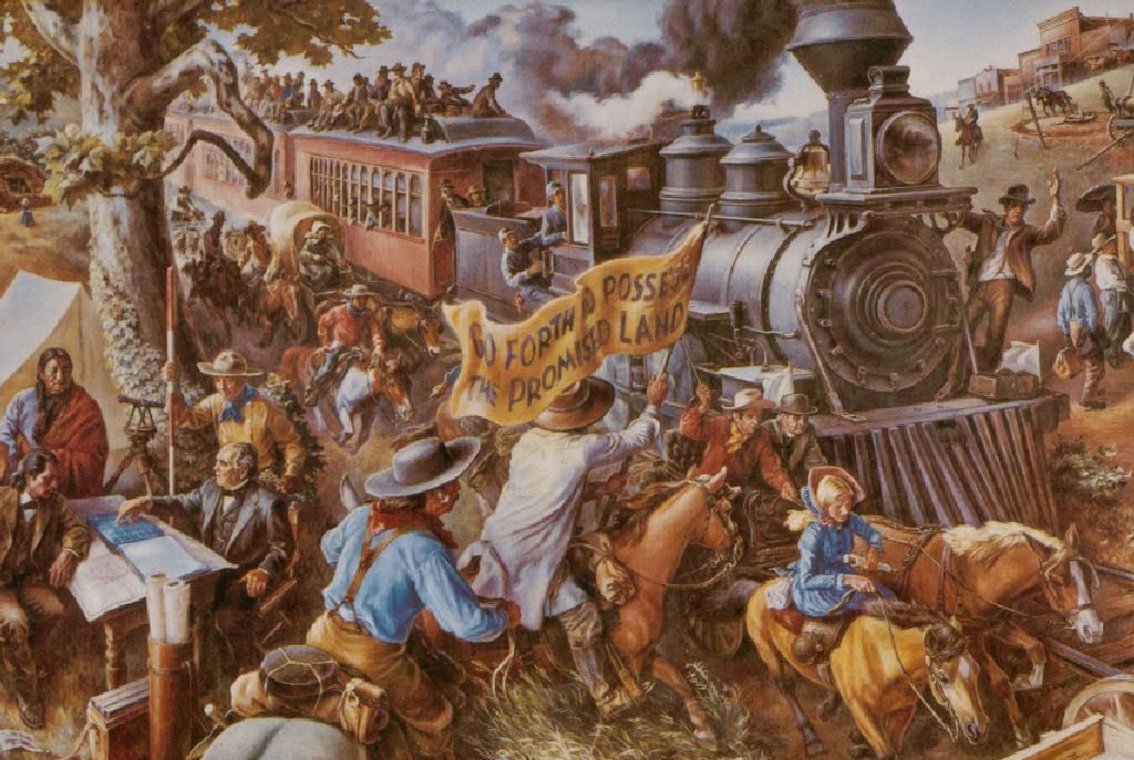
Go To Trains Part 3 Go To Trains 3A Go To Trolleys 1In this post I'll be covering the history of Trains, Trolleys, and Interurbans in Oklahoma City and give you some good links for fine articles and images other than I describe here. The Oklahoma Land Run wasn't just by horses and buggies and wagons. It was also "run" by trains! State Capitol Mural by Charles Banks Wilson
Photo By David Fitzgerald
Click on the pic for a larger view
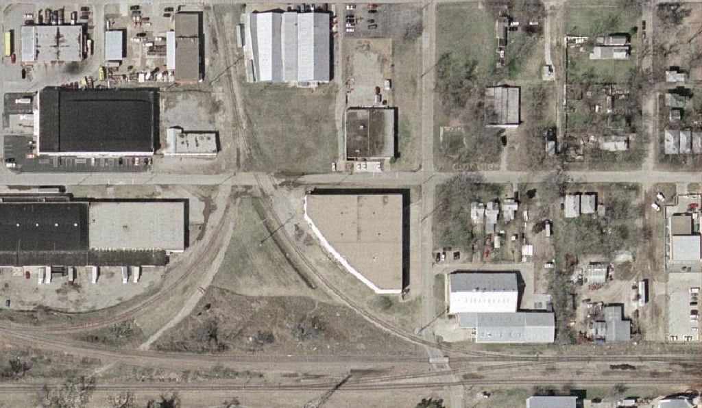
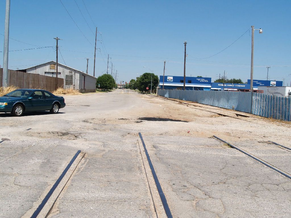
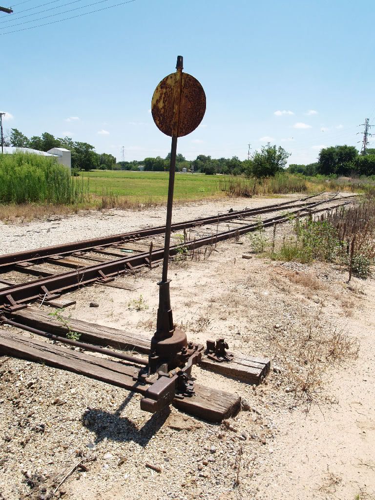
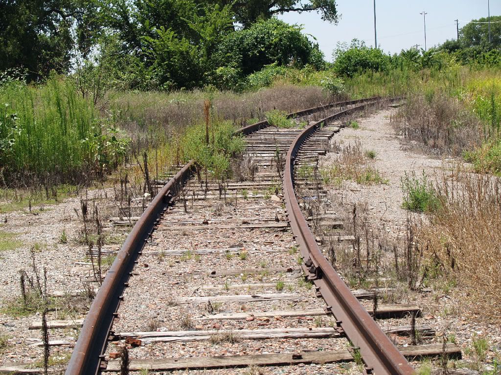
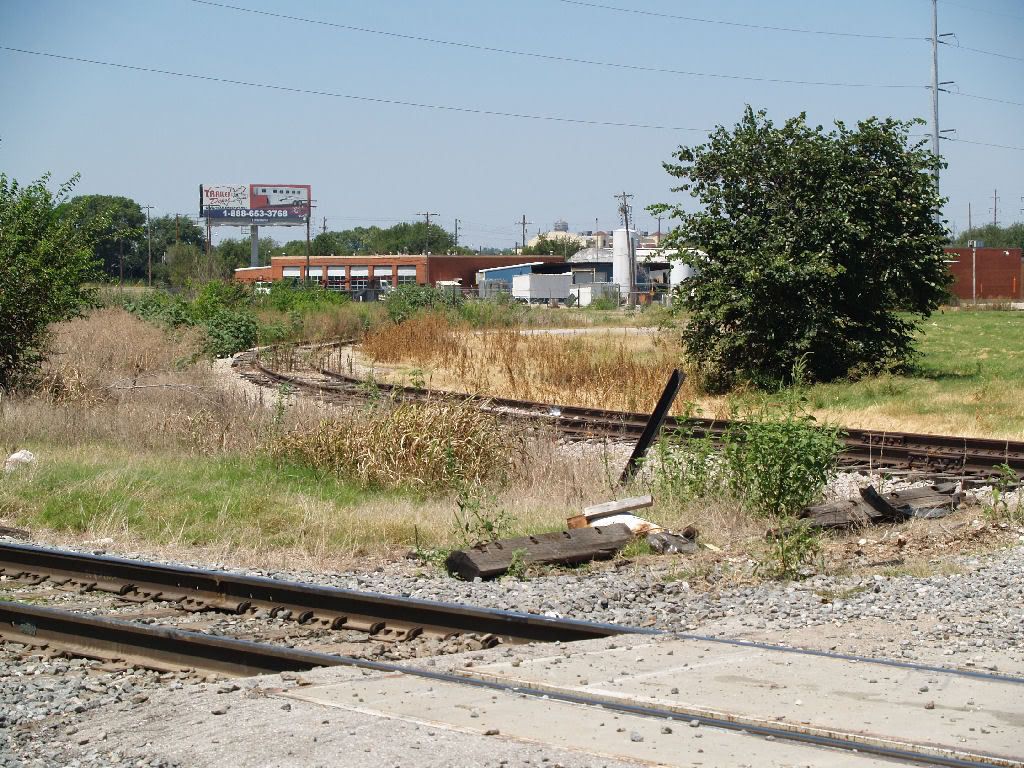
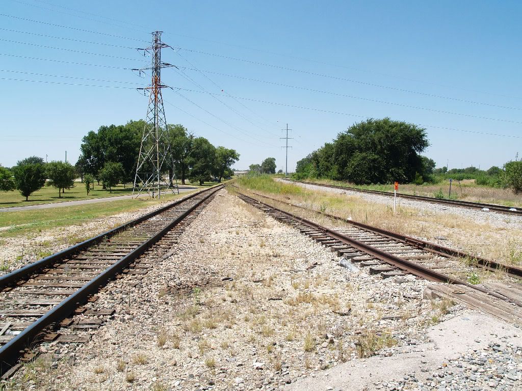
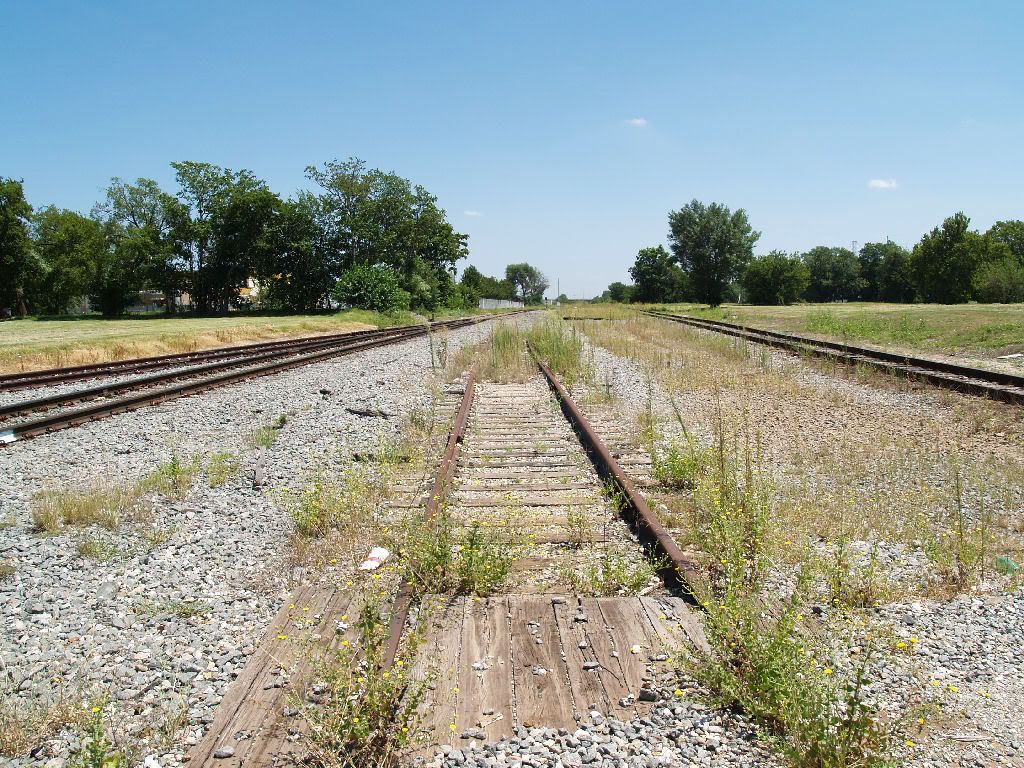
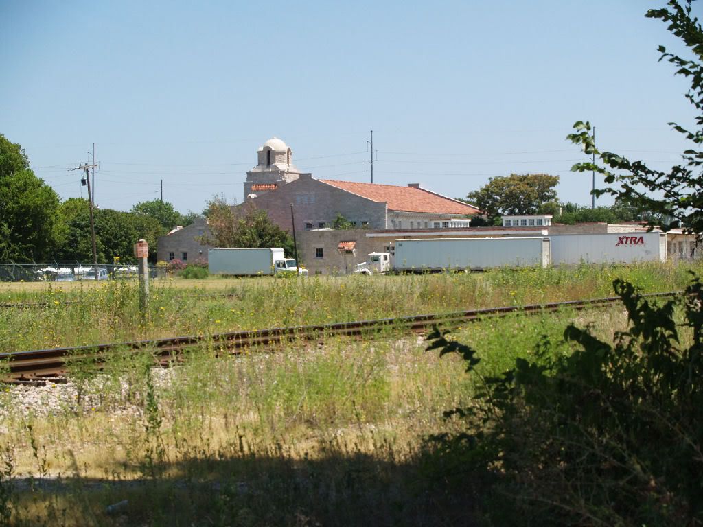
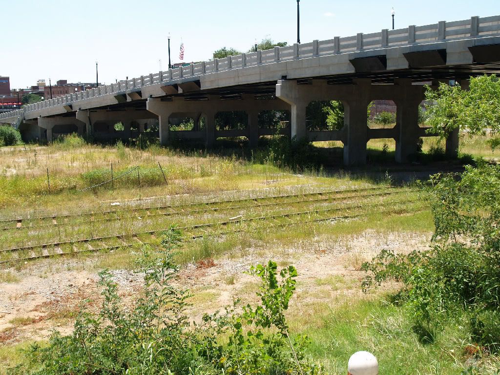
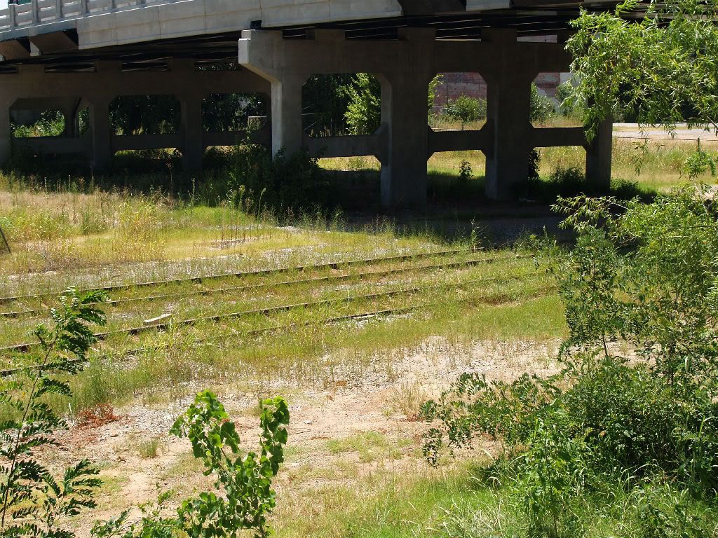
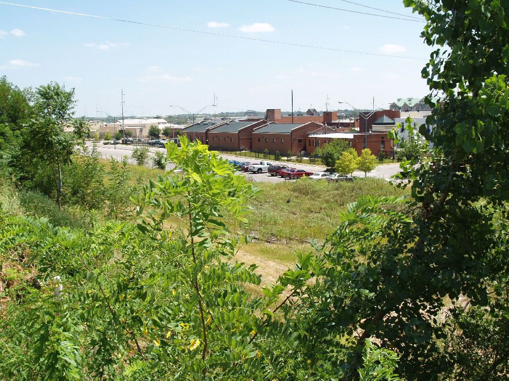
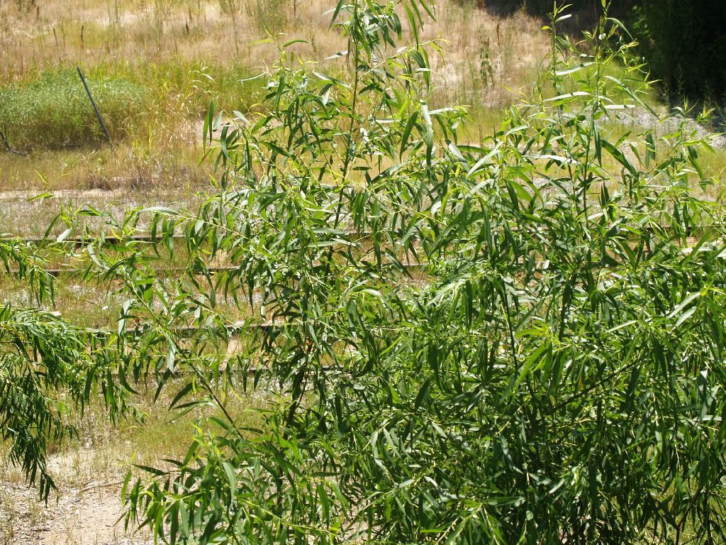
 Trains In OKC Today. Trains In OKC Today. Before waxing nostalgic, let's get a good dose of reality. Then I'll explore the past. But, as for today ... have a look at pictures that I took on a hot Saturday afternoon, August 11, 2007, and I'll pretty much let them speak for themselves. For all pictures, click the image for a larger view. Of course, I didn't take the Google satellite images ... wish that I could!
At S. Classen Blvd. Between SW 6th & SW 7th

On The Ground Looking South

Same Location, Looking North

Something Left Behind, Looking Southeast

Further South Looking South

Looking At Abandoned Track Curving Southwest

On the Tracks Looking Northwest Toward Classen

On The Tracks Looking East


At Walker Looking North Across The Tracks

Looking Northeast Across The Tracks

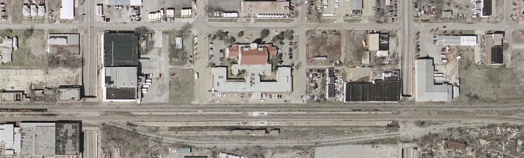
A Google Image of the Union Station Area

Looking Northeast At The Robinson Crossing

On Robinson Looking North

On Compress Street Under I-40 Looking West

On South Side of Deep Deuce Apartments Looking Southwest - Walnut Bridge


Same Location Looking Southeast Toward Bricktown Police Station

You Can Almost Not See Them, Now

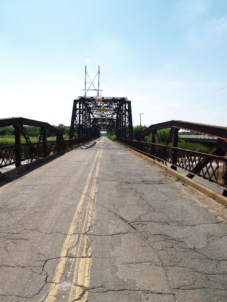
Trolleys In Okc Today. Well, this one's easy since there aren't any! Aside from unremoved but partially hidden trolley tracks here and there, and perhaps the old bridge on NW 39th Street shown below, that's all that remains.
On 4th St. Looking West Under Santa Fe Viaduct

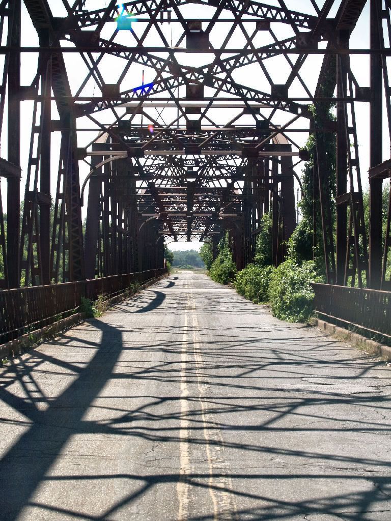
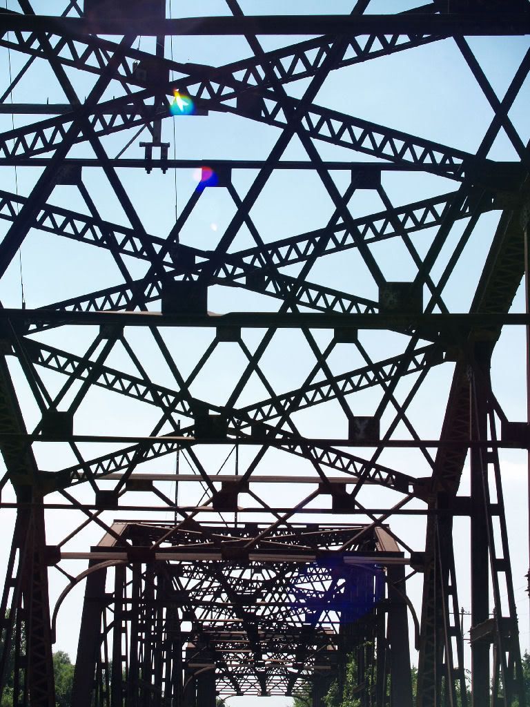
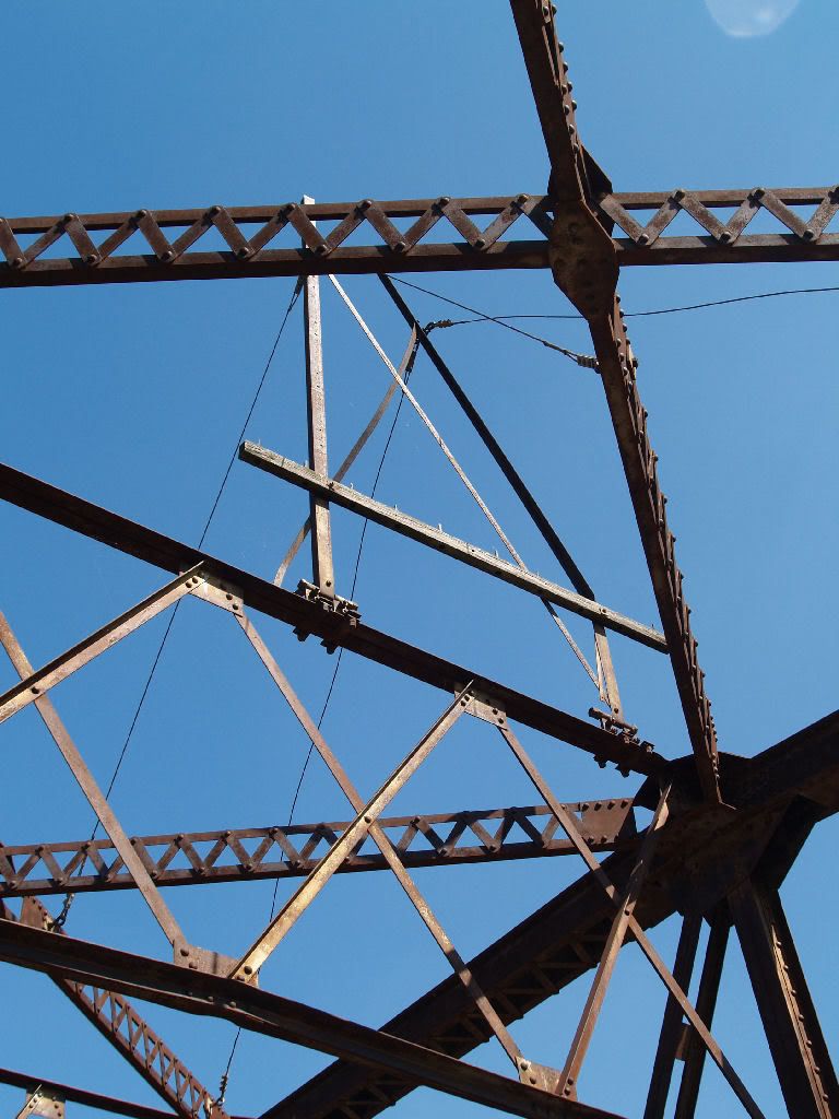
When I first wrote this paragraph,I'd thought that maybe the "old" NW 39th Street bridge at the north end of Lake Overholser shown below was used for the Yukon/El Reno Interurban line, but Larry (Buddy) Johnson of the Okc Metro Library System advises me that it was most probably NOT the rail bridge ... he thinks that the rail bridge was where the "new" NW 39th Street bridge is now, and that makes sense to me (particularly since part of the Rock Island line once used the same bridge as the Interurban ... the bridge below is certainly not up to big-time train standards, even size-wise). On further edit, the "most probably not" part is no more since I now have a pic of a trolley passing over the then-existing 39th Streettrain bridge, and it's not this bridge. Still, I'll leave the pics below for reference ... but the "real" rail bridge of times gone by is different, as you'll in the Okc Trolleys post in this series. The pics below were taken on August 13, 2007.
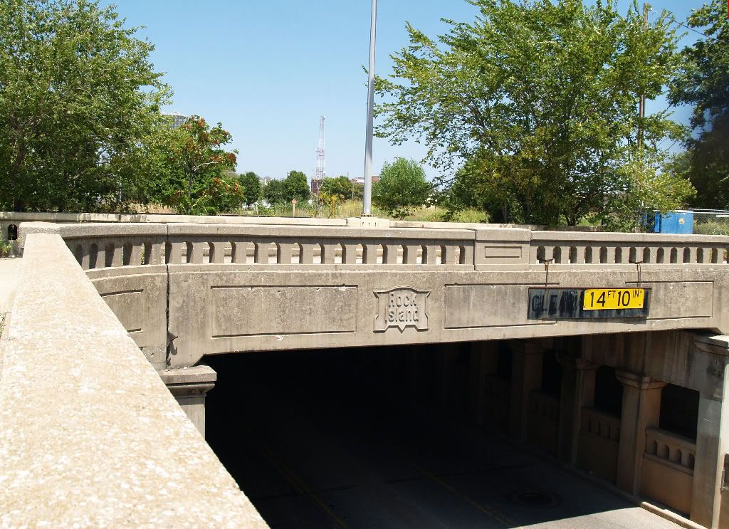
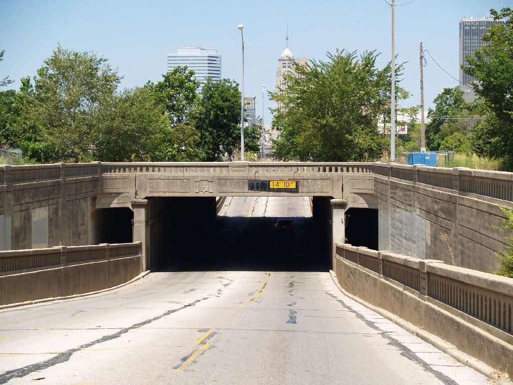
Old NW 39th St. US 66 Bridge Looking West


Looking Up, Notice What Must Have Carried Electric Lines


See ... I told you that the pics would speak for themselves, sad to say.
Go To Trains, Part 1 Go To Trains Part 2
Go To Trains Part 3 Go to Trains 3A Go To Trolleys 1
Go To Top
... Click here to read the full article and any comments ...
Edited 8/10/07 to add Oklahoma Railroad & Postal Map and to add descriptive text, on 8/12/07 to add the full 1930 zoning map, on 8/22/07 to add information about the Sanborn maps, and on 9/4/07 to add 1922 Sanborn Bricktown maps. For Oklahoma's 2007 Centennial Highway map, including a couple of Okc maps, go here. Everyone likes maps, don't they? (If they don't, they should!)This location will be my "repository" for historical Oklahoma City Street Maps and a bit of history which the various maps reveal, or lead to be revealed. As new maps are obtained deemed "worthy" by Doug Dawg for inclusion, this post will be modified again. As of today, here are the maps that will be shown and discussed at least a little ... click on a thumbnail map to move to the map ... 1890 Drawing
 | Sanborn Maps
 | Sanborn Example
 | 1922 Bricktown
 | 1911 Planning Map
 | 1924 Rail Map
 | 1920 Blue Book Map
 | 1930 Oklahoma Road Map
 | 1930 Okc Zoning Map
 | 1940s Street Map
 | 1957 City Map
 |
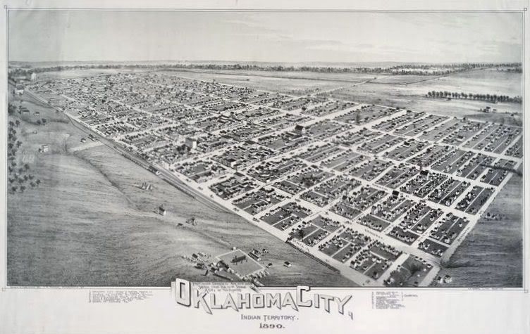
Oklahoma City, Indian Territory, 1890 by Thaddeus Mortimer Fowler. This is one of if not the most "well-known" of Oklahoma City "maps".
Click on the Pic For a Larger View
For a High Resolution image (3,298 x 2,218 px, 2.25 MB) from
Mark Klett's Photographing Oklahoma 1889/1991 (Oklahoma City Art Museum 1991), click here.

Note that Fowler uses "Indian Territory" instead of "Oklahoma Territory," and that's because until the May 1880 federal "Organic Act," the Unassigned Lands area was still part of Indian Territory. Everyone seems to like this drawing. In the high resolution version, street names and detail are much more visible. The above image is widely available from many sources; the one above comes from the New York Public Library.
T.M. Fowler came to be the most prolific artists doing panoramas like this one. According to American Panoramic Artists and Publishers,
The name which appears on the greatest number of panoramic maps in the collections of the Library of Congress is that of Thaddeus Mortimer Fowler. He was born in Lowell, Massachusetts, on December 21, 1842, and ran away from home at the age of fifteen. * * * To date, 411 separate Fowler panoramas have been identified. Of the 324 in the Library of Congress, the majority were acquired on copyright deposit. The Amon Carter Museum, in its article, "Texas Bird's-Eye Views," says that, "Fowler made a swing through Oklahoma and North Texas in 1890 and 1891. *** Fowler continued to draw and promote his views even into 1922, the year of his death."
Donald A. Wise's article, "Bird's Eye Views of Oklahoma Towns," says,
One of Fowler's finest views was the 1890 image of Oklahoma City. This view, as seen from the northeast looking to the southwest, was drawn on February 22, 1890, just ten months after the community was established. The prominence of the Santa Fe Railroad, the tree-lined North Canadian River, businesses, schools, churches, and utility facilities are detailed in this print. There are only two known original prints of this view. One is located in the George Shirk Collections at the Oklahoma City University Library. The provenance of this print includes information that it was purchased from the Thomas Streeter Collections for $600 in 1968. The other print is located in the Stokes Collection at the New York Public Library. The prints were lithographed in Boston by A.E. Downs.
Martha Fowler, a daughter of T.M. Fowler, stated in a 1980 interview, "There was a village in Oklahoma that he drew that became a big city. He had to be careful then. Once, he was just walking by some kind of a joint, and he made the mistake of lookin' in the window, and a bullet came right out and went through his hat. You just didn't act curious in them places!" Yep! That must have been Oklahoma City in 1890!
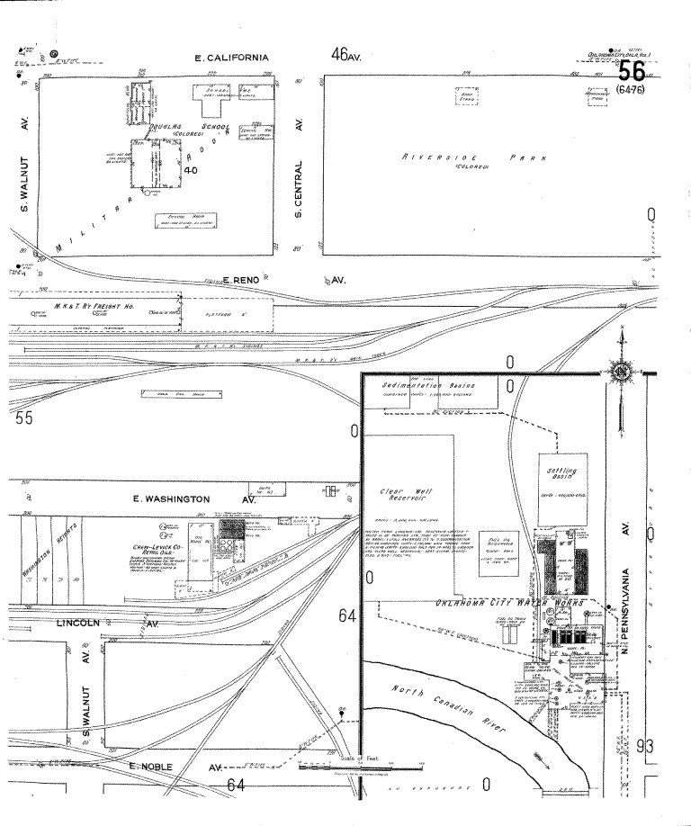
Sanborn Maps. Since 1866, the Sanborn Map Company has made detailed insurance maps around the country.
Larger image not available

While not freely available at Sanborn's website, if you have an Okc Metropolitan Library System library card (which is free), you can access Sanborn's vintage Oklahoma City (and lots of other Oklahoma town's) maps without charge.
To access the Sanborn maps via the Metro Library, get your library card out and ...
- Go to the library "login page"
- If you are using Norton Internet Security virus software, disable it for a few minutes ... 5 minutes is fine. If you don't, Norton somehow disables the web links to the Metro Library's automatic database access for those websites it links to which require a separate login and password.
- After loging in to the library's website and disabling Norton, a "Welcome" page opens ... it has a menu at the top. In that menu, click "Databases" and a Database page opens. It has lots of "Tabs" ... click the "Oklahoma" tab.
- A page opens ... one of the items in that page is "Sanborn Maps." Click it.
- The Sanborn Maps page then opens. In the drop-down box "Select State" box, choose "Oklahoma" (the only choice available).
- In the page which opens, select "Oklahoma City" (or other city you want), shown below

- Then, select an available map date ...

- Each map is broken down into thumbnails. Click on a thumbnail and that opens a page. To save a map, in the menu at the top, select "Download Map," shown below.

A PDF file will then open for that page. After it's open, you can save a copy to your computer.
I'm sure that you can figure out the rest. Each 1-page file contains a very high resolution image (typically around 5100 x 6130 px) so you can "zoom" to see all of the very fine print. When the PDF file is open, you can also export the images to a graphic file if you want. If you do, I recommend that you use the TIFF file format which works much better than JPG. After exporting, you can then save it as a JPG file in your graphics software.
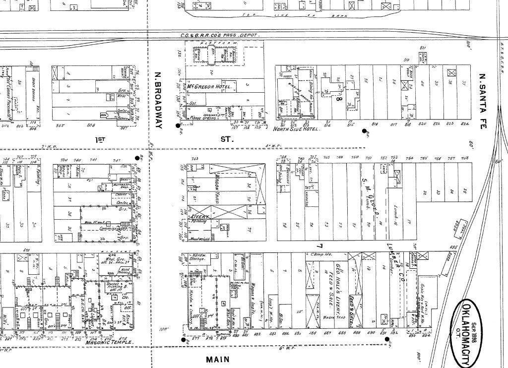
An example is shown below (but not nearly as "fine print" as you can see when you open a file in Acrobat Reader).
Click image for a larger view

I've saved and reassembled a couple of these complete maps into single PDF files. Very often, the original PDF source files do not orient "north" at the top of the map, and I've changed that in my modified files. These files are quite large but you can open and/or download them from here. To merely "open" one of the files below, left-click on the link as you normally would. To "save" to your computer, right-click on a link and select "Save Target As ..."
- 1894 Sanborn Oklahoma City Map (1.95 MB), click here
- 1904 Sanborn Oklahoma City Map (6.32 MB), click here
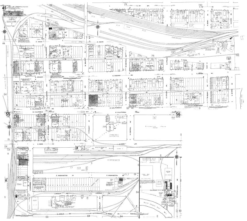
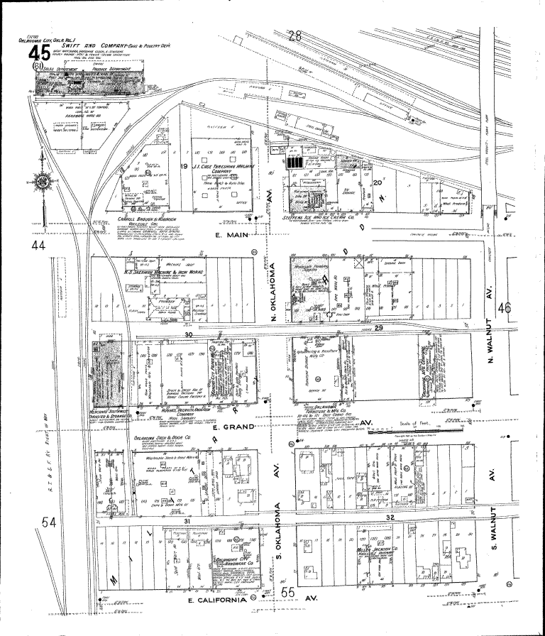
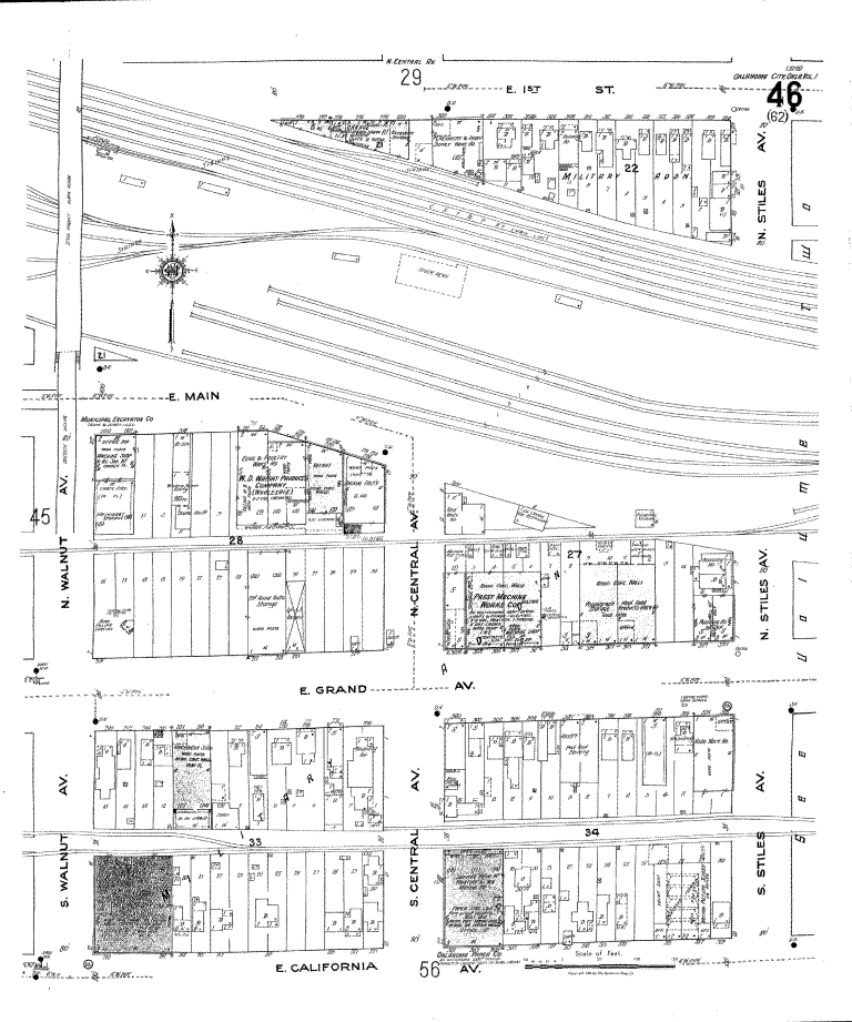
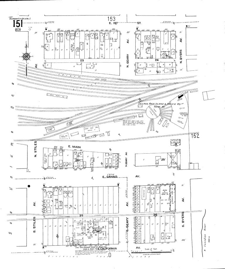
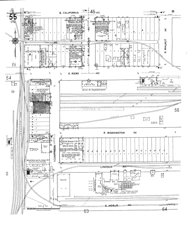
1922 Sanborn Bricktown Maps. Mainly, I had a close look at the 1922 Sanborn Maps to focus on the Bricktown area as relates to Okc Train history, covered in other posts. See Trains Part 3: The Dean Schirf Colletion. But, for a serious researcher, these maps provide a close-up look at the actual buildings located in Bricktown in that day, down to measurement in feet and many other details. So, I decided to post them here, also. What follows are particular Sanborn maps and, also, a generic "Bricktown" map which I've assembled from the larger parts, sizing them down substantially. The closest detail will always be in the "larger" and "very large" links, shown below. "Very large" means the actual images located within the Sanborn Map PDF files, usually 5,100 px wide. "Larger" is resized down to about 2,400 px wide, for the most part. Clicking an image opens a "large" image, but not too much larger than the small images which are shown below.
The 1st map, below, is the "composite" map, as well as I could manage to put it together.
Bricktown in 1922, Generally
Click the image for a somewhat larger view
Click here for a much larger view

The "composite" map, above, actually consists of 5 separate sections of the 1922 Sanborn map. Map 1 is the northwest area of Bricktown, Map 2 is the north central, Map 3 is the northeast; Map 4 is the southwest area, and Map 5 is the south central area. The 1922 Sanborn maps don't show what would be the "southeast" area, around Reno and Byers.
Map 1: Northwest Area
Click the map for a somewhat larger view
Click here for a larger view Click here for a very large view

Map 2: North Central Area
Click the map for a somewhat larger view
Click here for a larger view Click here for a very large view

Map 3: Northeast Area
Click the map for a somewhat larger view
Click here for a larger view Click here for a very large view

Map 4: Southwest Area
Click the map for a somewhat larger view
Click here for a larger view Click here for a very large view

Map 5: South Central Area
Click the map for a somewhat larger view
Click here for a larger view Click here for a very large view

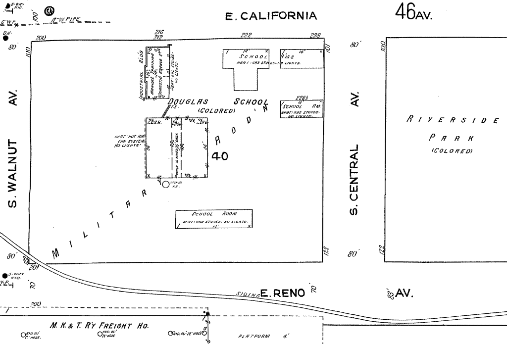
Sometimes, these vintage maps tell more than physical names, dimensions, and locations of streets, tracks, and buildings. Sometimes, they also give a glimpse into a day that we hope is long gone by. Compare, for example, the fine print for "Douglas" and "Irving" schools in 1922. If you can't read it, click the image for a larger view. Read closely what each picture says about "heating" but especially "lighting." This was not "social" commentary ... remember that the maps were primarily made for use by the insurance industry.
Douglas School On East Reno

Irving School, A Few Blocks North

The scrivener's text tells the sad tale and renders further comment unnecessary.
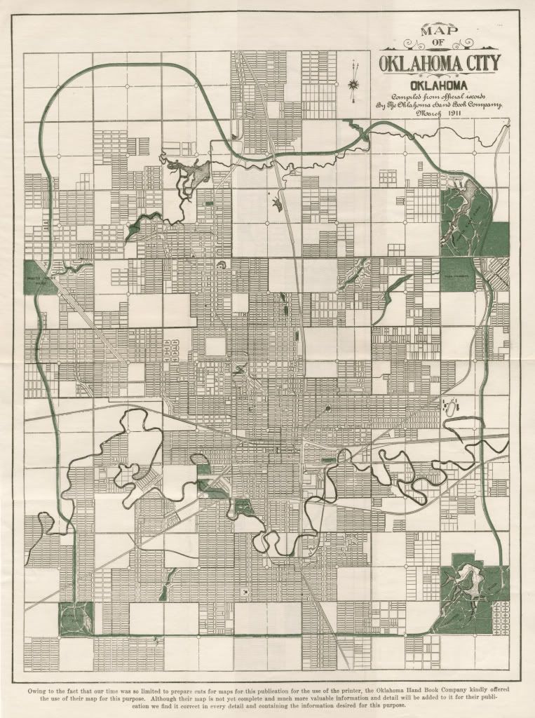
1911 Oklahoma City "Planning Map" by the Oklahoma Hand Book Company. This does not appear to be a document prepared by or at the instance of Oklahoma City. The text below the approximately 14" x 20" map reads, "Owing to the fact that our time was so limited to prepare cuts for maps for this publication for the use of the printer, the Oklahoma Hand Book Company kindly offered the use of their map for this purpose. Although their map is not yet complete and much more valuable information and detail will be added to it for their publication we find it correct in every detail and containing the information desired for this purpose." The implication is that the map was used in some publication but, if so, I don't know which one. This is one of the better maps I purchased from Doug Hamilton at Antique Avenue Market and is "suitable for framing."
Aside from aesthetics, the map is useful in identifing Grand Boulevard which circumvented the city, in showing the railroad and trolley systems then in place, and showing the location of the wild and woolly North Canadian River running along the south side of downtown.
Click on Pic For Larger View
For a Very High Resolution Image (3,582 x 2,154 px, 5.82 MB), click here.

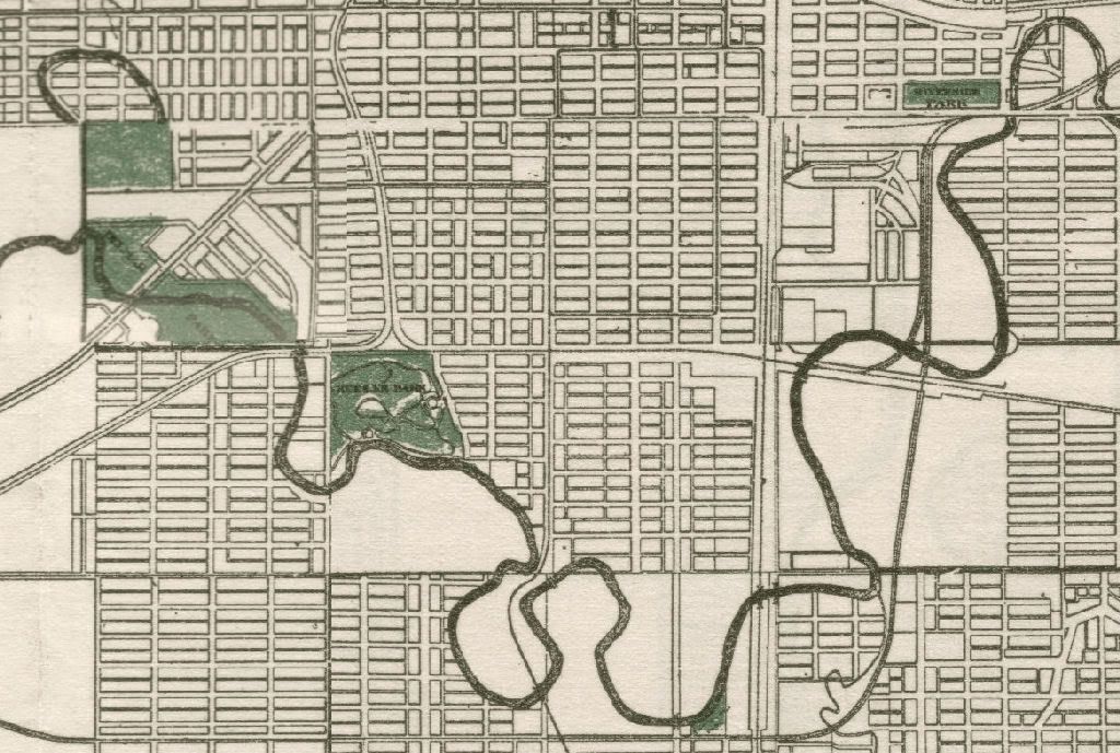
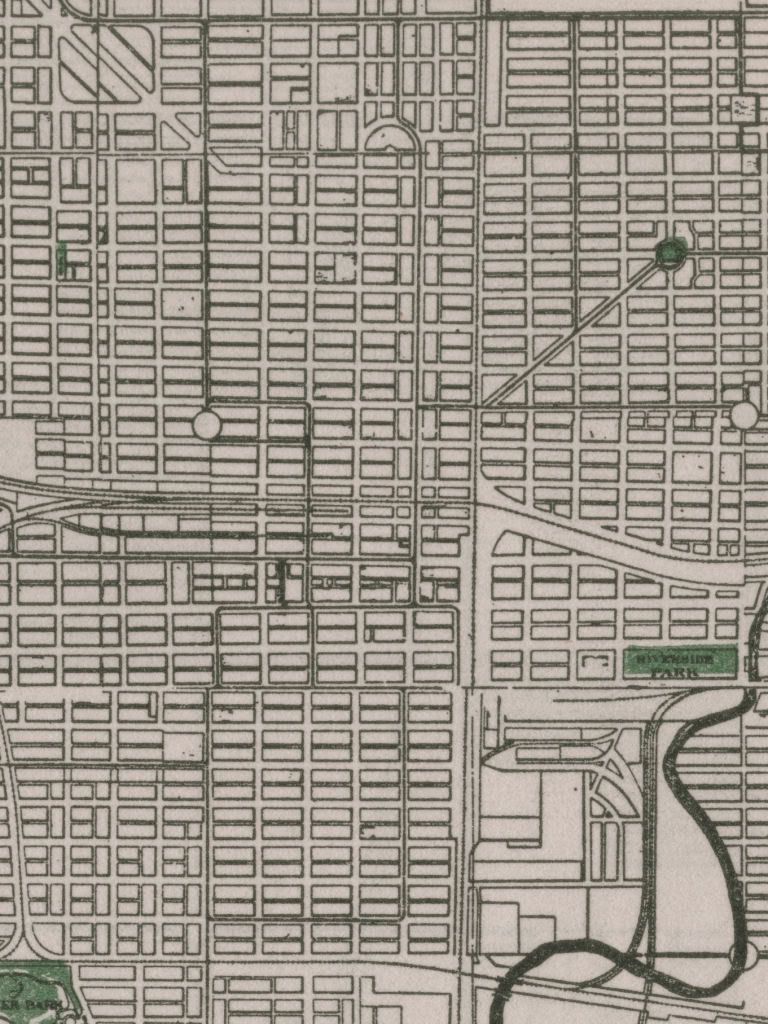
Zooming In On Downtown
Click on the Pics for Larger Views
Look At The Meandering North Canadian River!
Main Street is at the top, Western at the Left


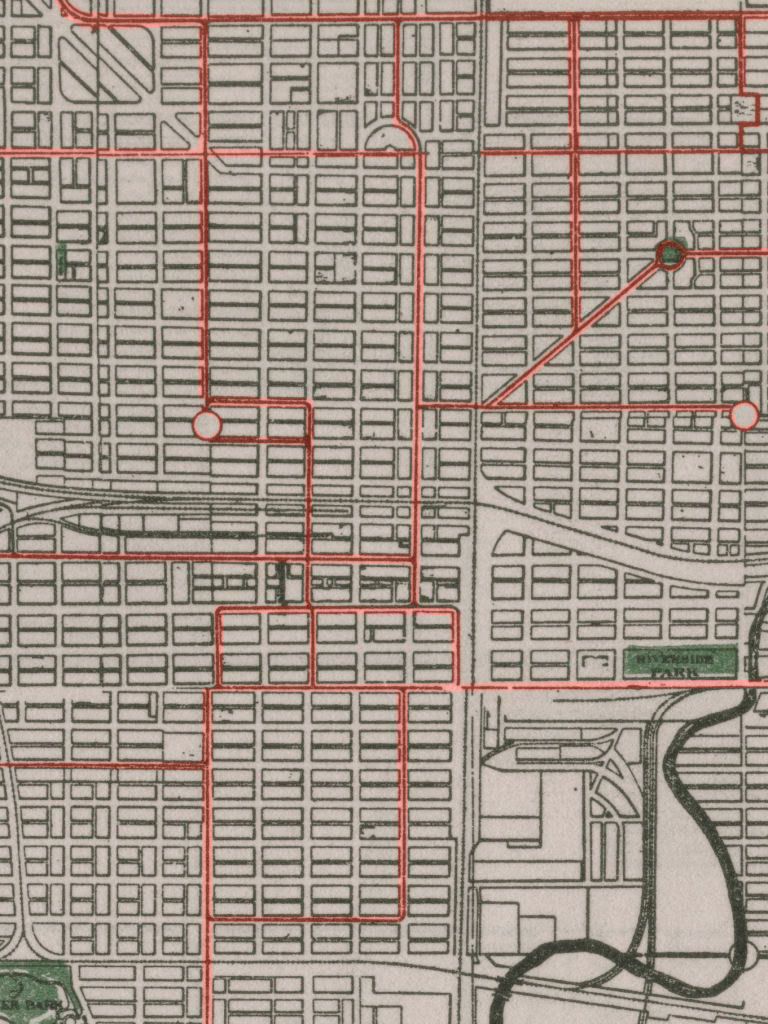
Trolley System In Above Map
(If I've interpreted the map correctly)

Railroads Split Downtown, East/West & North/South

The Impact of Rail on City Streets. As is evident from the 1911 Planning Map, rail was king in those days, even to the extent of dividing downtown east and west above Main and below 2nd street. A detailed map at the Oklahoma Department of Libraries by the US Postmaster General shows the Oklahoma rail and postal system in 1924. At that website, 20 800 x 600 px quadrants are individually shown, but I've assembled them together into a single map, below.
1924 Postmaster General's Oklahoma Rail & Postal Map
Click on the map for a high resolution view (2,860 x 3,346 px, 1.12 MB)

Excerpt from the larger map showing
the Oklahoma City Metro Area's Rail System
Click on the image for an expanded metro area

After several years of controversy at the local and national level, the east/west rail lines splitting downtown Oklahoma City were finally removed (which story will be a good topic for another day). The December 1, 1930, Oklahoman carried a front page story called, "Crowds Cheer Last Rock Island Train From Civic Center." The story described the fanfare which celebrated the last trip from the Frisco Depot north of the Skirvin westbound, and reported that,
Completing the impossible, the "pioneers of 1930" broke down the "iron wall" through Oklahoma City late Sunday to push on toward their Utopia, a model civic center. The "wall" was the aged Rock Island line of rails which has divided the city since its foundation, and the "pioneers" the young business men of the city led by a veteran, C.F. Colcord, city builder.
The Last Train Ride

After the blare of the ceremony had settled down and darkness enveloped the city, light blazed along the old right of way as workmen for the company lifted the tracks and others began leveling the station relic. Their task is that of removing all signs of the railroad in 48 hours. The new Union Station on Choctaw (now SW 7th) between Hudson and Harvey opened for business on July 15, 1931.
This topic will be considerably expanded in my next post, "Trains & Trolleys."
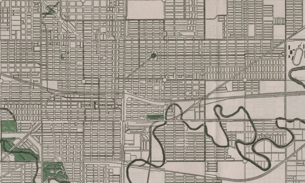
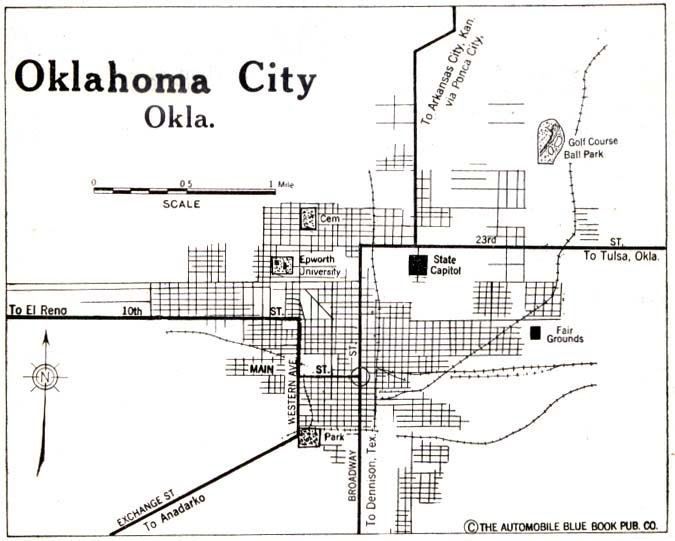
1920 Blue Book Map. Nothing, other than the fact that it "exists" and so is part of Oklahoma City lore, makes this "image" a keeper! I'd hate to have to navigate the city based on the map. Nonetheless, here it is.
Click on the Pic for A Larger View

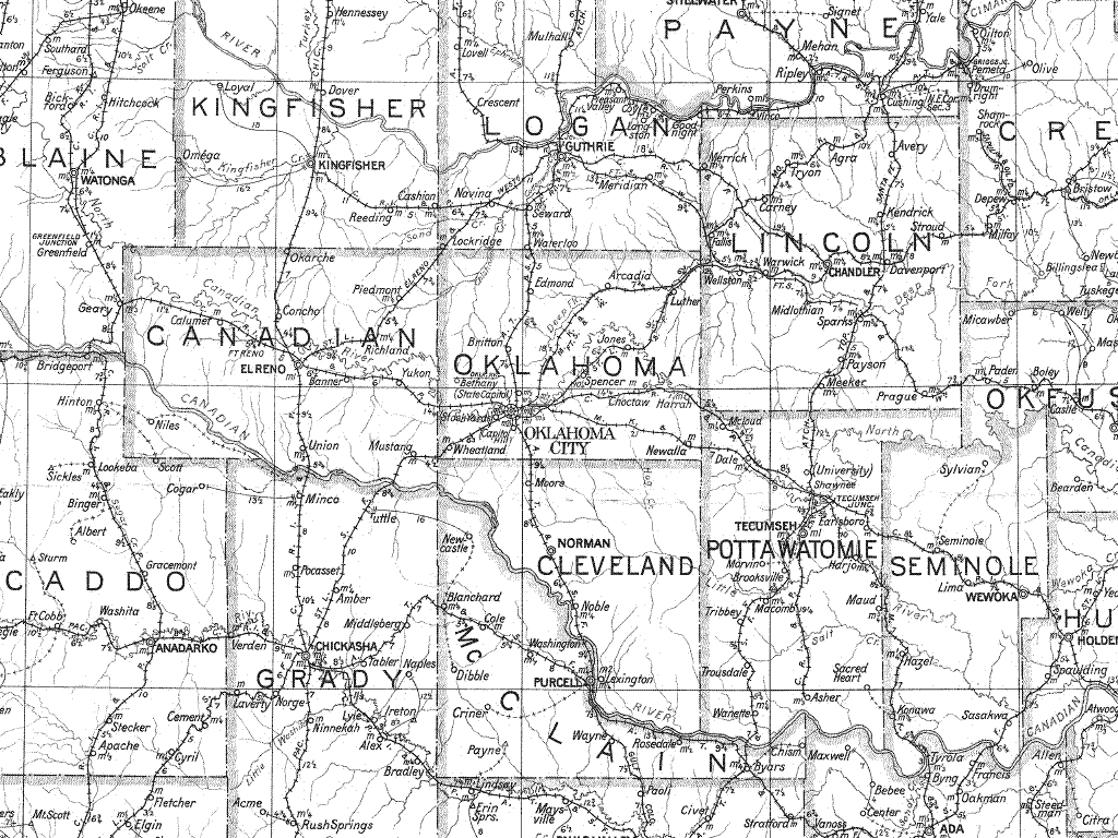
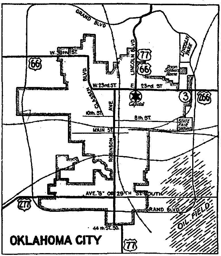
From Oklahoma 1930 Road Map. At least, that's what the source said (I've misplaced it and will identify it when I do). I've not actually "seen" the complete map, but, sadly, if this was a State of Oklahoma publication, the state's cartography was not particularly good for drivers in those days.
Click on the Pic For a Larger View

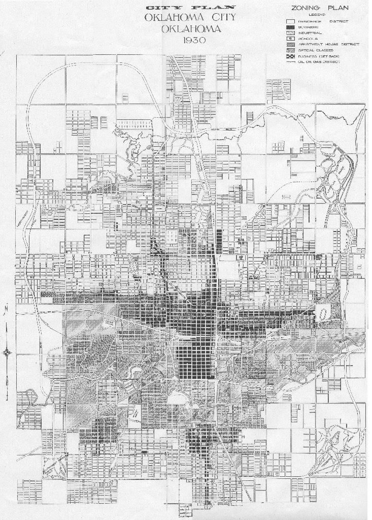
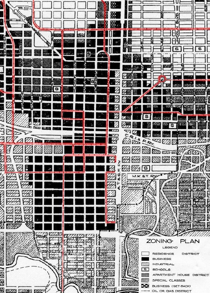
1930 Oklahoma City Zoning Map. This comes from a copy of a map I located at the downtown Norick Library and appears to be an official zoning map produced by Oklahoma City sometime in 1930. Text at the bottom of this map reads, "This map shows the boundaries of the various use districts, as set forth in the accompanying zoning ordinance, which is now in force, covering only the use of property."
Click the image below for a larger view
To see a high resolution (3,455 px x 4,825 px, 3.76 MB) view of this map, click here.

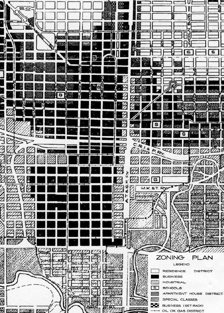
A cropped version of this map showing the downtown area appears below. It appears that when this map was produced that the east/west railroad which bisected downtown had not been removed, even though we know from the above that they were gone by the end of 1930. Images from 1931's "Great Race" (Ramsey Tower and First National Center) show the former railroad "right of way" east of Robinson (now Couch Drive) being used for vehicular traffic.
The 1930 Zoning Map is most useful in its identification of the train and trolley routes then in place and that topic will be more fully developed in my next post, "Trains & Trolleys." But, for now, here's the cropped image showing downtown when the map was made.
Click on the Pic for a Larger View

Above Map Showing Trolley Routes
(If I've interpreted the map correctly)

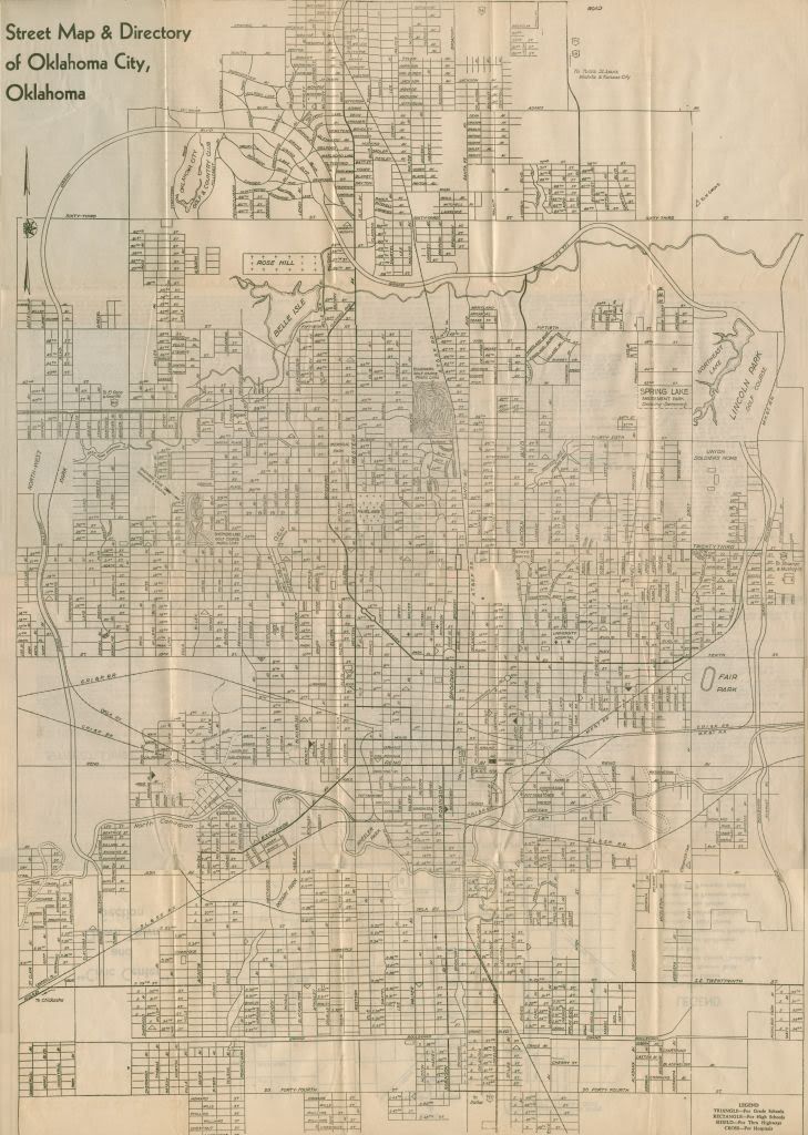
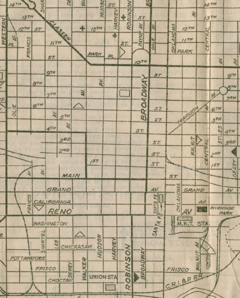
Manley's Office Supply City Map. This fascinating map was also purchased from Doug Hamilton at Antique Avenue Market. The map is not dated and one must look for "clues" in the map to make best guesses as to its publication dates. The "trick" is "bracketing" its "earliest" date with its "latest."
Earliest & Latest Date "Tips" From The Map- Union Station (completed July 1931) is present in the map
- Civic Center Buildings (completed by 1936) are on the back side of the map even though they are not shown in the main map and even though 89er's Circle (now Patience Latting) east of City Hall is not, either.
- Shepherd Lake Swimming & Golf Course is shown in the map. The last reference I located about the golf course was in the March 27, 1939, Oklahoman where a fellow was described as getting a hole-in-one on the 156-yard #6 hole. I found references to "Shepherd's Lake" as late as 1951, where some dogs were saved from frigid waters. A retrospective June 2, 1963, article described the course as "Oklahoma City's first golf course." Of course, the property became the eventual home of Shepherd Mall.
- The Union Soldier's Home roughly at NE 36th & Eastern is in the map. It opened in December 1918 and had a rocky history, particularly in the early 1930s ... in 1933 Gov. Alfalfa Bill Murray vowed to shut it down and vetoed funding legislation. Litigation ensued. The Oklahoman's archives reflect that it closed its doors "as such" in January 1937. Other articles, though, show that it came to be at least partially used as an annex to the Crippled Children's Hospital (at least as early as 1933-34 and as late as 1935), and, apparently, according to a January 26, 1939, article, the property had been used by Oklahoma City as a detention hospital for four years ... however, the article may have been referring to a building located adjacent to the former Union Soldier's home, I can't tell for sure. At least by 1944, the property became occupied by the State Department of Health. Hence, this "clue" is ambiguous from Doug Dawgz vantage point.
- Edgemere Golf Course is shown in the map on the north side of NW 36th and west of the A.T.& S.F. railroad tracks. Oklahoman articles indicate that this facility closed in 1946, it being purchased by the 1st Christian Church.
- Trolley lines are not present. After World War II, rail trolleys came be replaced by motor buses. An April 13, 1947, Oklahoman described the closing of the few remaining trolley lines in an article called, "An Era Passes: Trolleys Fold."
Street cars sang their swan song in Oklahoma City Sunday morning. At 1 a.m. Sunday the belle Isle, Capitol and Linwood cars left the corner of Main and Harvey for their final trips. They closed after 40 years of trolley service in the city. - The Classen "extension" south of NW 16th is not in the map. It opened in November 1952.
- The North Canadian River has not been "realigned." Construction did not start on this project until 1953 and was completed in 1958.
Soooo ... drum roll ... all things considered, I'm placing this map as being made in 1947, plus or minus 1 year, even though inconsistent items are shown in the map by that date selection. I'm guessing that the map maker was sloppy in some of the "landmarks" included in the map.
Enjoy the map and a couple of items found while researching some "clues" ... and, for sure, make your own best guess, too!
Click on the Pic For a Larger View
For a resolution image (6,101 x 8,571 px, 9.75 MB), click here.

A Closer Look At Downtown (Click on the Pics For Larger Images)

Civic Center Area

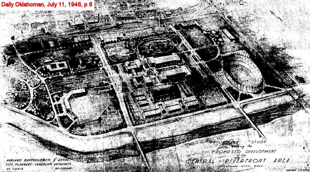
As said above, in trying to identify the date of this map, I searched the Oklahoman's archives to follow up on "clues" ... one of the more interesting finds was this 1946 proposal (which obviously got nowhere) for a downtown riverfront park, complete with baseball and football stadiums! No, it doesn't have anything to do with the topic at hand, but it was too good not to include, just the same!
A 1946 Downtown River Proposal
A Poor Image, But Still Cool!
Click on the Pic For a Larger View

One of the "loose ends" in dating maps was the location of Classen Boulevard south of 17th Street. Pre-"Manley" maps show Classen not continuing southbound south of 17th Street but instead that it turned southeasterly and, at that point, was what we call "Classen Drive" today, progressing until it intersected with 10th Street near Walker. This map shows the same "Classen" as the "pre-Manly maps." So, figuring out when Classen became the "Classen" we know today was a piece of figuring out when this map was made. The Oklahoman archives show that ...
Classen Becomes a Freeway in 1952?
Click on the Pic For A Larger View

I'll add more info about the "clues" shortly. For now, we know that the map had to have been made before 1952, when Classen became a "freeway!"
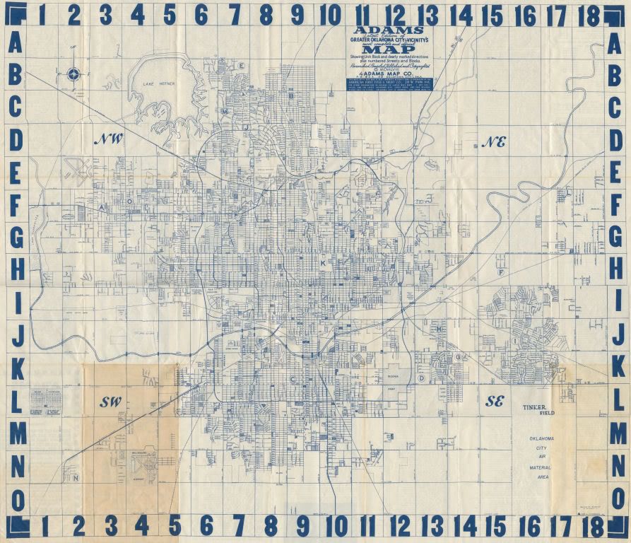
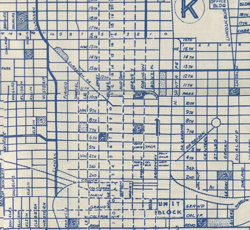
1957 Oklahoma City Street Map by Adams Map. Co. This map is a huge "fold-out" map made by Adams Map Company in 1957, measuring about five (5) feet square! It is yet another that I purchased from Doug Hamilton at Antique Avenue Market. I'll add more text about this map later. For now, have a look at the map!
Click on the Pic For a Larger View
For a High Resolution Image (5,866 x 5,046 px, 4.82 MB), click here.

A Downtown View

Go To Top
... Click here to read the full article and any comments ...
|
















 Posts
Posts


