Oklahoma City Metro History Kicks, that is. I had a rare occasion to meet someone at the Wellston McDonald's (north side of I-44) on November 13, 2008, and the best way to get to that facility from Oklahoma City is to travel Oklahoma State Highway 66 which leads to Wellston (a few miles into Lincoln County) and the back (north) side of that McDonalds. Thinking there might be some good photo ops, I took both camera and imagination with me and am I ever glad that I did!
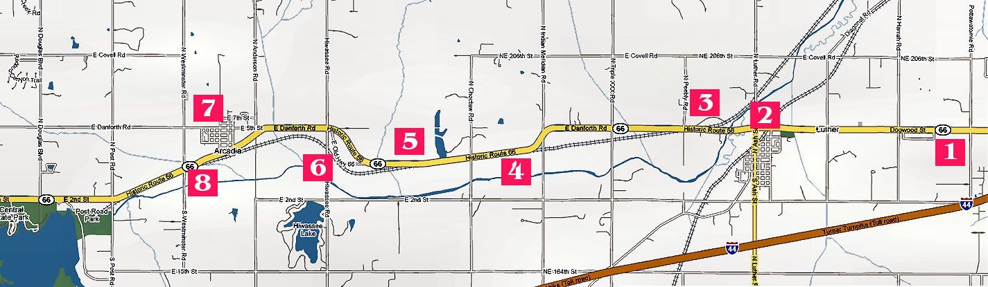
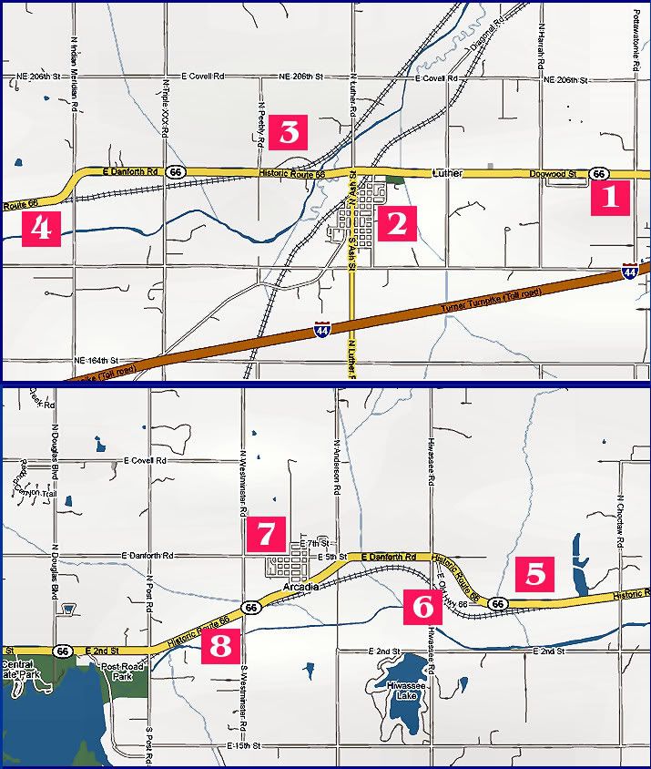
Stop 1 - W. Irving Stop 2 - Luther Stop 3 - US 66 Stop 4 - Land Run
Stop 5 - Gas Station Stop 6 - US 66 Stop 7 - Arcadia Stop 8 - POPS
A heck of a lot of Oklahoma City metro history is up that way ... no, it's technically not "Oklahoma City history," but, being in Oklahoma County (from Pottawatomie Road west), it's surely a part of the metropolitan area history and legacy, and it's a part that is unlike that which most Oklahoma Citians commonly consider.
This article not only gives you some starter research information, it gives you a quick tour that I'd recommend to any who are Oklahoma City history buffs or who just like "getting away" from the noise of the city into a rural and pastoral part of the metro. Take but a few steps north and east into the Route 66 zone in northeast Oklahoma County and you're there.
Enjoy the trip — it's one that you might enjoy taking on your own. By no means did my little excursion produce a comprehensive and definitive historical look into that area, but it does give a start and a few surprises. Read on, and enjoy!
THE AREA OF THE TOUR. My primary purpose for the trip was to meet someone in Wellston, as I said. Oklahoma Highway 66 exits I-35 a few miles north of the I-44 (Turner Turnpike) exchange — the signs mark the highway which, at that point, is the same as N.E. 2nd in Edmond. Following Oklahoma Highway 66 eastbound, after passing by Arcadia Lake, one arrives at Arcadia, then Luther, then the Oklahoma County eastern border. A few miles further east lies Wellston in Lincoln County. I kept my eyes open while making that 1st leg of the trip. After my meeting, on the return leg, my tour began ... the tour travels east to west on Oklahoma Highway 66 toward I-35.
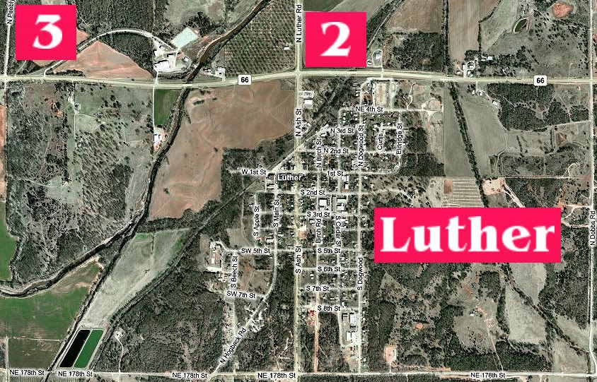
Points of interest described in this article are shown in the maps below. The first map shows the tour layout but it is more easily seen when that layout is broken into two segments. Both are shown below.
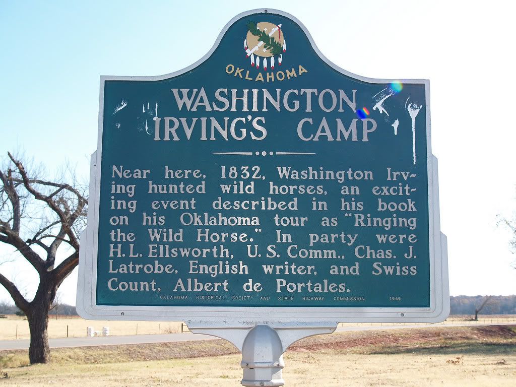
 STOP 1: WASHINGTON IRVING MARKERS. That would be the "Legend of Sleepy Hollow" and "Rip Van Winkle" Washington Irving (1783–1859), said to be America's first internationally (meaning European) acclaimed writer. In 1832, he accompanied Captain Jesse Bean and his U.S. Rangers on an trip through what is now central Oklahoma, that trip being described in his A Tour on the Prairies. Chapter 25 of that book, called "Ringing the Wild Horse", is mentioned in the 2nd marker shown below.
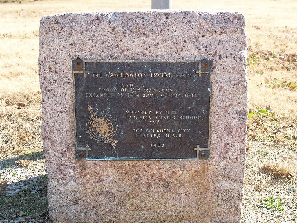
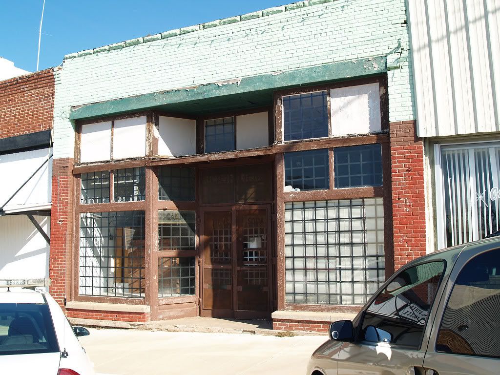
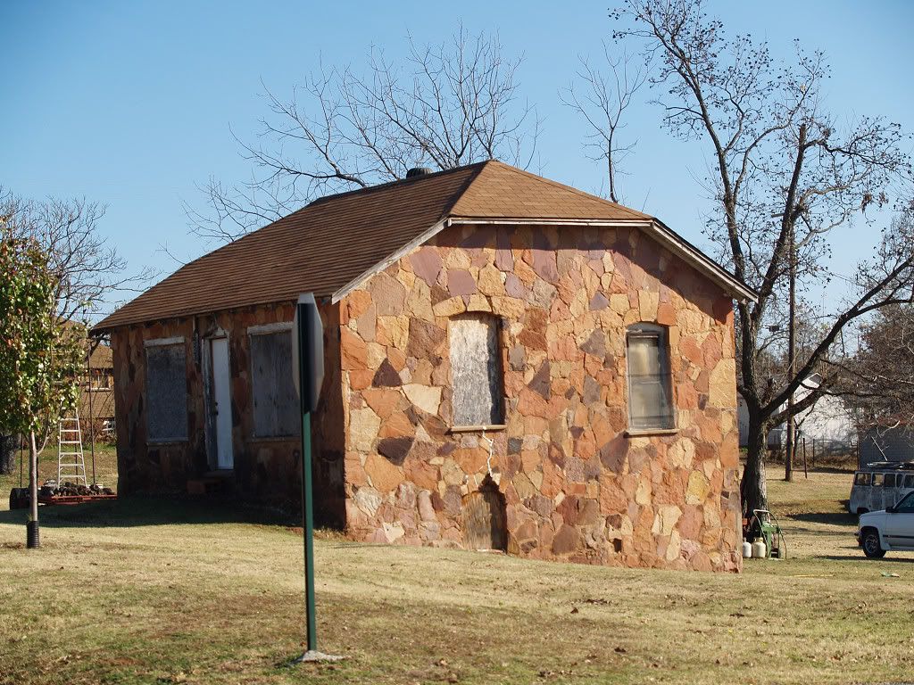
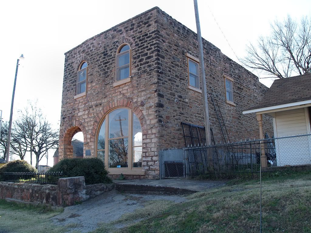
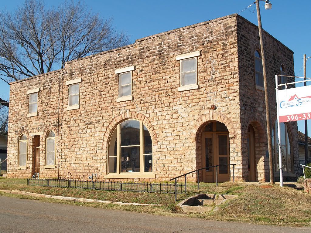
STOP 2: LUTHER. Luther, located in Oklahoma County's Luther Township, is about 3 miles west of Pottawatomie Road, the eastern boundary of Oklahoma County.

The 1905 Oklahoma Map & Gazetter places its population at 400. George Shirk's Oklahoma Place Names says that its Post Office was established July 26, 1898, and that it was named for Luther Jones, son of Oklahoma City business man and railroad promoter C.G. (Gristmill) Jones. However, Bob Blackburn's Oklahoma County, Heart of the Promised Land (1982) says that the town was platted in March 1898 by Luther Aldrich. A flour mill and cotton gin, as well as other businesses (including a hotel, newspaper, grocery, hardware, bank) made it natural for the Frisco Railroad to establish a station there — although it's also possible that it was exactly the other way around, i.e., that the station was responsible for the growth. Blackburn's book shows Luther's population hitting a peak of 1,159 in 1980 (its 1st year over 1,000) but the 2000 census shows Luther at 612. Although the present makeup of Luther is largely white, given that it was home to the Booker T. Washington High School (presumably a black segregated school), that was not as true in its earlier years. A March 22, 1906, Oklahoman article. At issue in a legal dispute was which particular schools either white or black students should attend, or something like that. The article noted that when a particular school was built white students were in the majority and that black children attended school in an alternative building. By 1905, the ratio was reversed, said the article, and the white/black students were flipped into the respective other building. The "main" school was constructed "near Luther," the article said. This is all pretty fuzzy but the point that a significant part of Luther's population was black seems rather clear.
Perusing the 1901-1907 Oklahoman archives (with statehood, Oklahoma became, technically, a "dry" state), I noticed about 10 notices for applicant's liquor licenses in Luther but not much else of consequence (disregarding a few stories about murders, etc., which don't really tell much about history).
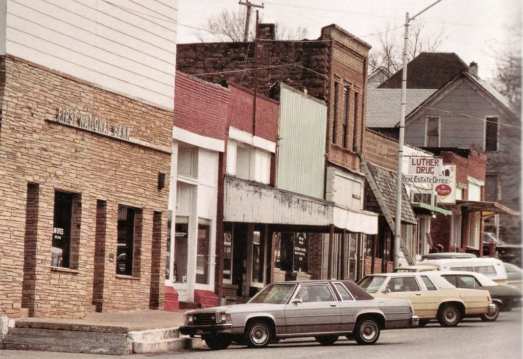
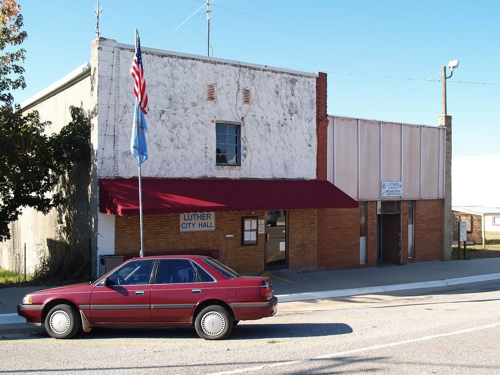
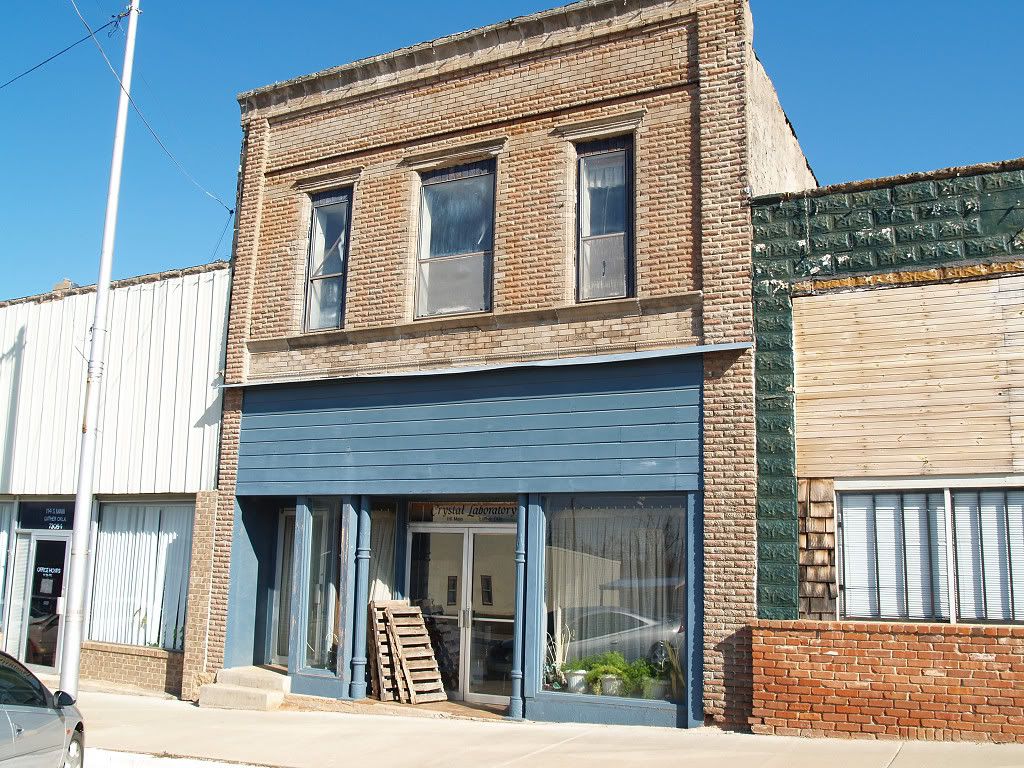
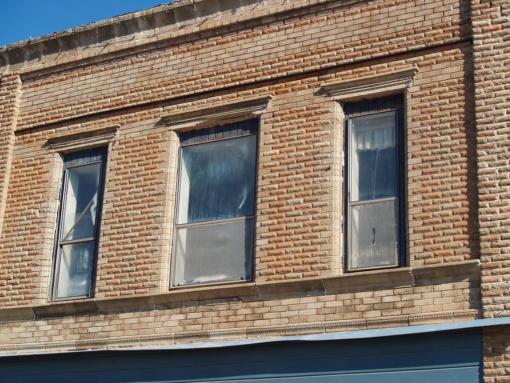
Bob Blackburn's book contains a couple of Luther photographs taken by David Fitzgerald, presumably shortly before the book's 1982 publication. It may be interesting to compare the photos with those I took 16 or so years later.
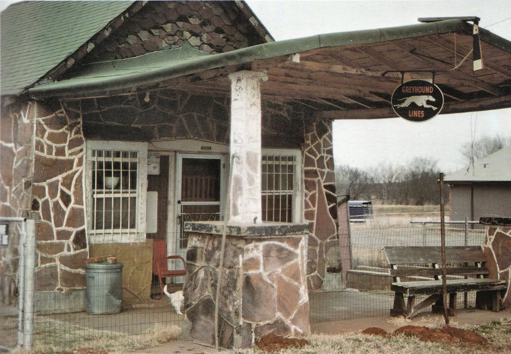
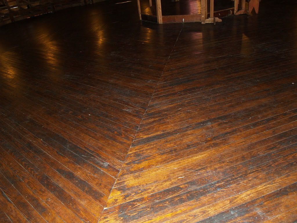
Old US 66 Bus Station
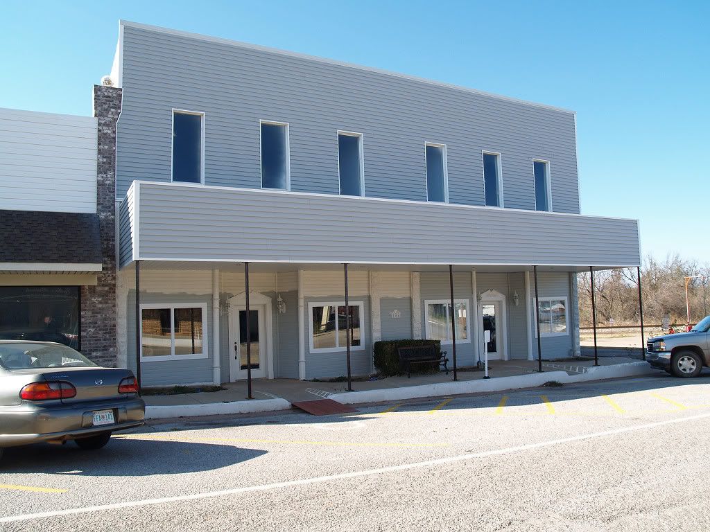
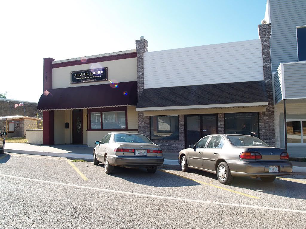
Below are the photos that I took during my personal tour. There are indeed some newer buildings, largely on the east side of town, but I was mostly interested in the antiquities and in downtown, shown below. Click on any image for a larger look.
Downtown Views Along Ash (Luther Road)

South of downtown


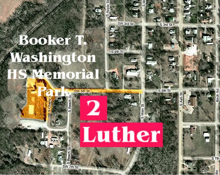
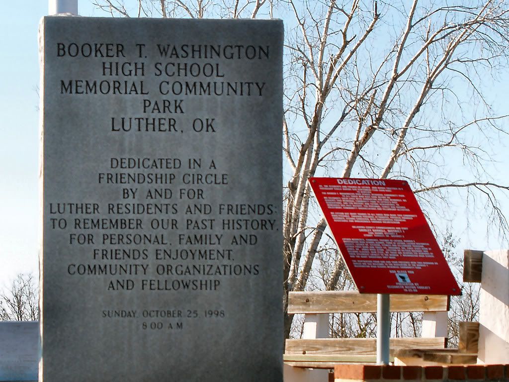
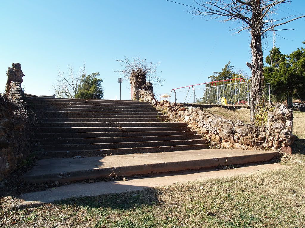
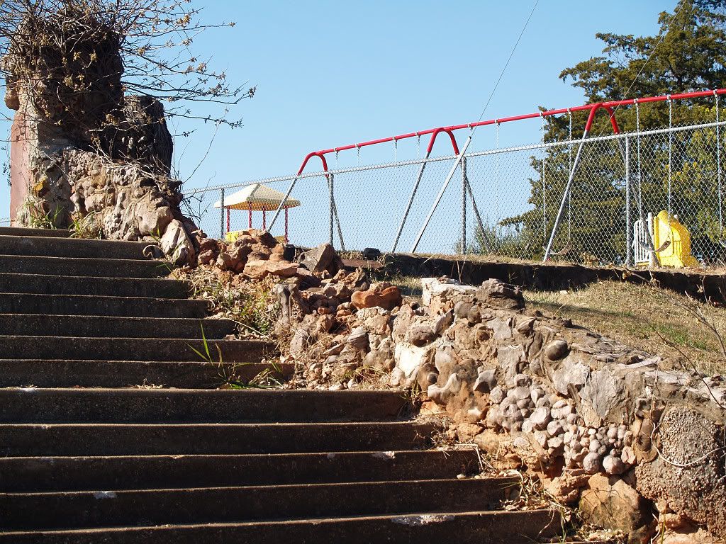
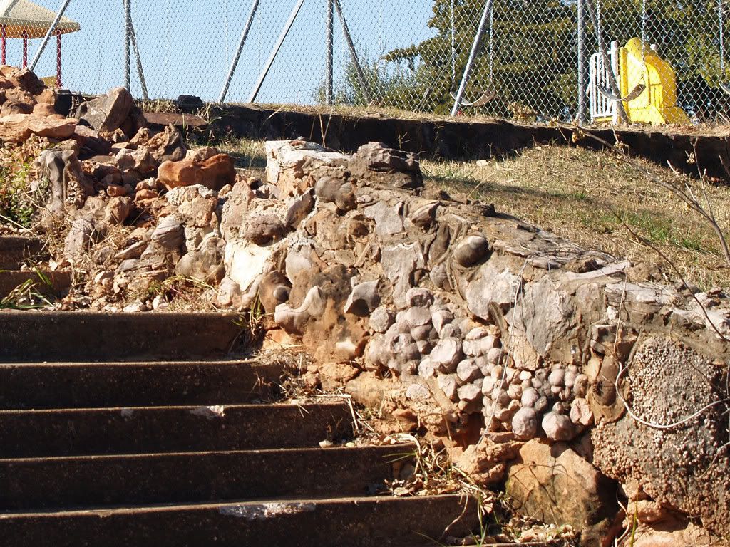
Location of the Booker T. Washington High School Memorial Park
The Park
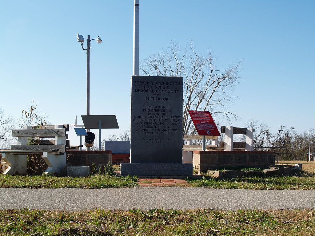
Park Entrance -- check out the banister
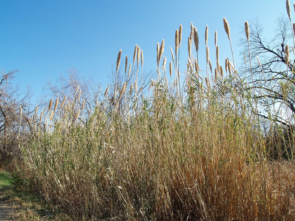
Grass (?) along the road -- 10 feet tall
By my uneducated eye, it does appear that Luther is fairing well -- several upgraded properties downtown and new residences on the east, an activity center on the south -- but the old parts are those which contain the charm, and plenty of them exist to see.
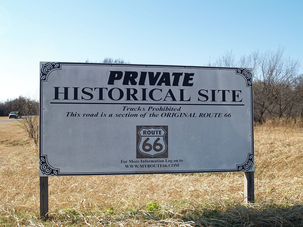
STOP 3: SEGMENT OF ORIGINAL US 66. US Highway 66 was initially built from Edmond to at least the Oklahoma County line in 1917 but it was not paved until 1929. The highway's course generally matched the Deep Fork River (of the Red River) which paralleled the MK&T RR tracks from Arcadia to Luther and then the river, MK&T, and Frisco tracks northeasterly toward the county line. Just a few hundred feet west of Luther on Oklahoma Highway 66 an individual owner has preserved and made available for public viewing an original paved segment of US Highway 66. The map below shows the location and where the original road crossed the Deep Fork River (which it no longer does).

A sign on the north side of the highway marks the entry
Following the original segment eastward

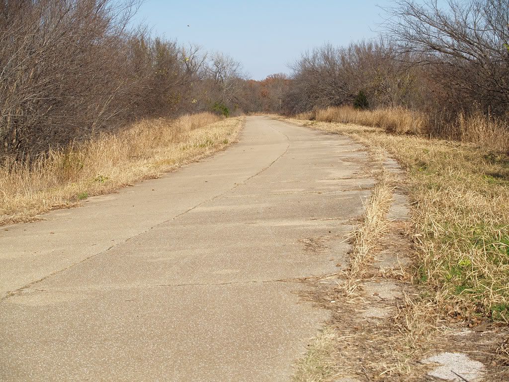
What a driver would see
When US Highway 66 was paved in concrete (the parts shown in these images were paved around 1929), cars were narrower, road shoulders didn't exist, and the roads could get downright curvy.
STOP 4: LAND RUN MARKER. Proceeding west on Oklahoma Highway 66 at a location I wouldn't have expected (since it is located well into Oklahoma County slightly west of Indian Meridian Road), this Historical Marker on the south side of the road caught my eye:
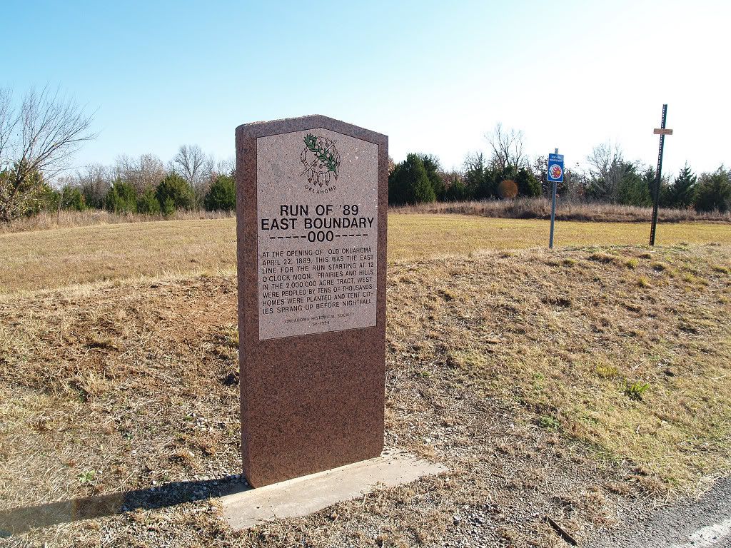

Since this marker is located about 7 miles west of the Oklahoma County line (Pottawatomie Road), if the marker is accurate, a 7-mile strip of Oklahoma County east of the marker must not have been included in the April 22, 1889, Land Run -- if and when I get this figured out, I'll amend this article.
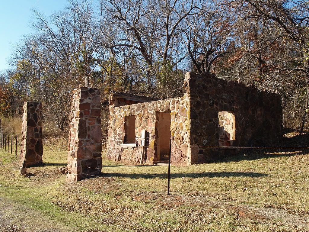
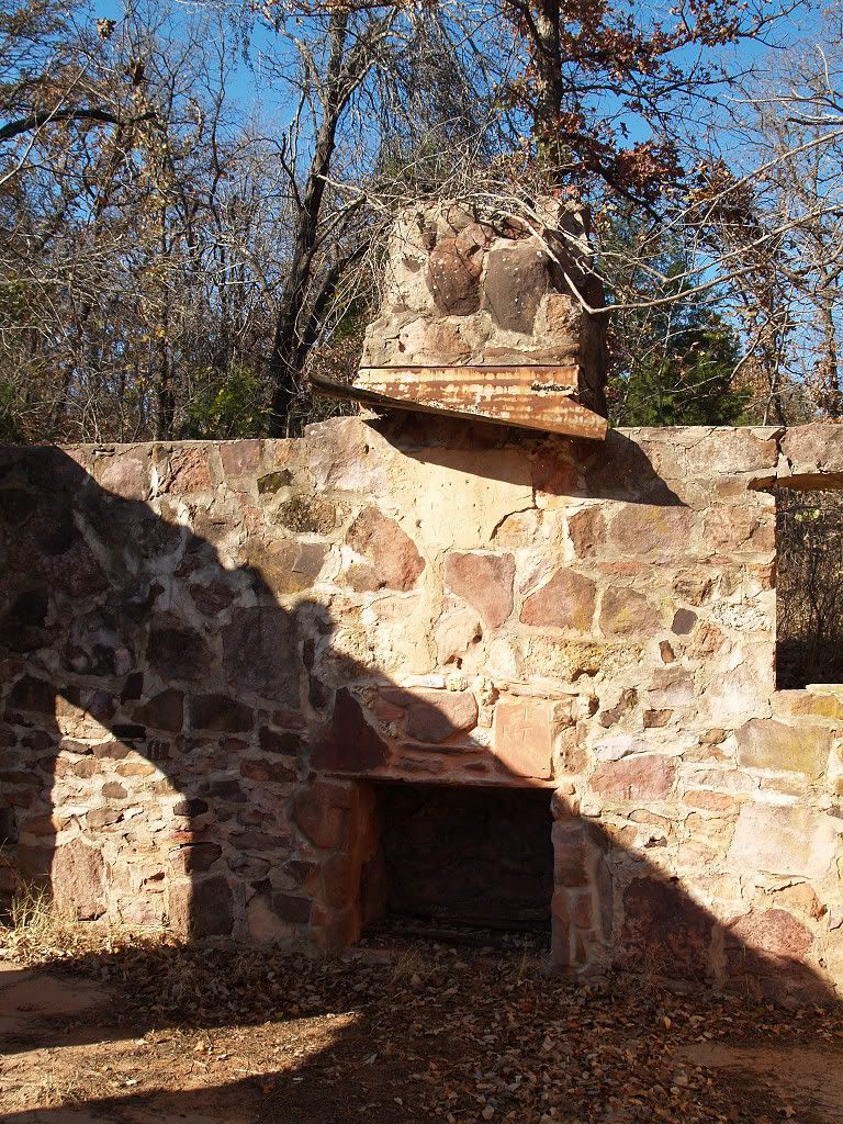
STOP 5: GAS STATION & COUNTERFEIT SHOP. Continuing west, I initially passed by the "ruins" shown below but then I thought better about doing so. Doubling back, I observed one of the more interesting stops on the tour -- a US Highway 66 Gas Station built before US 66 was paved — but it was more, as you shall see.
A small sign and picture are on the entry
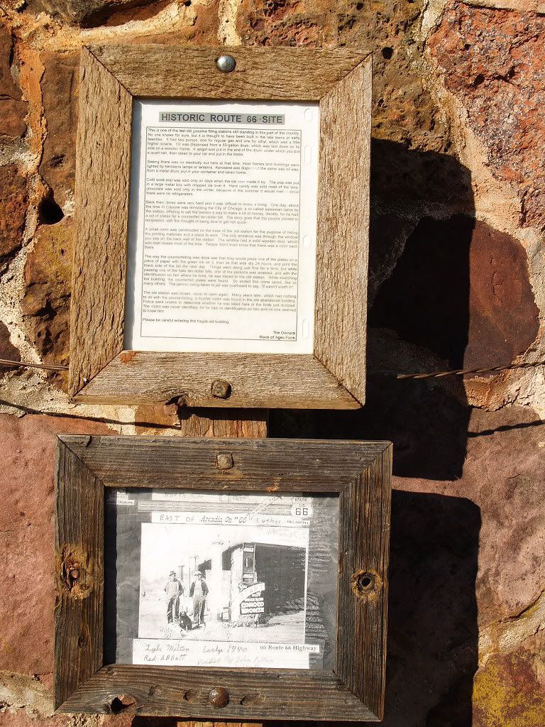
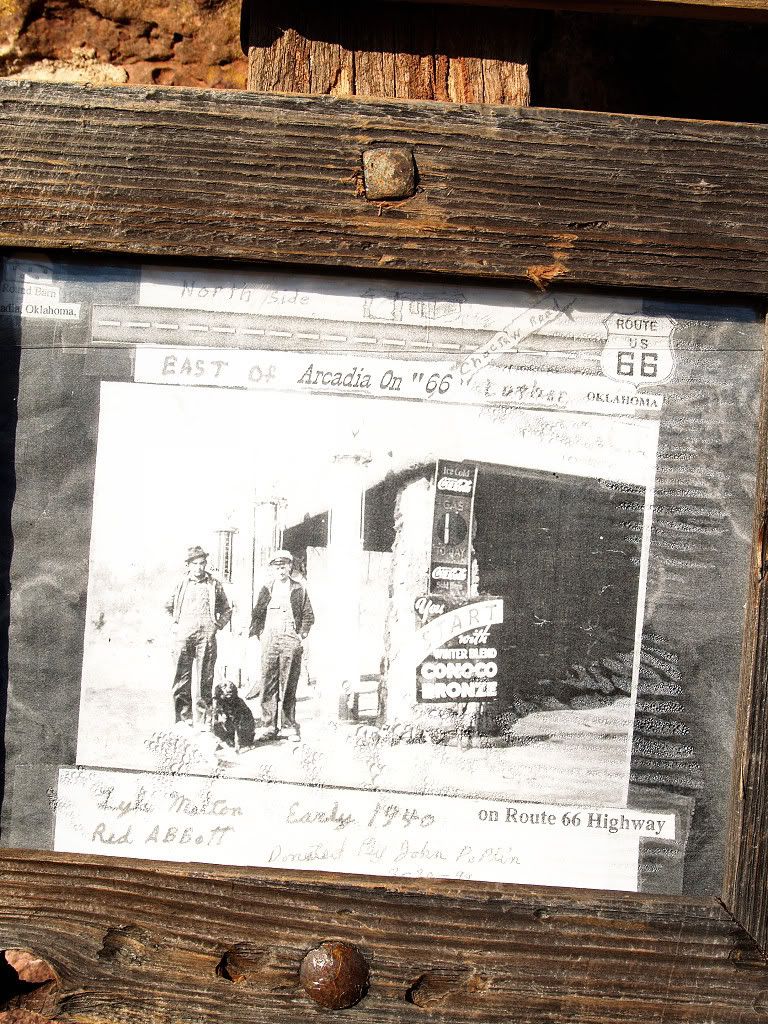
Part of the text above the picture reads as follows:
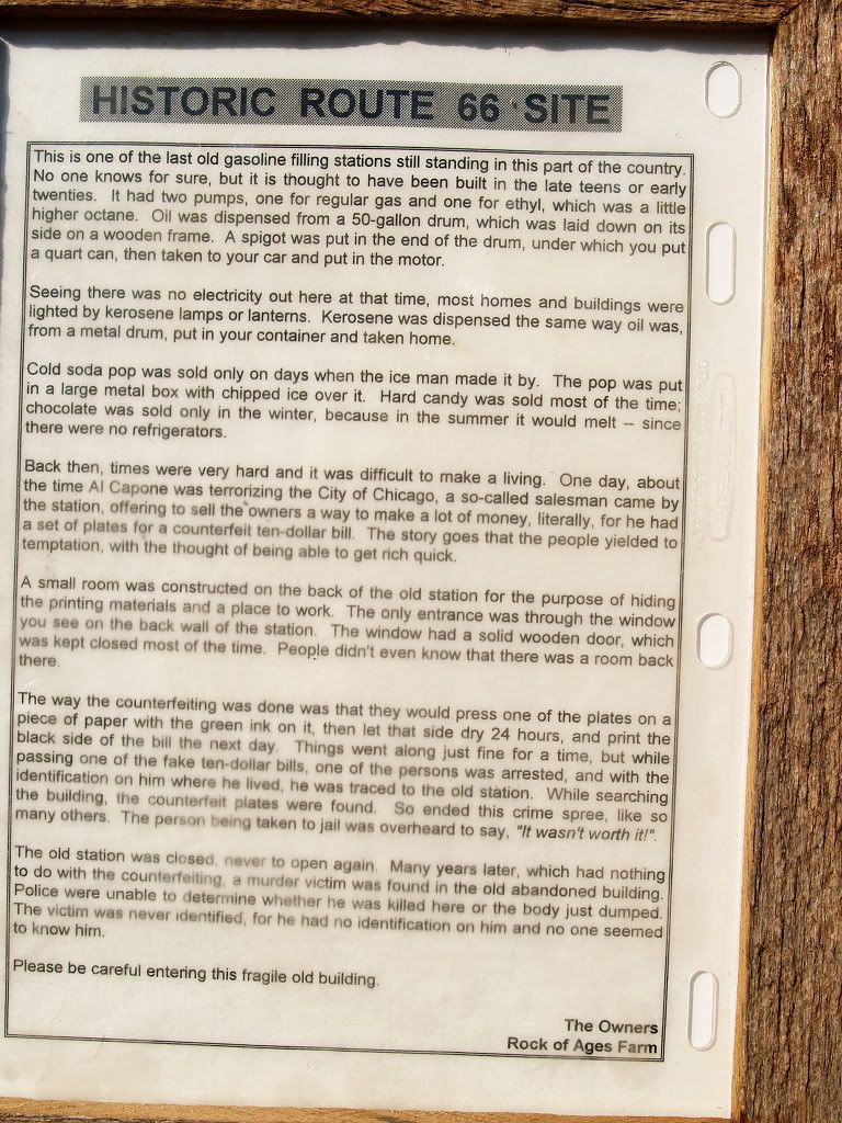
This is one of the last old gasoline filing stations still standing in this part of the country. No one knows for sure, but it is thought to have been built in the late teens or early twenties. * * *Here's a picture of the interior, looking north.
Back then, times were very hard and it was difficult to make a living. One day, about the time Al Capone was terrorizing the City of Chicago, a so-called salesman came by the station, offering to sell the owners a way to make a lot of money, literally, for he had a set of plates for a counterfeit ten-dollar bill. The story goes that the people yielded to temptation, with the thought of being able to get rich quick.
A small room was constructed on the back of the old station for the purpose of hiding the printing materials and a place to work. The only entrance was through the window you see on the back of the station. The window had a solid wooden door, which was kept closed most of the time. People didn't even know that there was a room back there.
The way the counterfeiting was done was that they would press one of the plates on a piece of paper with the green ink on it, then let that side dry 24 hours, and print the back side of the bill the next day. Things went well for a time, but while passing one of the fake ten-dollar bills, one of the persons was arrested, and with the identification on him where he lived, he was traced to the old station. While searching the building, the counterfeit plates were found. So ended this crime spree, like so many others. The person being taken to jail was overheard to say, "It wasn't worth it!". ¶ The old station was closed, never to open again. Many years later, which had nothing to do with the counterfeiting, a murder victim was found in the old abandoned building. Police were unable to determine whether he was killed here or the body just dumped. The victim was never identified, for he had no identification on him and no one seemed to know him.
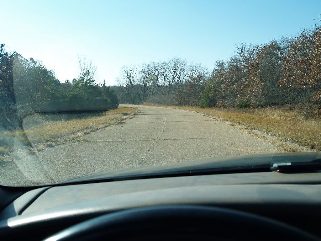
STOP 6: ANOTHER US 66 SEGMENT. A little further west and shortly before reaching Arcadia, another original segment of the original US 66 veers off on the south side of the main road, as shown by the map below:

Click on map below for a larger view
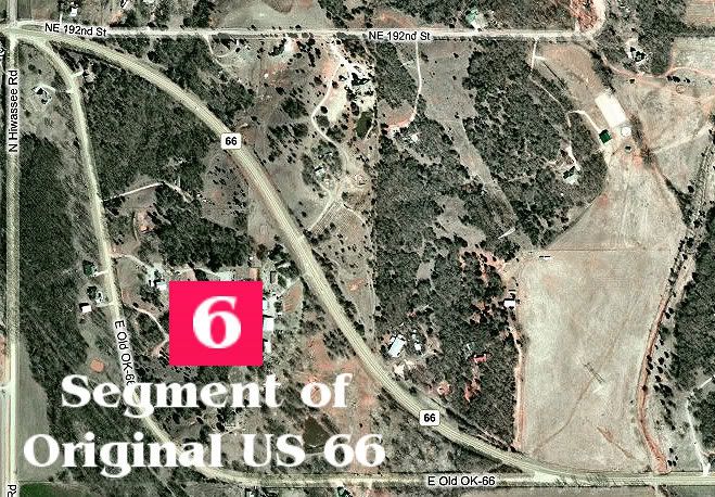
Unlike the earlier US 66 segment, this one is still used as a public roadway with houses along the way which bear the proud address of "Old US 66" but unlike the former this segment's concrete has been covered with asphalt.

I'll add a couple of photos showing the homes later.
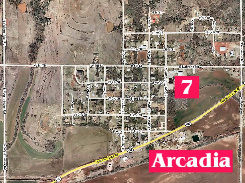
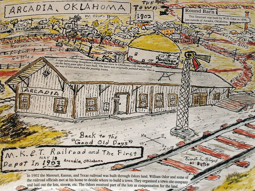
STOP 7: ARCADIA. Arcadia is a part of the Deep Fork Township, Oklahoma County.

I'd earlier thought that Arcadia was initially a largely black community, but I was mistaken at least in terms of degree. While visiting Arcadia's famed Round Barn during the tour, I purchased a $6 "Remember Arcadia" 80-page paperback booklet containing lots of anecdotes, family history, school photos, etc., which contain a wealth of Arcadia history, but most of the "faces" shown in the school photos and the like were white, not black. Probably, black faces were not as readily available because it is clear that Arcadia had a very significant black population in its early days -- and still does. The 2000 census shows Arcadia's population as 279, 55.56% black, 32.62% white.
I don't know the exact initial racial makeup, but it is plainly evident that both whites and blacks lived in this small town established in 1890. George Shirk's Oklahoma Place Names says that Arcadia's post office was established August 2, 1890, and that the town's name means, "ideal rustic contentment." Arcadia's 1905 population was 125. January 1903 Oklahoman ads to sell real property there boasted that the town's population would be 1,000 in a year; an April 1903 ad said that it would be 2,000 "this summer." I looked at the US Census records from 1900 through 1930 but they were no help, possibly because Arcadia was not an incorporated town, I don't know about that one way or the other. I just know that Arcadia was not listed in any of the census records that I reviewed during the time stated.
Finding no evidence that any such population explosions ever occurred, my untested conclusion is that, at best, Arcadia remained true to its name, a place where "ideal rustic contentment" could be found, but that no remarkable population growth ever did occur.
Bob Blackburn's 1982 Oklahoma County, Heart of the Promised Land, does say this about Arcadia's early prosperity:
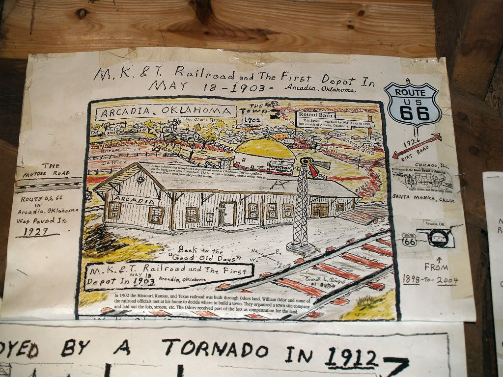
Like other towns in the county, Arcadia experienced its greatest expansion during the first decade of the century. By 1906 the town had 27 commercial buildings, including two cotton gins, three grocery stores, two general stores, a furniture outlet, and a combination barbershop-pool hall. With three churches and two schools (one for whites, one for blacks), Arcadia by 1910 was one of the most prosperous towns in the county.The KATY railroad (Missouri-Kansas-Texas) laid tracks through Arcadia in 1902 and it established an Arcadia depot on May 18, 1903.
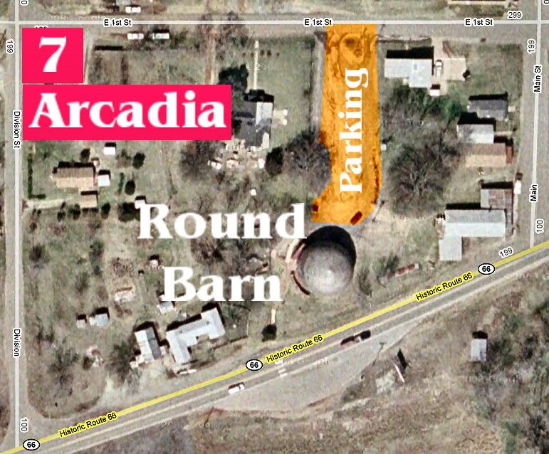
A zoomed in map showing the Round Barn
Before visiting the Round Barn, I drove through the town and took the photos shown below ... as usual, click on a photo for a larger image.
I didn't take pictures of new commercial developments that I observed since that wasn't what I was looking for. But it is evident that Arcadia is prospering perhaps more than it has at any time in the past.
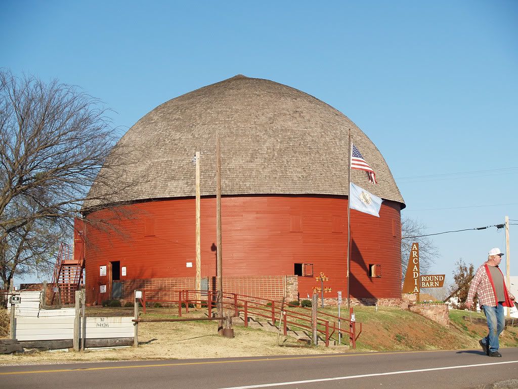
Now, it's time to visit the famous Round Barn. As shown in a map above, enter the parking area on the north side of the barn. It's free as is admission to the Round Barn itself.
The Round Barn was built by William Odor in 1898. Before showing my photos, have a look at this photograph in Bob Blackburn's 1982 Oklahoma County, Heart of the Promised Land. Quite obviously, the Round Barn was then in a serious state of disrepair and neglect:
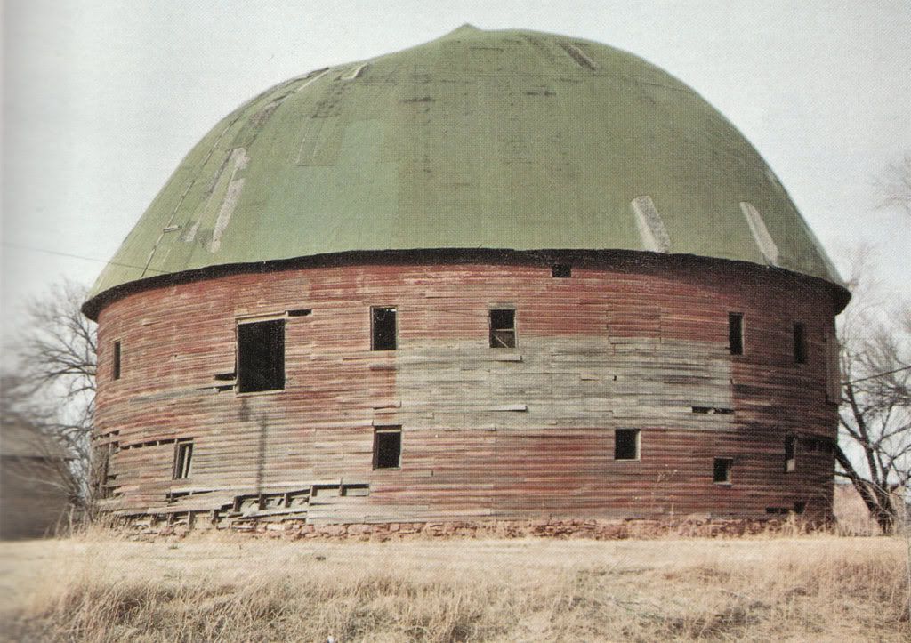
I've not studied the booklet I purchased at the Round Barn to learn how that changed, although it absolutely has. Have a look at the photos I took on my tour, below.
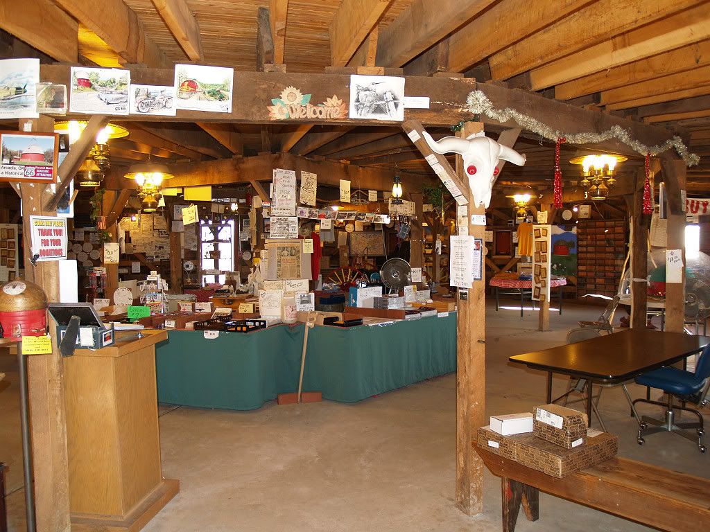
Entering the 1st level gift shop,
memorabilia adorns just about every square inch
of vertical and horizontal space, only a few of
those inches being shown below.
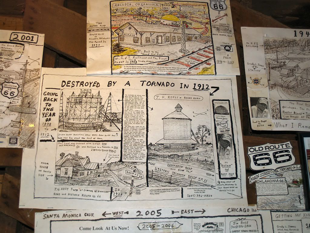
The round barn identified below as destroyed by a tornado
in 1912 was not this round barn but was another.
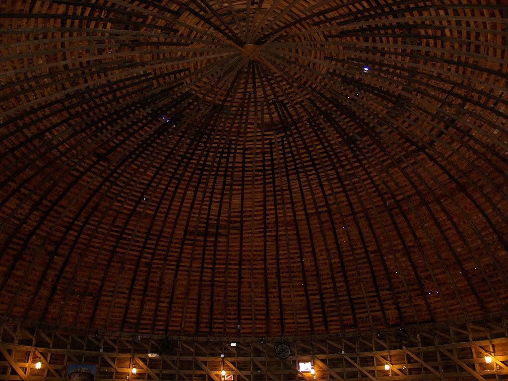
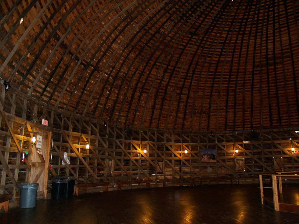
The 2nd Floor is amazing. If you whisper on one side,
your whisper will be heard on the other.
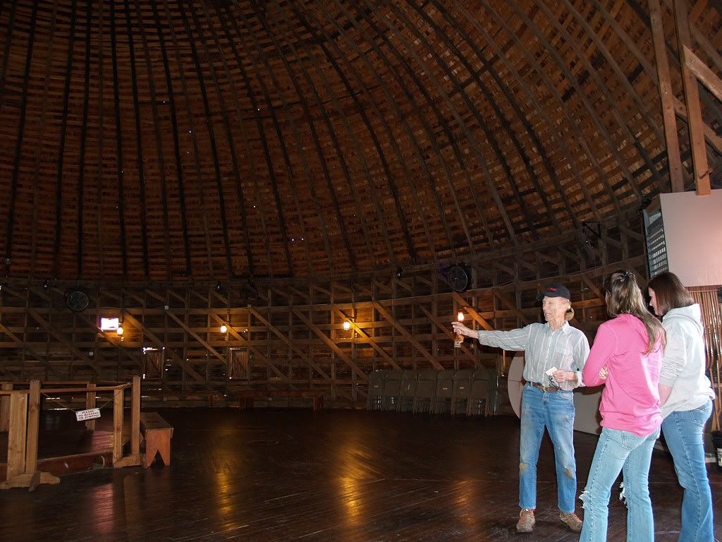
The area is available for party rental. The two ladies
shown here were making party arrangements during my visit.

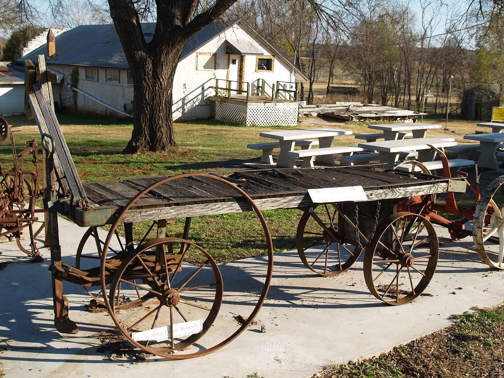
Outside, old hardware is displayed around the parking area.
Below, a baggage/cargo cart from the MKT days is shown.

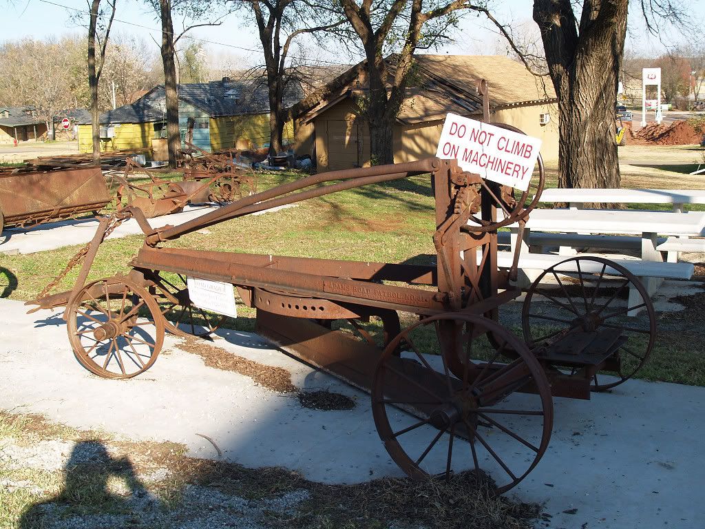
An early day road paver
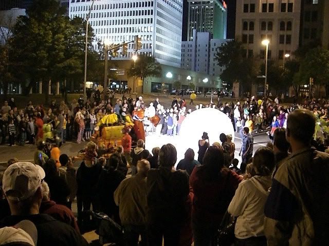
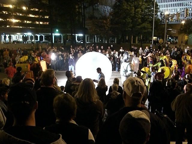
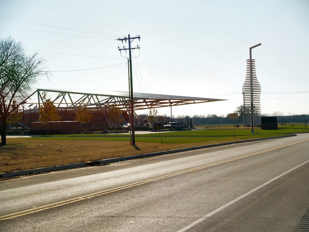
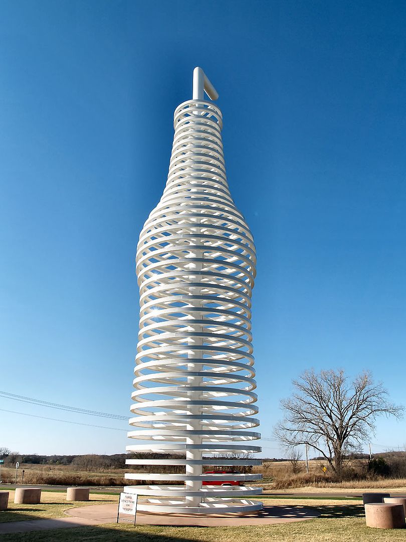
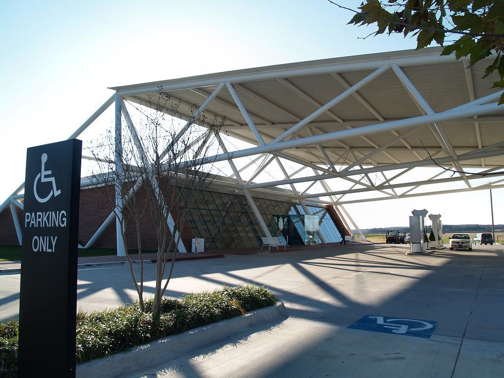
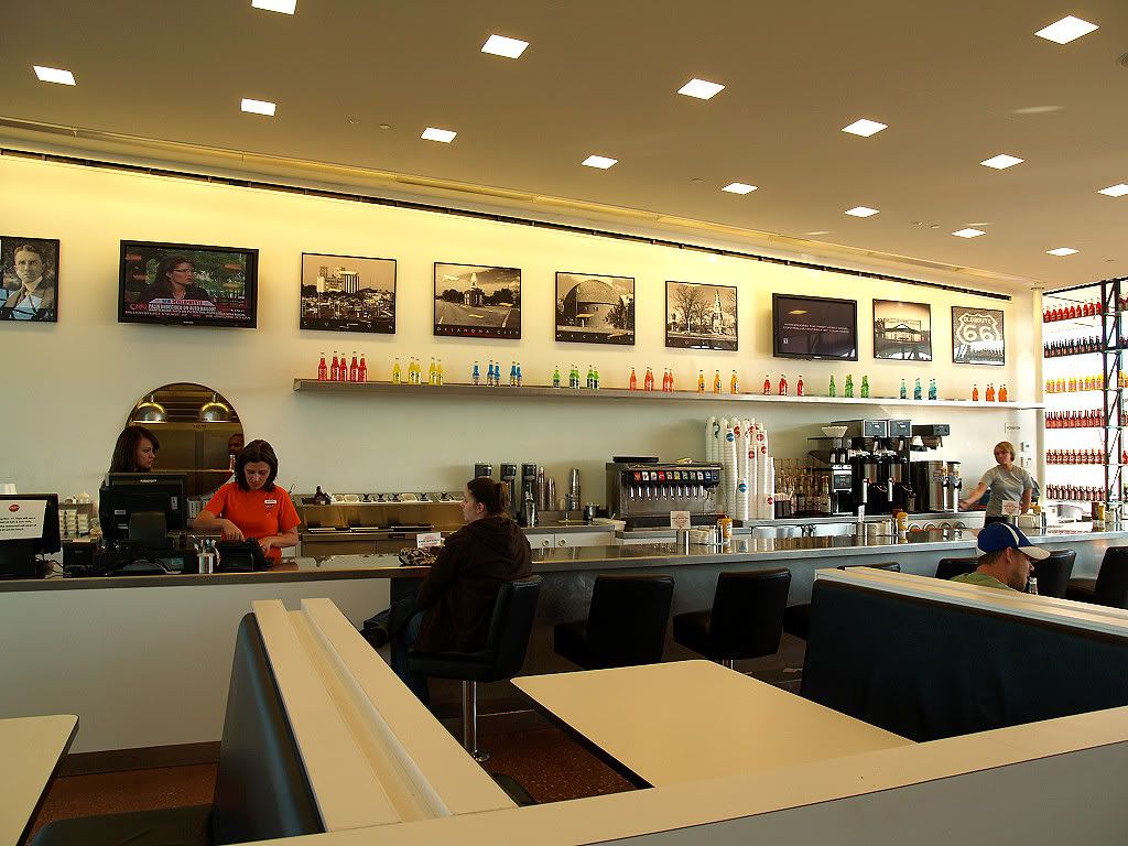
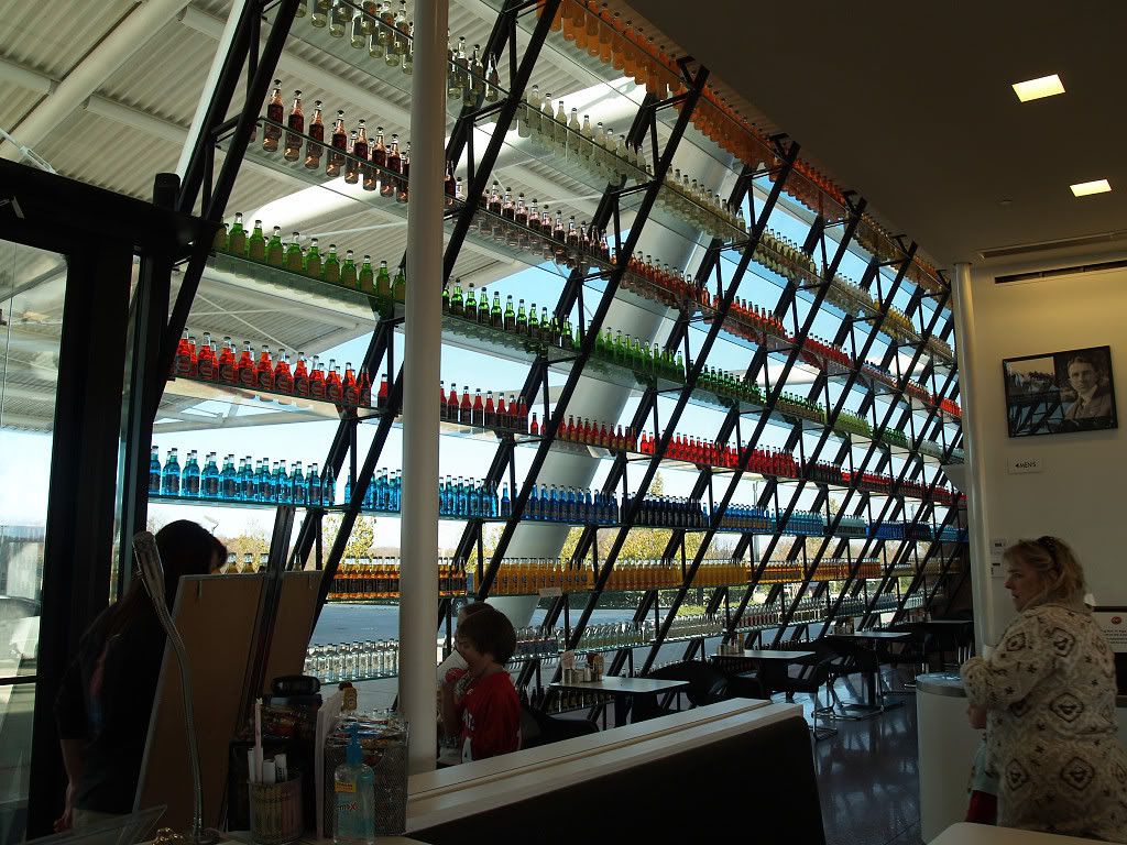
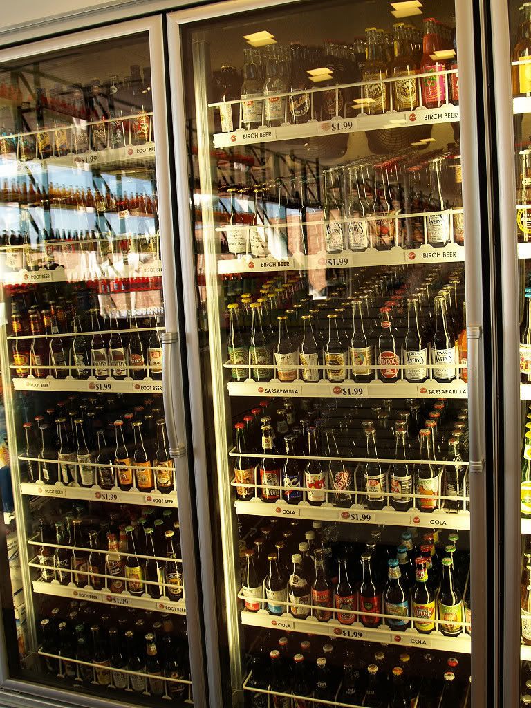
STOP 8: POPS. Leaving the Round Barn and continuing westbound on Oklahoma 66, the 21st Century greets travelers on the former Mother Road. Home of over 500 varieties of soda pop, and marked by an LED-lit bottle designed by Rand Elliott, POPS opened for business in 2007. How tall should an iconic pop-bottle on Route 66 be? Sixty-six feet, of course! Inside, 12,000 or so bottles of red, green, blue, and yellow bottles adorn the angular glass walls while Route 66 memorabilia adorns its interior walls which are more ordinary.
Below, enjoy the photos of POPS taken on my November 13 tour! As always, click on an item for a larger view.
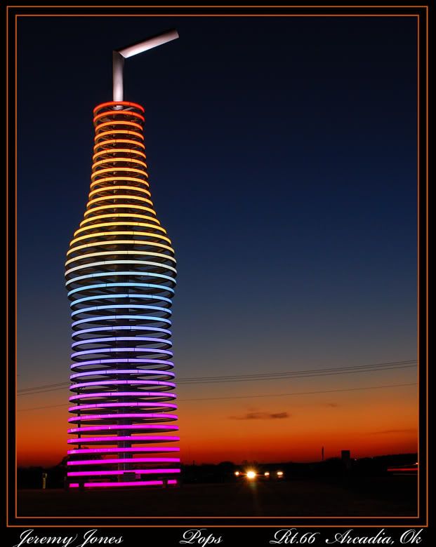
At night, the bottle might look like the photo below,
credit to Jeremy Jones at this link.

That's it! Hope you liked the history tour and got some kicks in this Route 66 History Tour!