Updated 2/25-26/2009 to add aerial maps, a section on the city's early day vice district, many additional buildings (the vast majority of which do not presently have corresponding pages -- that will come), and perhaps most importantly a Building Index page, described below.
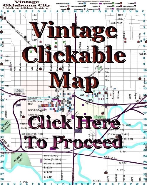
This is an on-going ever-expanding project, a Vintage Oklahoma City Clickable Map. Boundaries are North 18th and South 15th on the north and south, and Klein and Stonewall on the west and east. To enter the map, click the image below. For a brief review about how to use the map, continue reading below the image.
The map is in its infancy and, before it's done, my intention is to populate the map with as many buildings as I'm able that fit within the map boundaries. In its present very incomplete state, 149 buildings or areas are identified but only 30 of them presently have separate pages with images and other information. Largely, to get the project started, I've focused on the Central Business District but even that part is not fully populated.
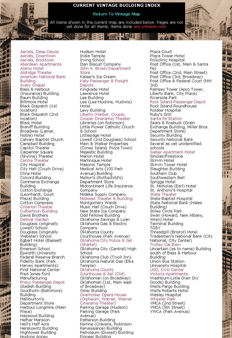
Two Ways To View. The 1st way, of course, is to use the clickable map. But, since no really good to identify all buildings in the map I've added a 2nd way -- the Building Index Page.
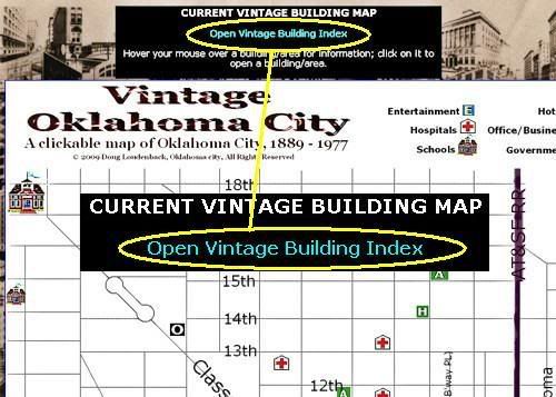
At the top of the clickable map page, notice that a link is present to the Building Index page ...
Click the Building Index Page link and the Building Index will open ...
Click the image below for a look at the full page
Notice that one can easily switch between "views" by clicking a link at the top of each respective page.
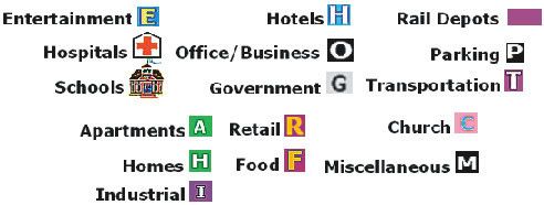
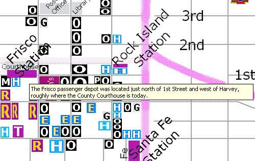
Legend in Clicable Map. In the clickable map page, a legend is shown at the top of the map, a clip of which is shown below:
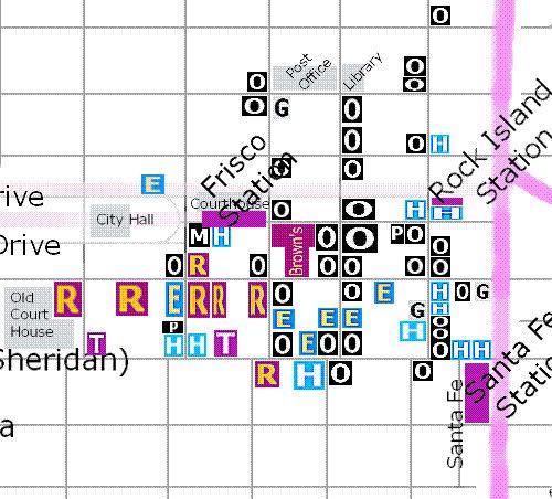
So, when looking at the Central Business District (for example), when you see something like the crop below, a good idea will be visually present as to the type of buildings displayed:
Most often, there isn't room in the map to identify buildings by name, it's just not practical. But, as you hover your mouse pointer over a building, a brief description should appear:
My hope is that I'll be able to figure out how to include pop-up notes in the map which will be more useful in a rollover onmouseover onmouseout type of event, as shown in an example of the goal, below:
While I can do that with "text," I've not learned how to do that with an image map which involves a better knowledge of java script than is in my present possession.
Click on one of the buildings an one or two photos and additional information will open in a separate window or tab, leaving the main map in the background:
Click the image below for a larger view
When done, close the window or tab and the map will be restored.
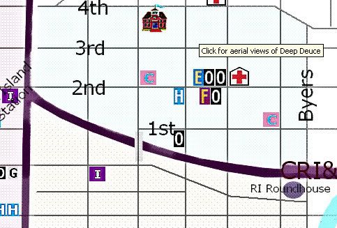
Aerial Maps. With the 2/25/2009 update, I added an element to the map not earlier present -- aerial views of (1) downtown, (2) the warehouse district, and (3) Deep Deuce, as well as a page on the city's early-day vice district. Notice that the "regional" areas are lightly colored. When in one of those areas and not on a building, a small message will appear like that below:
To open a page with aerial photos or images of the area, just click in any of that otherwise empty space.
Clickable Map Size. The map's dimensions are 1800 x 2265 pixels, so that's a bit large and will require scrolling. If your web browser supports it, you can increase or decrease the display by use of Ctrl- (minus) or Ctrl+ (plus), if you want.
Feedback. Feedback is welcome, particularly if problems are encountered. This will be a work in progress covering several months of time, I expect. Frankly, the map will be added to over years of time, should I live so long.
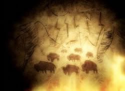
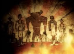
Let's get ready to R U M B L E ! The evening of Tuesday, February 17, 2009, was a big big night for OKC Thunder fans ... not only was our first love in town to play against our new and more enduring love, it was also announced to be the evening of the unveiling of the Thunder's new mascot.
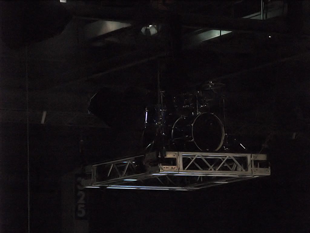
About 3 minutes before half-time, way up in the rafters was this vaguely defined image hiding in the darkness ...
What was that shadowy thing sitting way up there above center court? Half-time beginning, the Ford Center's video display presented the true story of, and predicate for, what was about to occur ... see Rumble's website for the full animation, and for related videos at Rumble's website, click here ...
For hundreds of years the tale has been told around Native American campfires. A great herd of American bison was lost in the Arbuckle Mountains during a ferocious storm — the kind only Oklahoma can produce.
.
Hail fell and tornadoes spun all around the herd as they stampeded, trying to find their way to the safety of the plains.
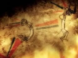
One lone bison stayed behind as he helped each of his friends escape down a treacherous ravine . . .
. . . once all of his friends were safe he began his descent and found that his way blocked by fallen boulders.
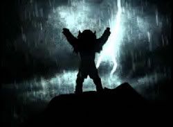
Lost, and left to face the storm alone, he climbed to the tallest mountain peak, searching for a way down.
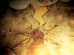
There, he was struck by a bolt of lightening. The bolt did not destroy him, but, by the power of the god of thunder, it changed him.
Suddenly, he walked on two legs like a man. He possessed amazing strength and agility — he could jump higher, run faster, think more clearly than any beast.
But because he was no longer just a bison — and yet not a man — he was alone. The legend grew through the years — sightings of a mighty bison, with remarkable powers, roaming the hills all by himself.
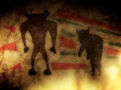
Not until a group of men who carried similar powers came to Oklahoma City did he find somewhere he belonged. These men also possessed the power to jump higher, run faster, and perform acrobatic dunks more spectacular than anyone in the land.
They too carried the roar of Thunder every time they took to the court.
So he joined their team. And the legend of Rumble was born.
The animation had run its course. Whoa! Heady intellectual stuff! What next, after that lesson in historical anthropology?
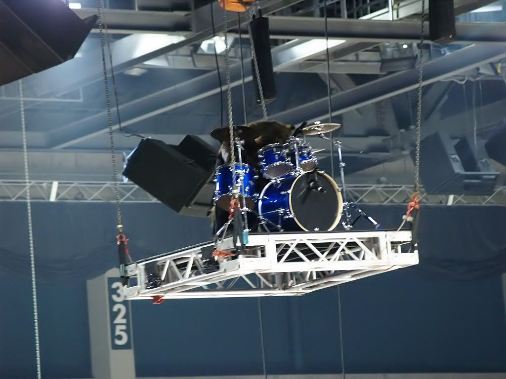
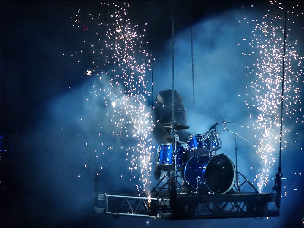
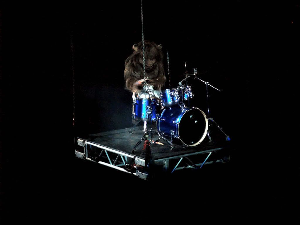
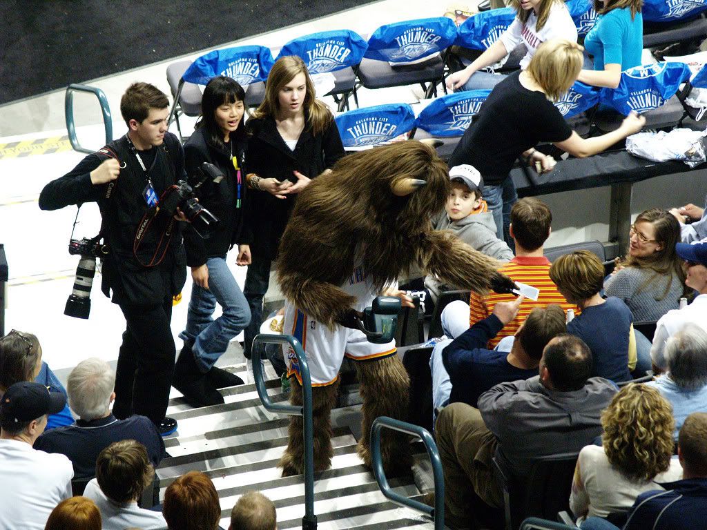
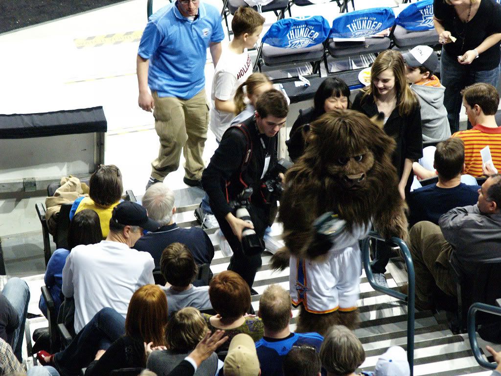
Spotlights in the arena went crazy but began to focus upon that shadowy thing sitting way up there in the rafters. As the smallish no-net-below platform was lowered, it was then that we knew, we really knew,the Legend of Rumble was real. Too, we learned that while roaming the hills and plains Rumble had picked up impressive percussion skills (not to mention an unabashed flamboyant rock-star style). Below are some photos that I took on this night of nights in the Thunder's history ...
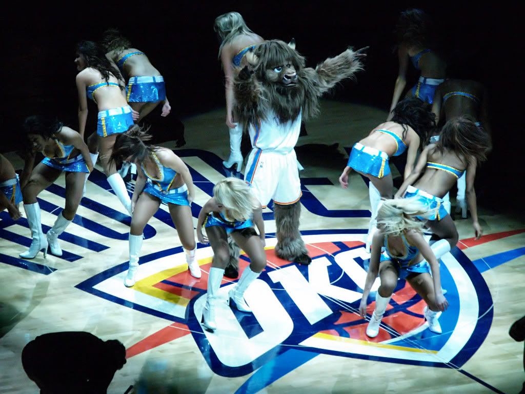
We saw the respect given him by the Thunder Girls (their posture here admittedly being open to interpretation)
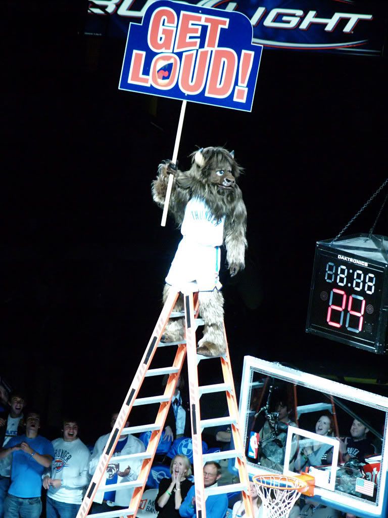
We saw his oblivion to ridiculous heights
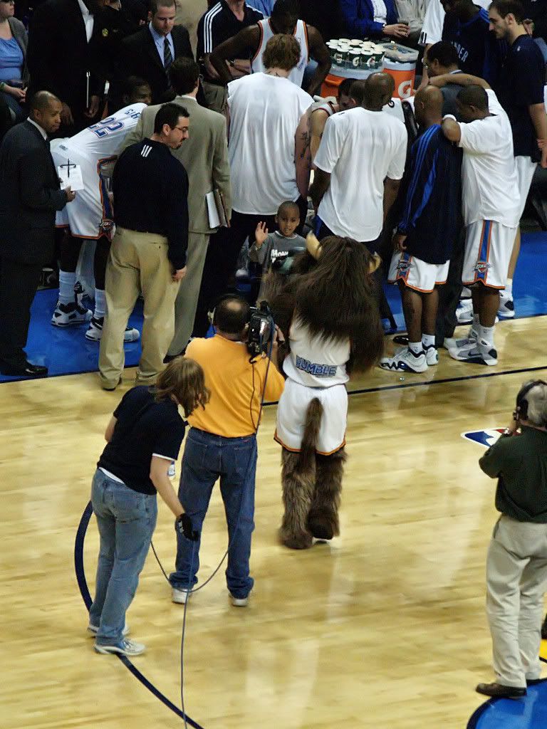
We saw him stand ready to help the coaches & team
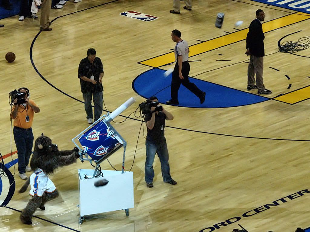
We saw him unveil the Thunder's new Gatling T-shirt gun
We saw him mingle with the fans and his skills as a self-photographer
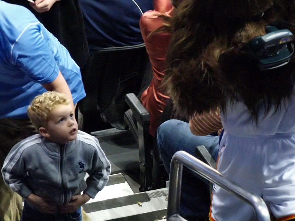
The eyes of young fans told us, and we saw, and knew, that Rumble was absolutely and instantly the best mascot in the NBA!
Thank you, PBC, for making Rumble, and his place in Oklahoma history, the Thunder Mascot right here in Oklahoma City! You did a really great with this one.
About That Man Stone. One who looks around very much at very early day photographs of Oklahoma City and its environs cannot fail to notice that the name, "That Man Stone," since he pops up in those very early historic photos more than any other photographer. He took pictures of Oklahoma City before the April 22, 1889, Land Run and on the day itself, and he took pictures after. At least one of his photographs is included in the Library of Congress American Memory collection, shown below:
One can simply not look though an early-day photographic history of Oklahoma City and not encounter one and many photographs attributed to "That Man Stone." Illusive Identification. But, who the heck was That Man Stone? What was his real name? Was he really a "man" Stone or was That Man Stone a woman? Where did he live, where was he born and when and where did Stone die? Where was his home before he died? What relatives survived him? Incredibly, for such a prominent recorder of early day Oklahoma City history, almost no solid information appears to be available on-line or in print that I could locate.
I guess that the above report speaks for itself, even if its presence does acknowledge the importance of That Man Stone being worthy of being listed in OHS's to-do list.
I scoured my personal Oklahoma City history collection of books but found only one item which identified That Man Stone by a real name. That was in Terry L. Griffith's fine Oklahoma City: Statehood To 1930 at page 25 , where, in describing a 1909 photograph, he said, "This view of West Main Street was taken by early city photographer Grover M. Plew, who used the moniker 'That Man Stone.'" So, I spent a lot of time looking in my Oklahoma City history books, and on the internet, and in the Oklahoman's archives searching for Grover Plew ... and the results were ... nada. Maybe Griffith had solid information but I couldn't find anything to support what he said about the real name of That Man Stone and from what I did locate it appears that Griffith was mistaken.
To confuse things further, I found this website about travel in Oklahoma City and read in the right margin that, "Early 20th century Oklahoma City photographer 'That Man Stone' was a woman."
By piecing together information from the Oklahoman's archives and mixing that with a little information from on-line images at the Research Center of the Oklahoma Historical Society and the American Memory of the Library of Congress, at least part of the real identification of That Man Stone came together.
First, he was a man. Second, his name was not Grover M. Plew. Third, his real name was either Fred L. Stone or Fred E. Stone, but it was probably the former.
The source containing the most information was a July 4, 1920, item in the Oklahoman, as shown below:
Click on the article for a larger view
Unfortunately, the item does not indicate the names of the people in the oval photos ... Stone and/or Buchanan. Are they younger and older images of Buchanan or is the older guy That Man Stone? In any event, if the written information is accurate, and until I find something to the contrary I will take it to be:
Stone's name was Fred L. Stone
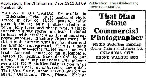
Stone set up the That Man Stone Company in Oklahoma City in 1909, but, as seen in the 1911 ad below, he had a shop in Chickasha earlier than that
In 1914, he sold his interest in the company to R. (Rufus, from another source) Buchanan
The business continued using the original name after the sale (and from other sources that was so at least until 1930 if not later ... see the 1930 Melrose Apartments ad below)
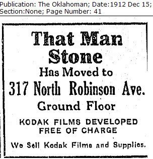
The article also notes that Stone brought the first panoramic view camera to Oklahoma and created so much attention with it that he simply became known as, "That Man Stone." And, at the time, the company business was located at 317 N. Robinson in space occupied by the Bank of Oklahoma building today.
The Oklahoman's archives also contained ads in February through November 1912 which showed the business being located at "309-310 Post Office Building, Main & Hudson." Hmmm ... that's a post office building I'd missed in my previous reading but, in fact, the building will show up in one of That Man Stone's photographs below. Below, a pair of ads give that post office's address and identifies Mr. Stone's ties to Chickasha as to the business he offered for sale in July 1911:
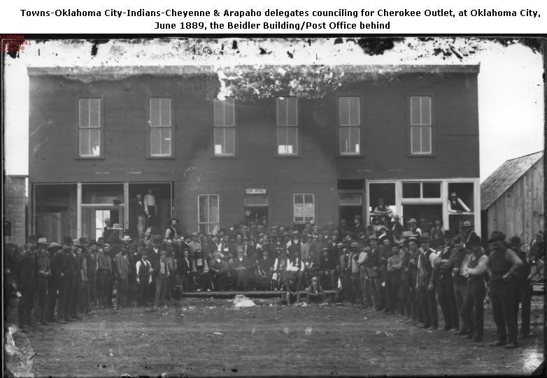
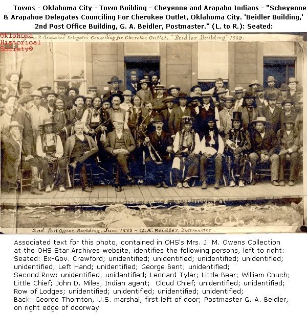
A pair of June 1889 images (the same image but with different cropping) of the post office property located in OHS's Star Archives appears below. The photographer was not identified in the OHS sources, but, as will become evident when getting to the photos in the Chamber's book, the photograph was certainly taken by That Man Stone.
The above building was also named the "Beidler Building," it being named after the postmaster at the time. Stone's office may have been in this building in 1889, I don't know, but it was certainly there in 1911 as shown by the "For Sale or Trade" advertisement a few images back. Later in 1912, he relocated to 317 N. Robinson, as shown by this December 1912 ad:
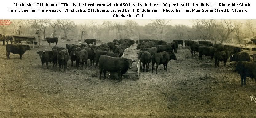
Credits on some of the OHS and Library of Congress photos indicate that Stone lived in Chickasha before he moved to Oklahoma City ... I'm assuming that he moved to Oklahoma City since he moved his business here from Chickasha. As I said, tracking down the detail has been illusive so far, and I'm hardly done trying to put the pieces together. As an example, see the OHS photo and credits for the cattle photograph below:
In the above, note that OHS shows Stone's name as "Fred E. Stone," not "Fred L. Stone," but that was presumably a scrivener's error. A panorama photograph taken by Stone of "J. Ellison Carroll, champion roper of the world and cow boys who took part in the roping contest, Oklahoma City, Dec. 31, '09 - Jan. 1, '10," gives photographer Stone's address as "Chickasha, Okla." As previously noted, Mr. Stone sold his Chickasha business in 1911.
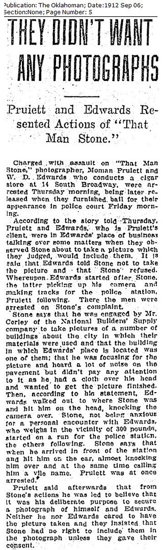
This 1912 Oklahoman article indicates that Stone may have been something of a pavarazzi in his day ... but probably not since Stone was then engaged by a commercial customer to take photographs of his buildings. However, the early day famous (or infamous) lawyer, Moman Pruiett, and W.D. Edwards, were in the camera's view. Not wanting their photograph taken, they became aggressive with Stone and Pruiett was charged with assault. Outcome? I don't know.
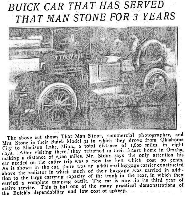
It's too bad that the photograph below, taken in September 1914 of Mr. Stone in his Buick, is so poor in quality as not to be able to see what Mr. Stone looked like. For now, it's the best that I can offer.
I've been unable to learn a thing about Stone's pre-Oklahoma history or origins. About his death, the only thing I've found so far is the article below which indicates that, by June 10, 1917, Stone was already dead.
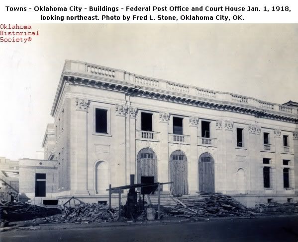
Note the use of "Fred S. Stone" in the above. Can't anyone keep this outstanding photographer's name straight? Presumably, the person who wrote the above article wouldn't make so serious an error as to say that Mr. Stone was dead if he wasn't. But, was he? Several photographs taken during construction of the Federal Post Office and Courthouse in 1917 through as late as December 4, 1918, which are located in the OHS archives note that the photos were taken by "Fred L. Stone." A namesake child? Bad scholarship? Was Stone really alive? I don't presently know, but, because of the June 1917 Oklahoman article, I doubt it. An example of the photos appearing at the OHS website (the notes are OHS's) appears below:
As already said, after Stone sold his interest in the That Man Stone Company in 1914, Buchanan continued business under the same name. So, when you see a photograph after 1917 or so which is attributed to "That Man Stone" or "That Man Stone Co.," it was probably NOT Mr. Stone that took it. An example that appeared in the following ad for the opening of the Melrose Aparments in 1930:
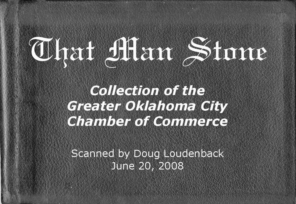
THE CHAMBER'S BOOK. Last summer, Dean Schirf, corporate secretary of the Greater Oklahoma City Chamber of Commerce, kindly allowed me to scan the images contained within an unadorned black binder-book owned by the Chamber. Click here for more information about Dean and his love affair with trains. A copy of the cover, but with text added by me, appears at the top of this article ... the "real" book cover has no text on it at all.
Below are all of the photos which are presently contained in the Chamber's book. It is evident that, in some cases, the photographer was not Mr. Stone but was "That Man Stone Co.," presumably by Rufus Buchanan or an employee of the company after Fred Stone's ownership in the business came to an end. Not many of the photographs have identifying notes on them so some interpretation is needed. Neither are they ordered in time-chronological sequence, so I've reorganized the pages a bit.
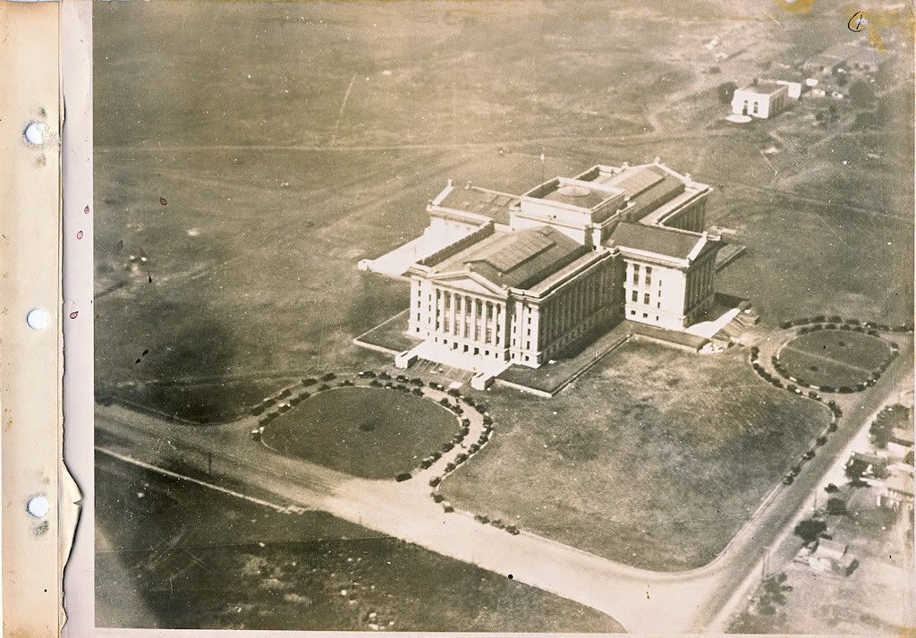
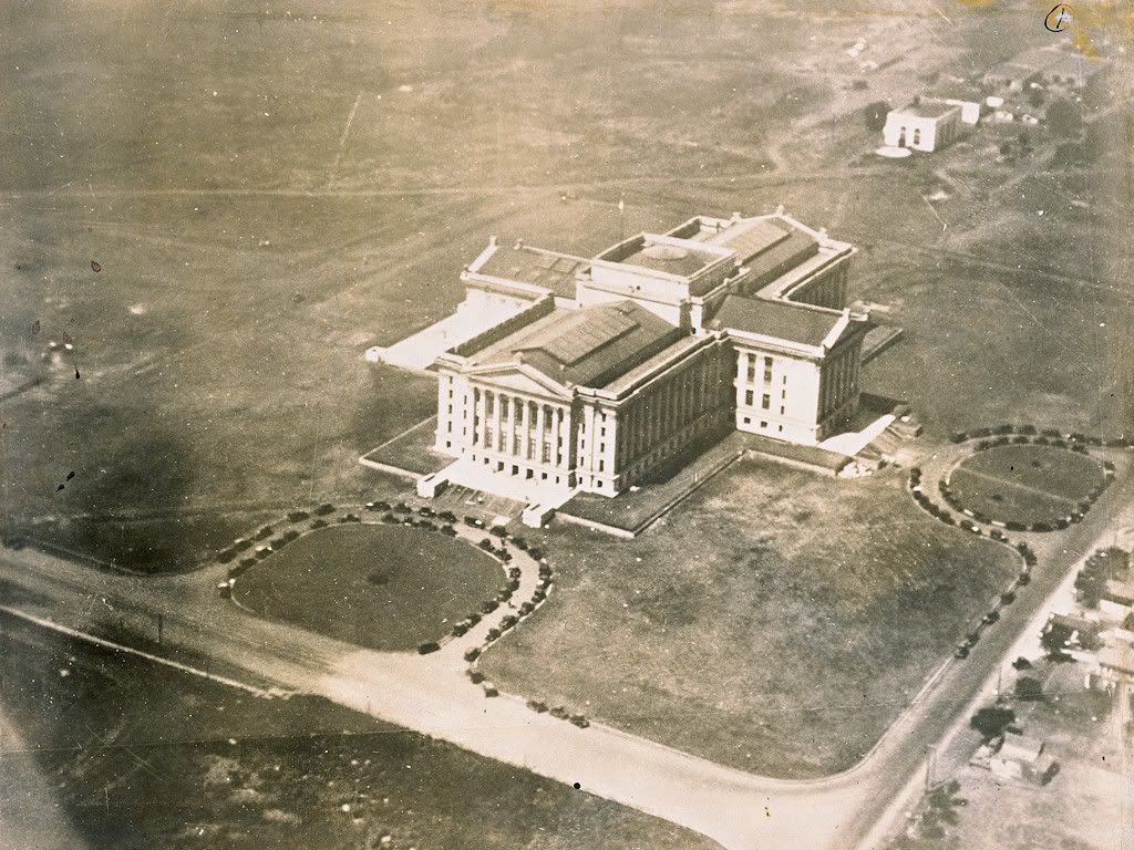
As laid out in the book, the pages are in a binder and each photograph is on a fabric page to which a photograph is affixed. In their non-cropped state, the physical pages look like the example shown below of the completed State Capitol Building. The exemplar image also provides an instance of a photo probably not taken by Stone. Construction on the capitol building began in 1914, it was delivered to the state in unfinished condition in 1917, and the building was completed in 1919. Since Fred Stone sold his photography business to Buchanan in 1914 and was presumably dead before June 1917, it is unlikely that he took the aerial shown below.
OK, let's get on with the show. I've cropped the images contained on layout pages like the above just to show the images. Here they all are, thanks to the Greater Oklahoma City Chamber of Commerce and, most especially, to Dean Schirf, its corporate secretary. Click on any image for a larger view.
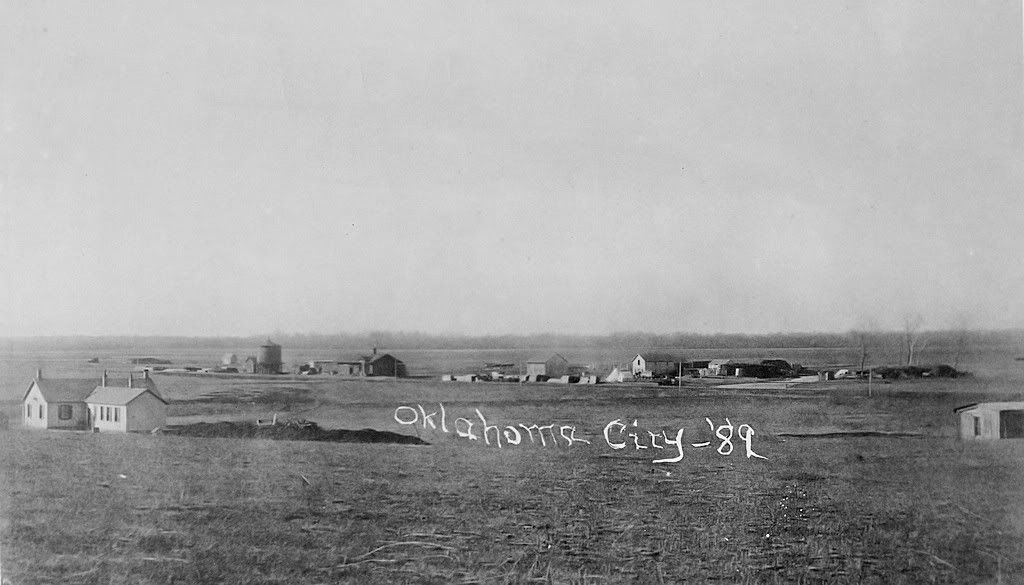
Oklahoma City Before the Land Run
The Morning of the Land Run Recall that many "land runners" came by Santa Fe train
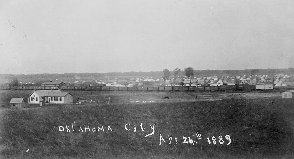
Two or Four Days Later -- The Land Run was on April 22 and April 26 is the probable handwritten date
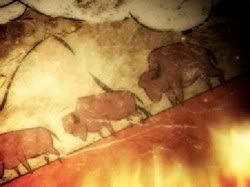
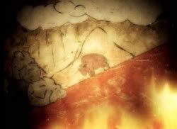
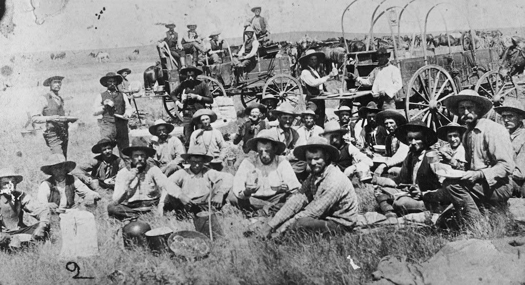
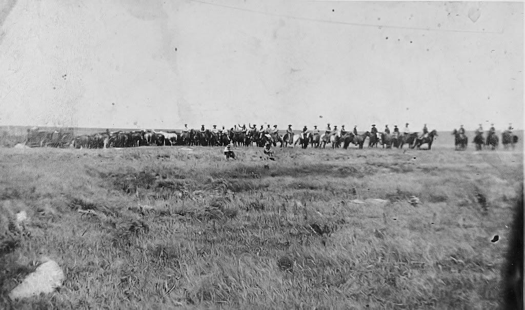
Undated photograph of cowboys in the Oklahoma City vicinity
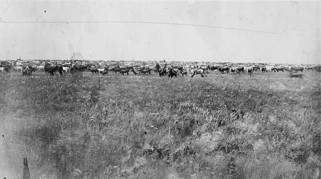
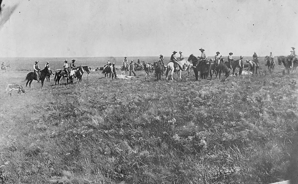
Undated photographs of cattle on the original OKC townsite
Undated photograph of the site of what would be the Culbertson Building at Sheridan and Broadway (at the "jog")
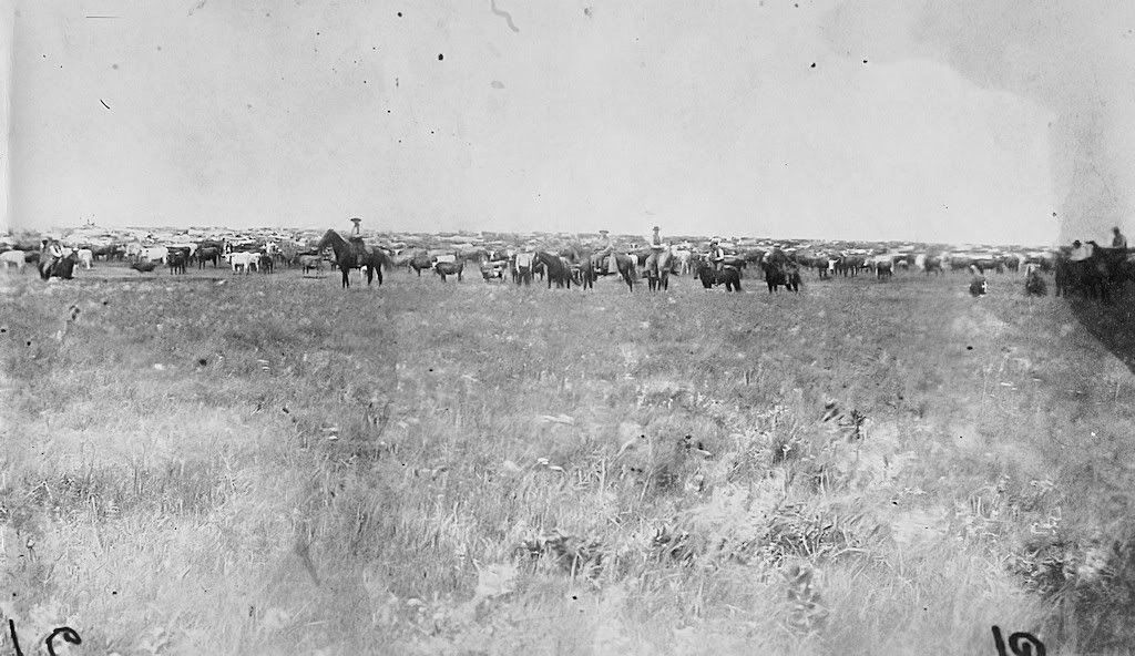
Still more cowboys in a panorama photograph and closer up
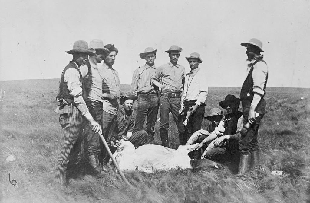
Eat More Beef
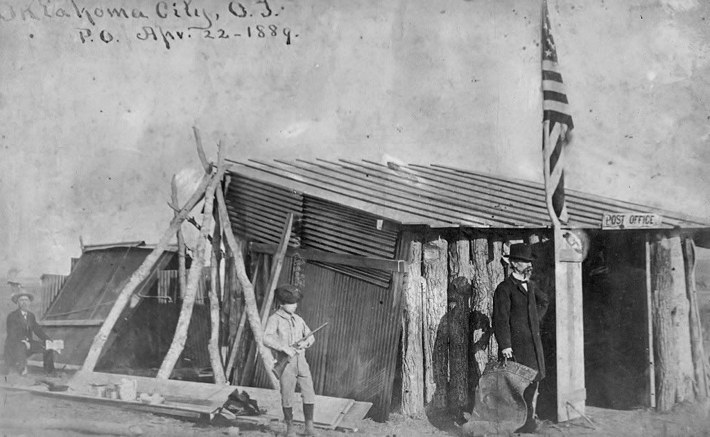
The First Post Office With Rifleman Standing Guard
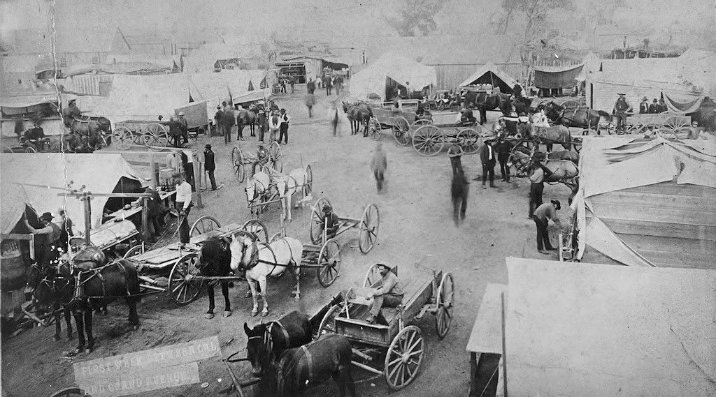
After the 1st Week at California & Grand (Sheridan)
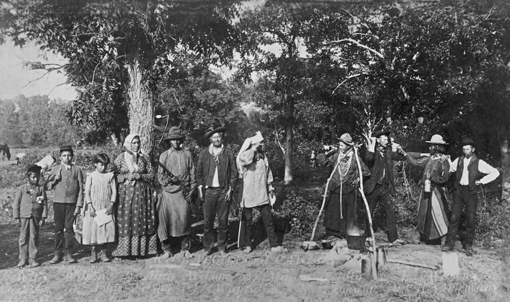
First Settlers -- A Spoof (look closely)
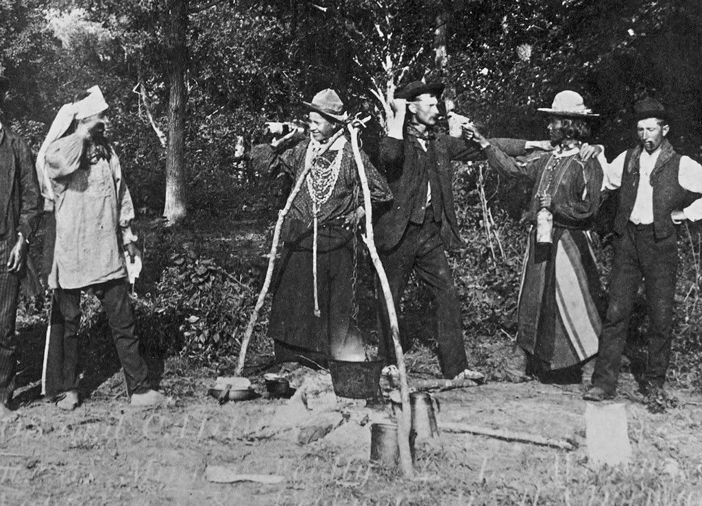
More Early Settlers
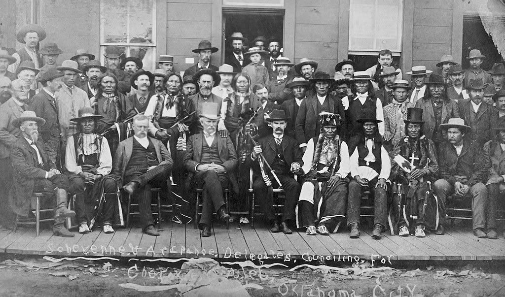
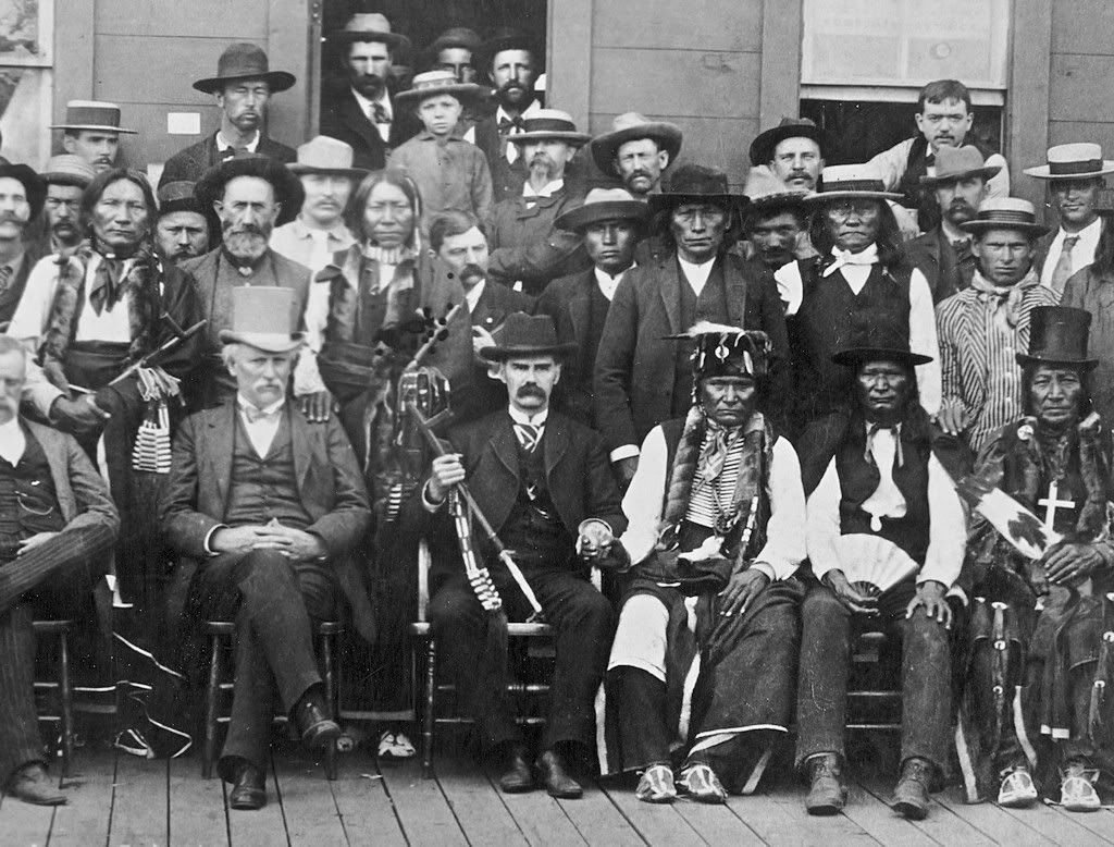
These are crops from the same OHS image, above, which showed the Beidler Building, but focusing only on the principals. The handwritten note on the photo reads, "Cheyenne and Arapaho delegates counseling for Cherokee Outlet -- Oklahoma City." The OHS note for this photo says that it was taken June 1889.
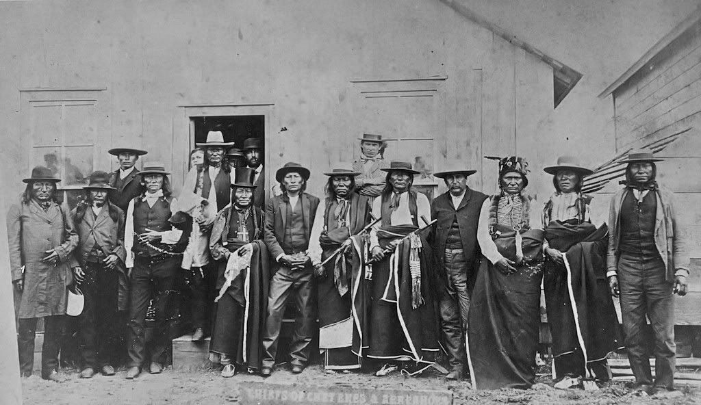
Cheyenne & Arapaho Chiefs
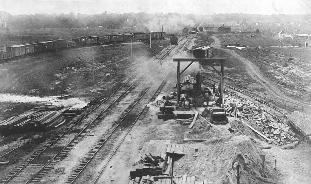
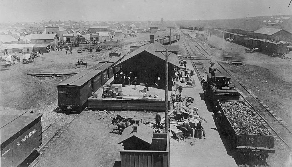
Along the Santa Fe Tracks Undated but probably a year plus or minus six months after the Land Run
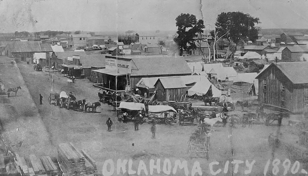
Oklahoma City in 1890
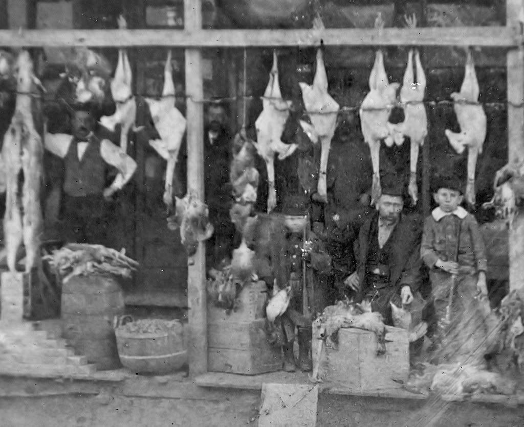
How About Some Poultry on "Starvation Day" 1892?
A Closer Look At Them Birds ...
A Racetrack
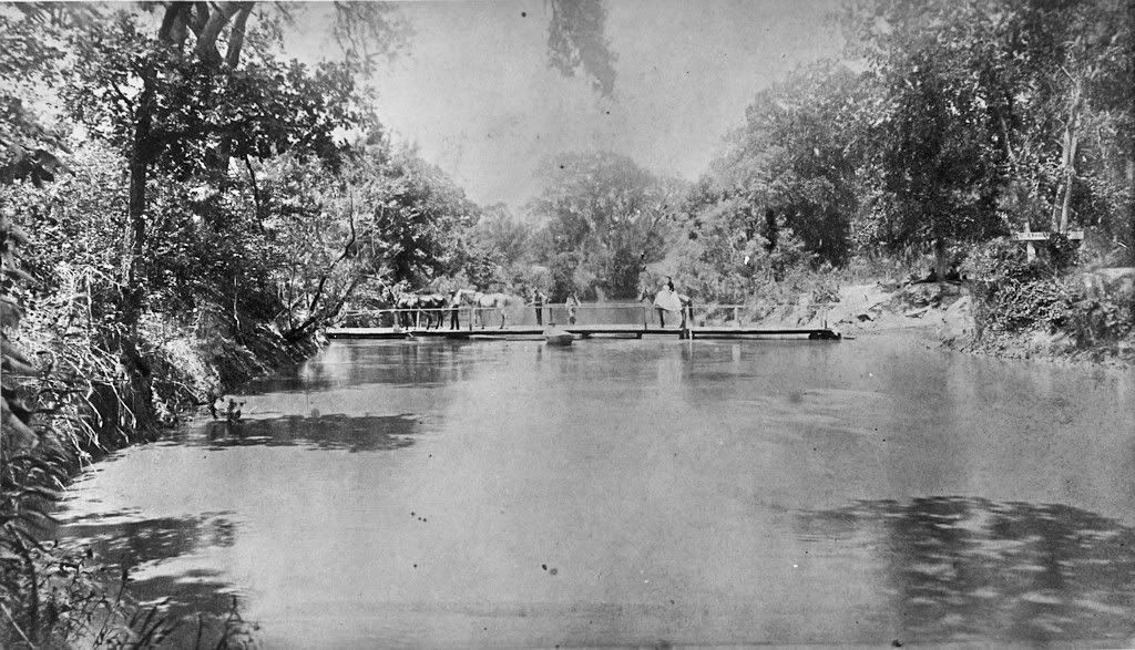
A Footbridge on the North Canadian River
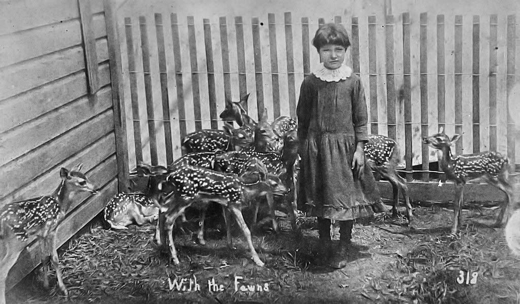
A Little Girl & Her Baby Deer
This marks the end of the photos in the book that should rightly be attributed to That Man Stone, Fred L. Stone. The aerials which follow are likely taken by the That Man Stone Company by Rufus Buchanan or an employee.
The Completed State Capitol Building, circa 1918-19
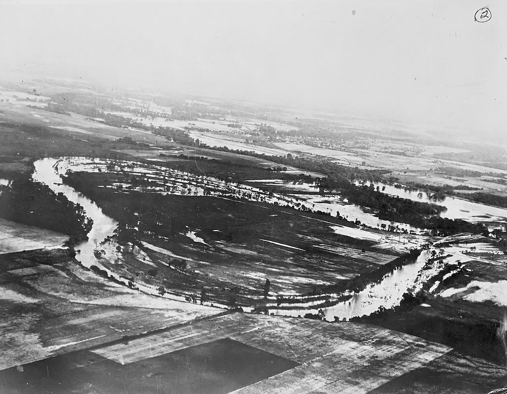
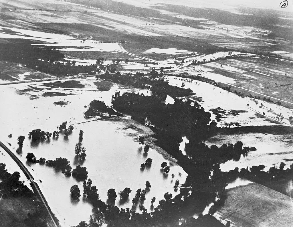
Flooding on the North Canadian River, Undated
A Similar But Different View
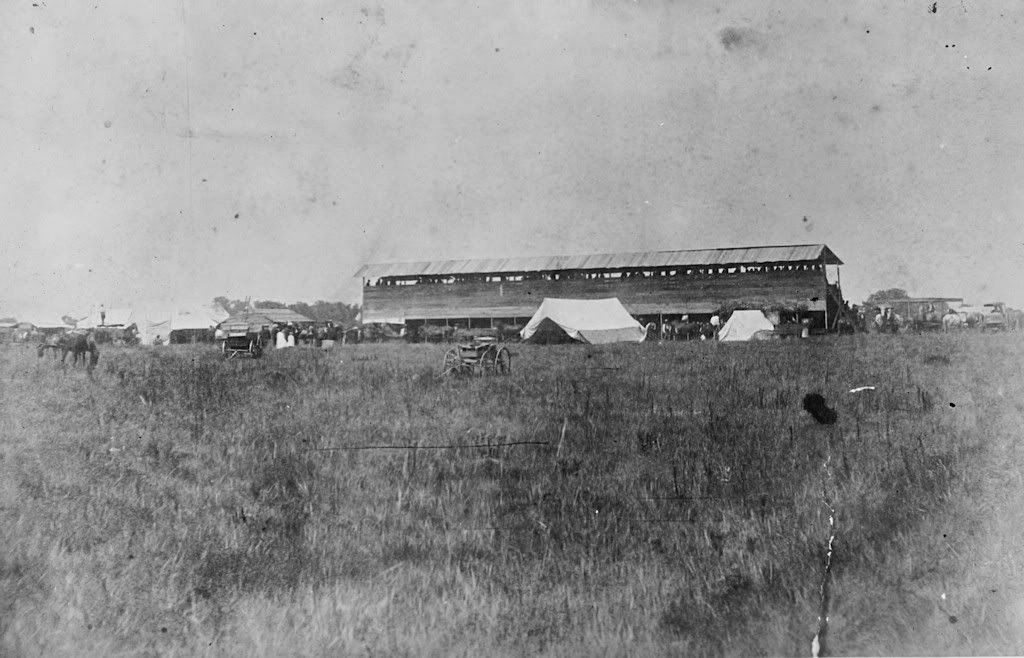
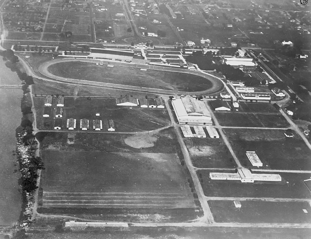
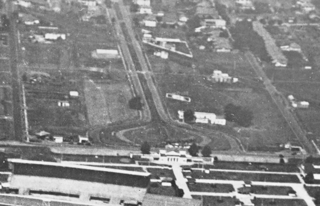
Fairgrounds, Looking West Notice the trolley turnaround at the top of the picture. The tracks were on East 8th and intersected with Eastern Avenue at the turnaround. The fairgrounds were completed in 1907, so this one could have been in Mr. Stone's time ... but airplane photos in 1907 strike me as doubtful (remember, the Wright Brothers & Kitty Hawk were in only four years earlier, in 1903).
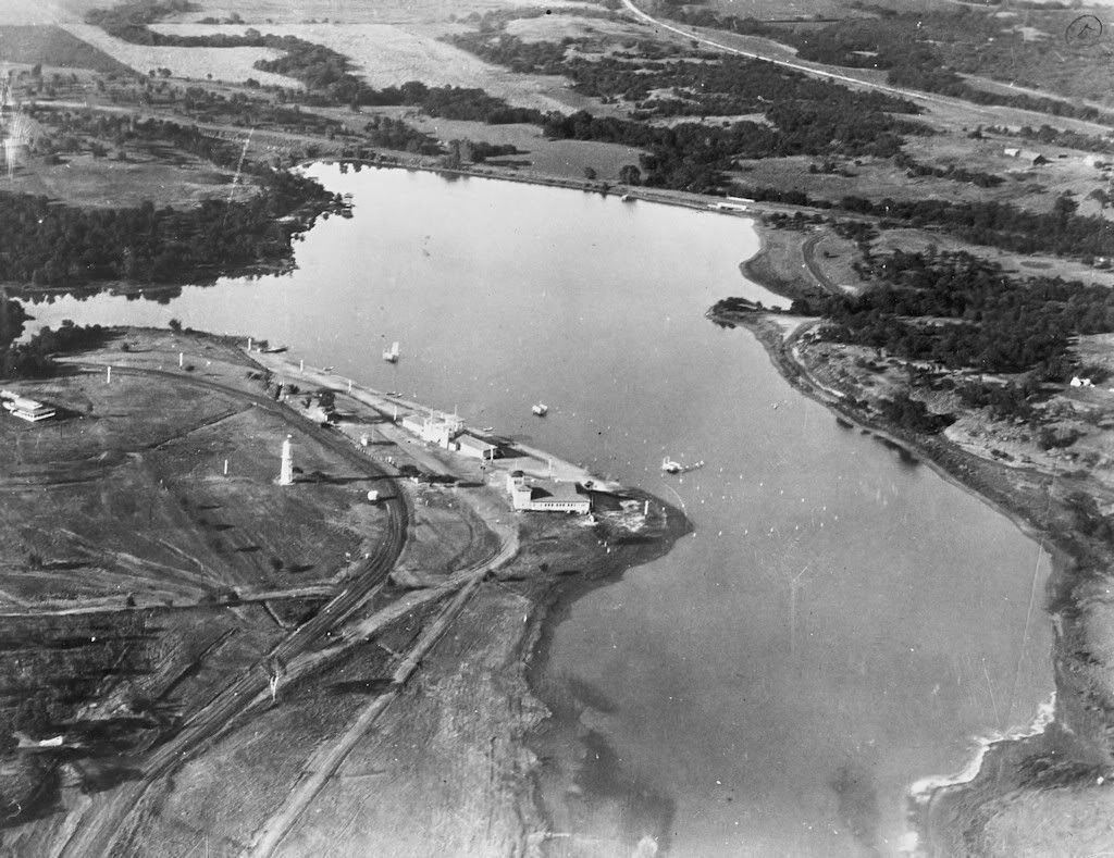
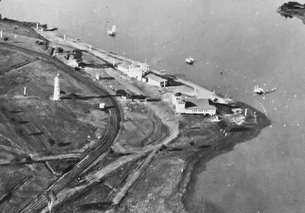
Uncertain, but I'm guessing this is Belle Isle. A crop of the photo below immediately follows ...
This ends the review of the Chamber of Commerce book of That Man Stone photos. I'll edit this article once I learn more information about Mr. Stone.
Many thanks, again, to the Greater Oklahoma City Chamber of Commerce and, particularly, to Dean Schirf.
FTC Warns Seth Wadley Over Deceptive Advertising…
-
One of my favorite hypocrisies about TV news is that they’ll file countless
reports about conmen, rogue contractors, scammers and other “consumer
protect...
Operation Scissortail - Our Latest Book!
-
[image: devon book cover]
We are very happy to announce the release of our latest book, "Operation
Scissortail," a narative history of the construction o...
Saturday in the Park..on a 113 degree day
-
For those who don't know, there is a reason I've gone very quiet at such a
pivotal moment for Downtown OKC. I accepted a position in Cleveland, Ohio
and I...

 .
.