skip to main |
skip to sidebar
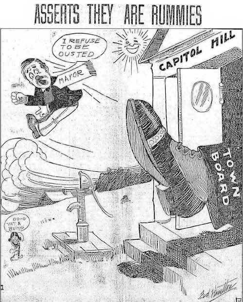 In researching information for my main article on Historic Capitol Hill, perhaps nothing more interesting popped out of that research than information relating to H.C. Schilling, Capitol Hill's ex officio mayor from 1905 until his removal from office on 1907. I say "ex officio mayor" since Capitol Hill did not have an official mayor, as such — it had a board of trustees and its president was unofficially called mayor. Most articles use the name, "H.C." but sometimes he is referred to as "H.G." Schilling.
H.C. Schilling had formed and caused East Capitol Hill Addition to be platted, immediately east of the Capitol Hill addition at some time before April 2, 1902 when he began marketing its parcels. An April 3, 1902, Daily Oklahoman article read, "Schilling's new addition to Oklahoma City will be paced on the market April 2, 1902. ¶ With especial inducements this is one of the most beautiful additions ever made to Oklahoma City. It has been platted and lots will be sold at price that will surprise you. A street car line will be built as soon as it is possible to get the material. This addition lays east of Capital [sic] Hill, and east of the Santa Fe tracks." Schilling was also very much involved in his addition's namesake, Capitol Hill.
Capitol Hill voted to become an incorporated municipality on March 21, 1904, by a vote of 72-61, and that status remained until yet another set of curious happenings occurred during 1909-1910 which resulted in the town of Capitol Hill being annexed by Oklahoma City — but that is another story. This one's about H.C. Schilling.
>>>CLICK HERE TO READ THE FULL ARTICLE<<<
... Click here to read the full article and any comments ...
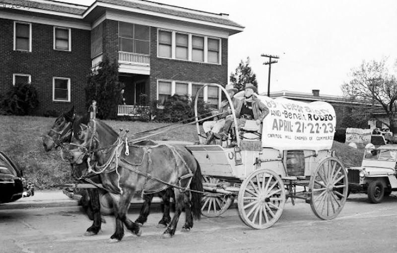
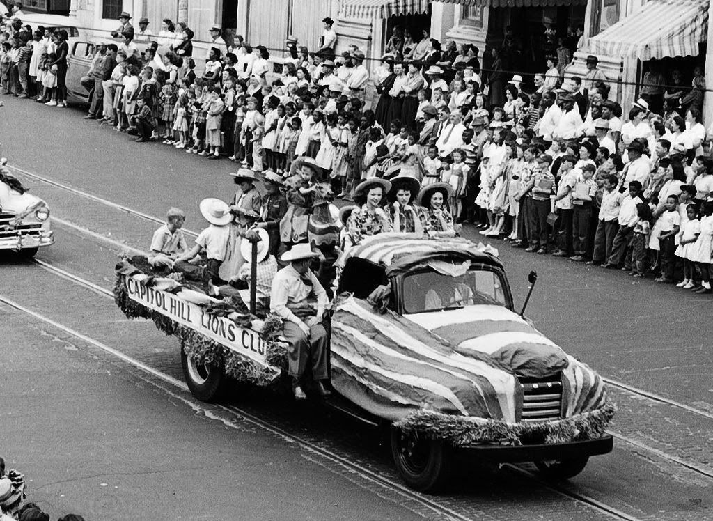
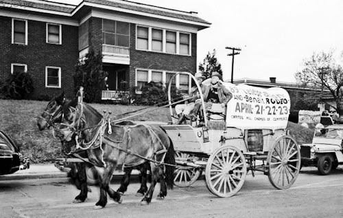
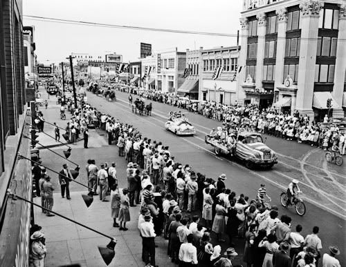
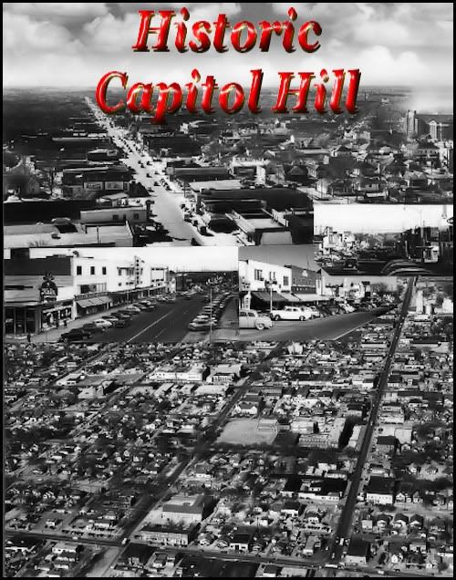 INTRODUCTION. INTRODUCTION. The origins of Capitol Hill will be discussed shortly. Here, I want to talk about the general character and personality of the residents of the area known as Capitol Hill, however that area might be defined (see below). They were and are a proud and feisty group of folk who care greatly for their identity as Capitol Hillians (my term but I couldn't think of a better) quite separate and apart from merely being Oklahoma Citians — not that they don't seem themselves as members of the larger community as well, which they do. But, of all the former towns that Oklahoma City has incorporated into its city limits, such as Britton, the strong and proud identity as being "from Capitol Hill" is probably more strongly felt than it is by any other town which Oklahoma City has absorbed — and, for that matter, incorporated municipalities which are surrounded by Oklahoma City on all sides such as Warr Acres and perhaps even the posh municipality of Nichols Hills. Below are photos from 1948 and 1949 showing the participation of Capitol Hill in 89er parades in downtown Oklahoma City — those people clearly wanted everyone else to know who they were and where they came from — Capitol Hill! I don't know but seriously doubt that a Nichols Hills float was in either of these parades.
Definition Capitol Hill Story Old Photos Schools
Early Buildings Trolleys & Floods 1923-1940s
Places to Sleep & Eat 1940s-1960s Today

 I don't get no respect. For some, many, or most, from Capitol Hill, it is also true that a pervasive undercurrent is that Capitol Hill hasn't received the credit that it is due, and/or has been ignored or thought of as being less important than Oklahoma Citians who reside north of the North Canadian River, particularly in the north central and northwest parts of the city. Such a sentiment is shared by many other "south siders" who reside in other southwest and southeast parts of my town. I don't get no respect. For some, many, or most, from Capitol Hill, it is also true that a pervasive undercurrent is that Capitol Hill hasn't received the credit that it is due, and/or has been ignored or thought of as being less important than Oklahoma Citians who reside north of the North Canadian River, particularly in the north central and northwest parts of the city. Such a sentiment is shared by many other "south siders" who reside in other southwest and southeast parts of my town.
Doug Dawg gives respect right here in what is hoped is a reasonably thorough and fair treatment and tribute to that special race of white folk (I'll explain why I use that term in the next section) who are now, and always will be, indelibly imbeded with the Capitol Hill gene.
WHAT IS CAPITOL HILL? This one's something of a toughie, particularly concerning the area included.
AREA. In an article by Jana C. Hausburg entitled, "South of the River - The Community of Capitol Hill at the Oklahoma City Metropolitan Area website (you may need to press F5 after clicking on the link to load the article), she reports that:
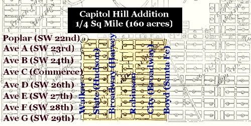
It should have been the home of the state capitol. At least, that was the plan. Home to a promising hill overlooking much of Oklahoma City, the area was named accordingly by B.R. Harrington, a newspaper correspondent for the Wichita Beacon. In 1900, he purchased the land from Miss Tryphosa Boyd, who had been among the early settlers attracted to the area after the Land Run of 1889, when Oklahoma lands were opened by the Federal Government. Her deed bore the signature of President Grover Cleveland.
Harrington platted the 160-acre tract near the old Santa Fe Trail and staked out individual lots for sale. His purpose, said Harrington, was to give "sober and industrious mechanics an opportunity to secure homes."
The site originally extended from Walker to Santa Fe, and from what is now called SW 22nd to SW 29th, the north boundary being the North Canadian River. Later, it grew to incorporate Penn Ave. on the west, SW 44th on the southern edge, stretching all the way to I-35 on the east. The area just described is shown in a 1909 city map cropped and annotated below to show that original Capitol Hill Addition — an addition to Oklahoma City.
 But that's just the beginning definition, not its ending one. As described below, in 1904, residents decided to form a city separate from Oklahoma City — Capitol Hill — as a town and not as a plat. As yet, I've not located a map which shows the area encompassed by that new town but I expect that I will before I put this article to rest. That incorporated municipality was, more likely than not, a larger area than the original Capitol Hill plat. But the town's legal identity as a municipality was short-lived. In 1909, it became incorporated in to Oklahoma City and, of course, after that, legal definitions are no longer relevant and identity turns from the objective realm to subjective notions as to what Capitol Hill IS. In the subjective arena, no definitive answers will ever be determined which are acceptable to all. But that's just the beginning definition, not its ending one. As described below, in 1904, residents decided to form a city separate from Oklahoma City — Capitol Hill — as a town and not as a plat. As yet, I've not located a map which shows the area encompassed by that new town but I expect that I will before I put this article to rest. That incorporated municipality was, more likely than not, a larger area than the original Capitol Hill plat. But the town's legal identity as a municipality was short-lived. In 1909, it became incorporated in to Oklahoma City and, of course, after that, legal definitions are no longer relevant and identity turns from the objective realm to subjective notions as to what Capitol Hill IS. In the subjective arena, no definitive answers will ever be determined which are acceptable to all.
Well, sort of. Even though a consensus might not be formed as to what Capitol Hill IS, a consensus is possible by what it IS NOT. When reading William D. Welge's Oklahoma City Rediscovered (Arcadia Publishing 2007), a generally fine book which includes a very nice section on Capitol Hill, some of his comments and photographs included Packingtown and even Oklahoma City Community College way far away from what any others (that I know, at least) would include as part of the Capitol Hill definition. But, I am not from Capitol Hill (even though my 1st wife taught school at Capitol Hill Junior High while I was in law school, my closest familial tie to the area). I decided to ask the view of the Capitol Hill folk who are regulars at OkcTalk.com in this thread which received many replies but quite naturally produced nothing absolutely definitive.
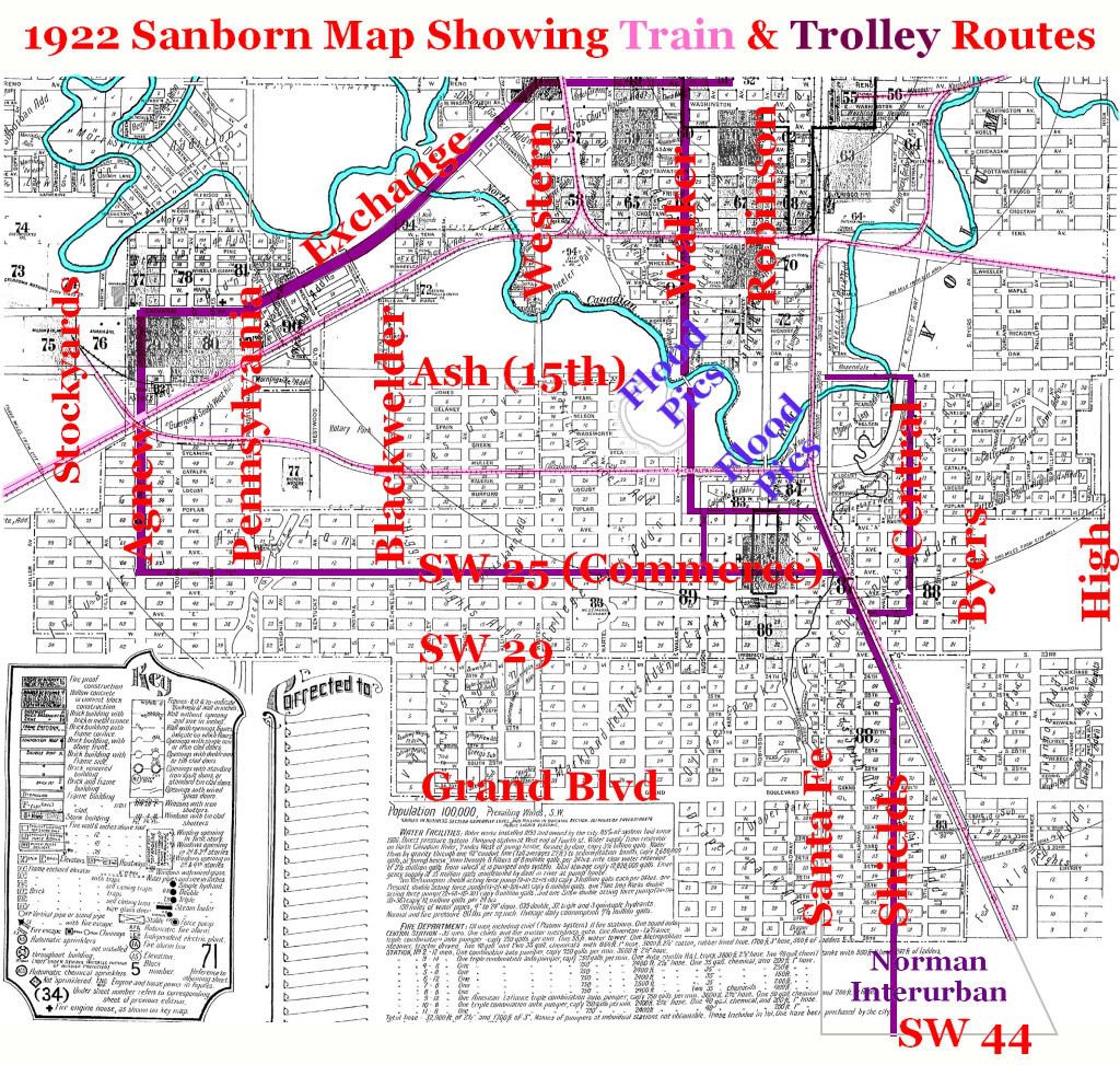
A fair consensus, though, may be that most Capitol Hill people consider Capitol Hill to be a composite of parts 1, 2, and 3, in the second map below (but note that Ms. Hausburg would extend it a mile further west, to Pennsylvania). First, the map is shown without color-coded Capitol Hill areas:
From A 1922 Sanborn Map Cropped To Show The Area
The dark red line shows the ORC trolley routes
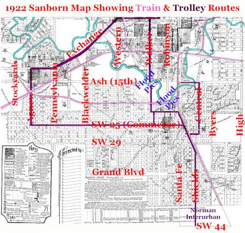
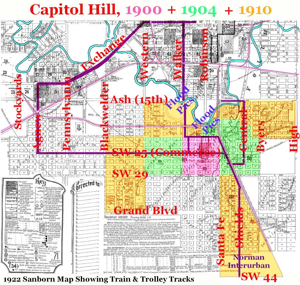
Same Map Showing Capitol Hill Growth, 1900-1904-1910

Frankly, I think it likely that the above is as good as it's gonna get by way of consensus but I reserve the right to modify this perception after obtaining something definitive about Oklahoma City's absorption of Capitol Hill in 1909 or perhaps something else objective about which I am not presently aware.
RACE. Above, I mentioned that Capitol Hill was composed of "white folk." Here, I'll be more precise. During the days of the Oklahoma Constitutional Convention and the constitution which was subsequently adopted by vote of the people, Oklahoma's constitution embraced the notion that two, and only two, races, for constitutional purposes, existed: white and colored. If a person had any degree of African blood, they were "colored." Everyone else was "white." This March 29, 1916, Daily Oklahoman article, upon the adoption of Oklahoma City's first set of Jim Crow residential ordinances, reported that:
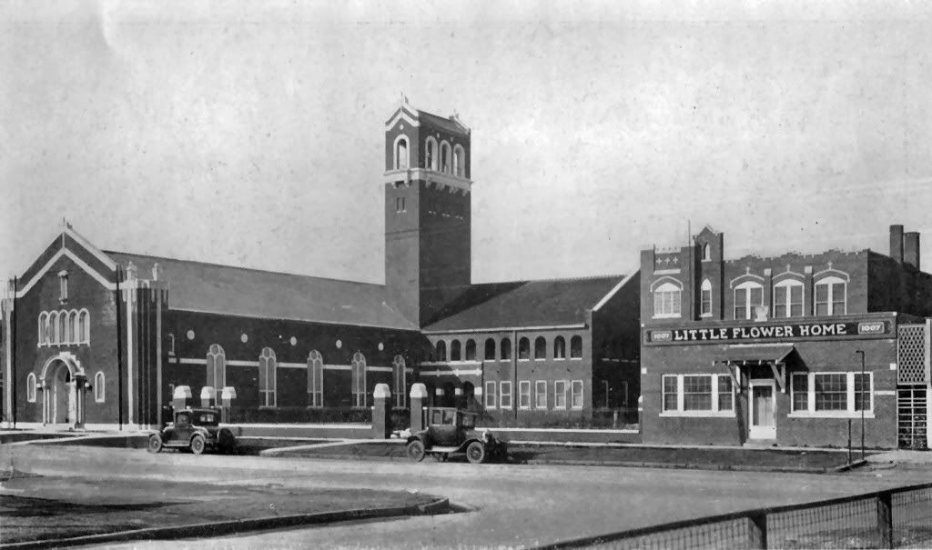
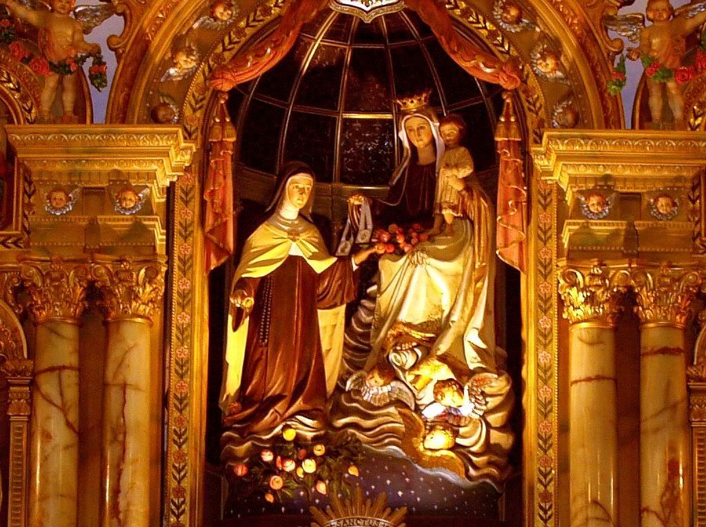
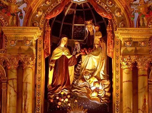
In Capitol Hill, with its 5,060 inhabitants there is not a negro resident. The new law means that this section of the city will be free of colored people for all time. Most probably, the Capitol Hill "white" residents included at least some Mexican Americans, or whatever the politically correct term is today. Today, the area may contain more Mexican Americans than "anglos." Immediately north of Capitol Hill on Walker is the incredibly beautiful (from the inside) Little Flower Catholic Church which is not generally regarded as part of Capitol Hill. That said, when the church (and, at the time, school) was formed in 1927, at least a part of its stated mission was to serve those in Oklahoma City whose origins were from Mexico, and they doubtless lived in areas around the church. So, if Mexican Americans weren't initially in Capitol Hill, they were certainly nearby and would come to be within.
Little Flower In 1927 From The Outside

Little Flower From The Inside In 2007
THE CAPITOL HILL STORY. Text to follow shortly.
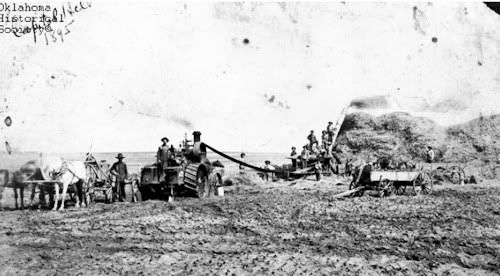
OLD PICS. Text to follow shortly.
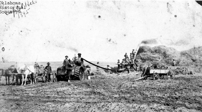
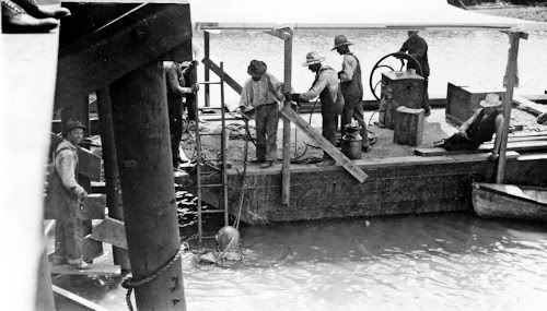
A Bailing Crew In 1895
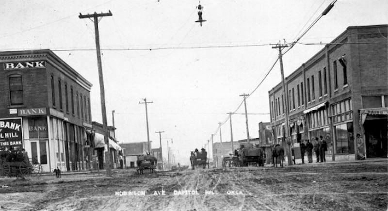
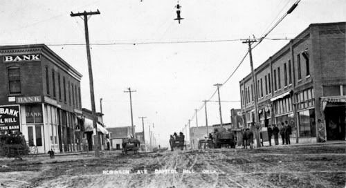
South Robinson In 1911
Credit Oklahoma Historical Society
SCHOOLS. Text to follow shortly.
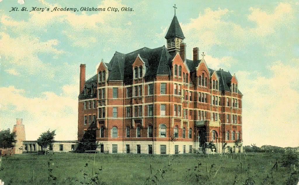
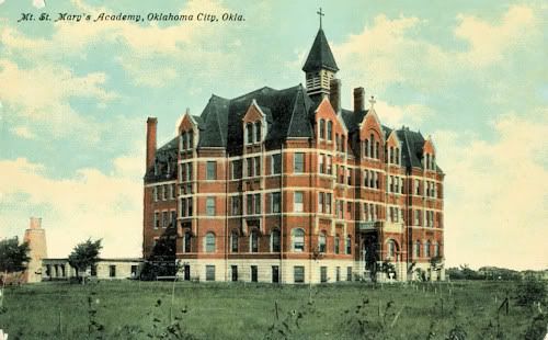
The 1st School — Mt. St. Mary's Academy (1903-1906)
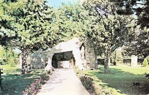
Lourdes Grotto At Mt. St. Mary's
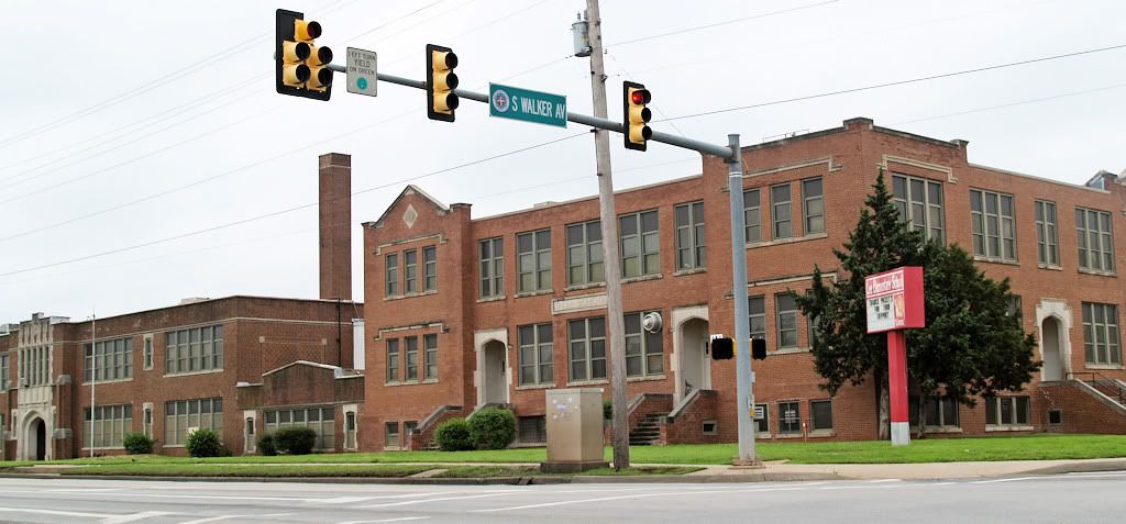
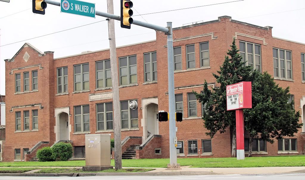
The 1st Public School — Lee School (1910)
Hudson & SW 29th
Lee School Today
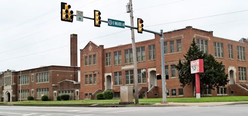
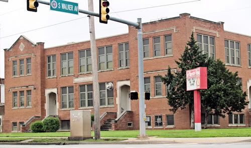
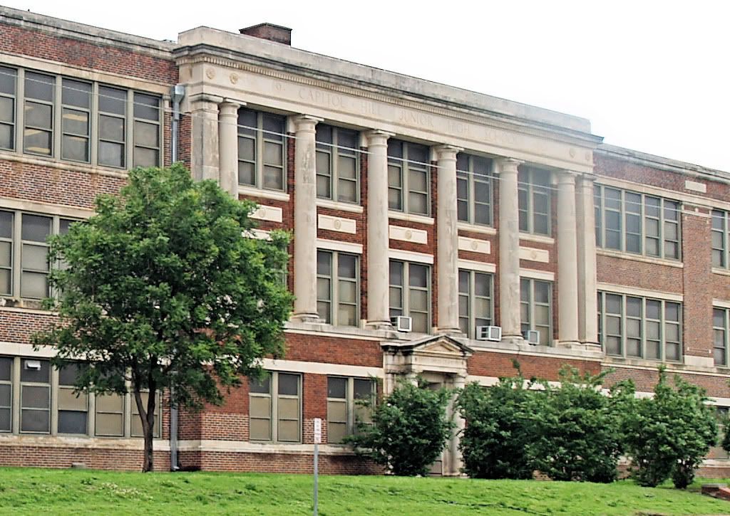
2nd School — Capitol Hill Junior High (1921)
2717 S. Robinson, Now Capitol Hill Elementary School
(Vintage Pic Not Available — 2009 Photos Shown Below)
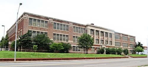
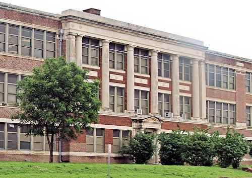
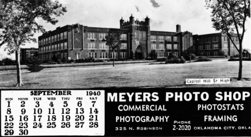
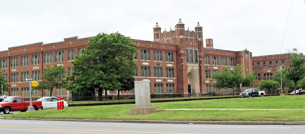
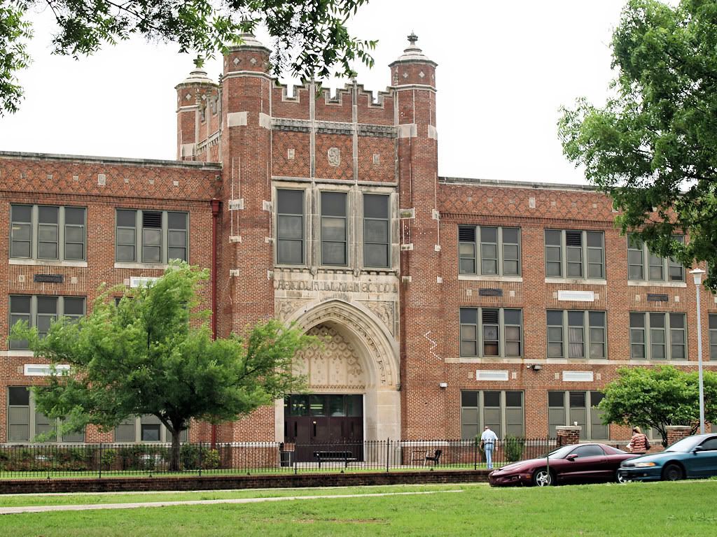
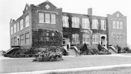
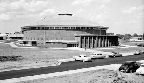
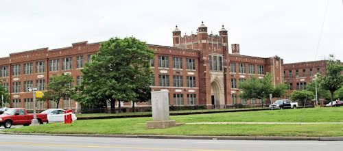
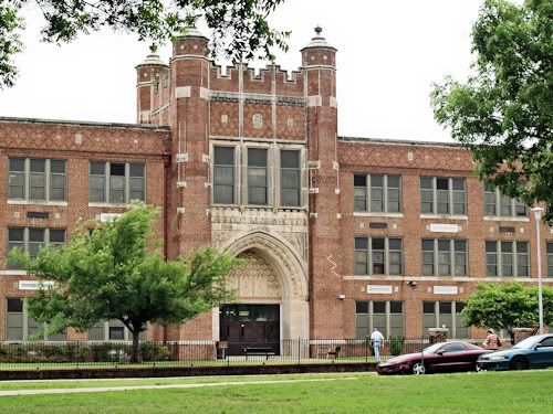
Capitol Hill High School (1928-29)
500 Southwest 36th Street
A 1940 Calendar Photo
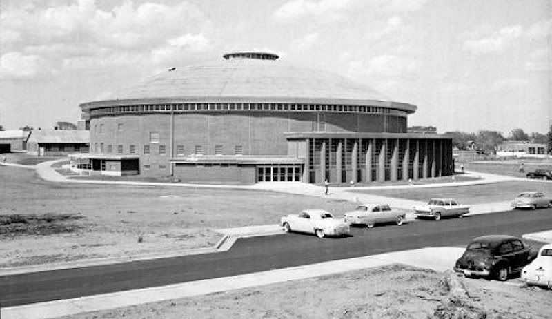
(Next 2 Pics Credit Oklahoma Historical Society)

1956 Gymnasium Photo
2009 Photos
EARLY DAY BUSINESSES & BUILDINGS. Text to follow.
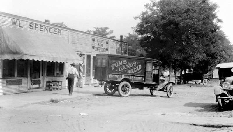
Capitol Hill's Tom's Dandy Bread
Delivering to Spencer Grocery At 2523 S. Central In 1922

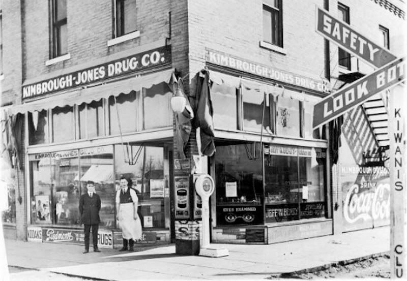
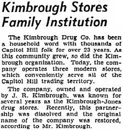
Kimbrough-Jones Drug Co. in 1922, 2543 S. Robinson
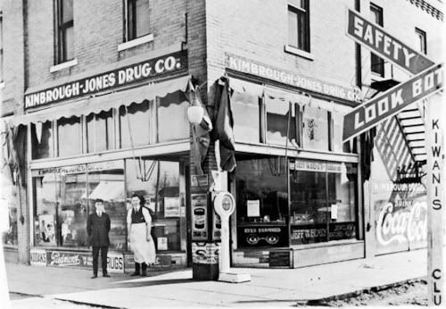
September 24, 1939 Article
 | Its Competition — March 2, 1906
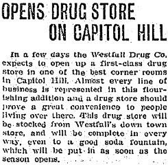 | |
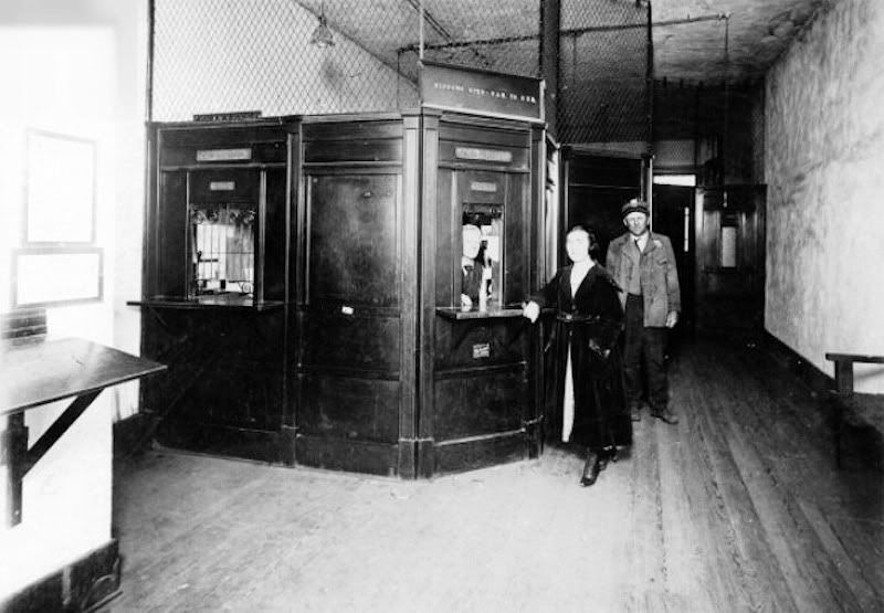
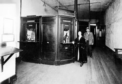
A 1922 Sanborn map locates the post office at 2613-15 S. Robinson, midway between Avenue C (Commerce/SW 25th) and Avenue D (SW 26th) in a building shared with a masonic lodge which occupied the second floor.
Inside The Post Office In 1920
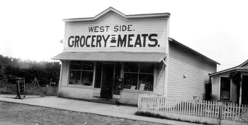
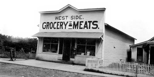
A Grocery At 547 Southwest 28th Street
Credit Oklahoma Historical Society
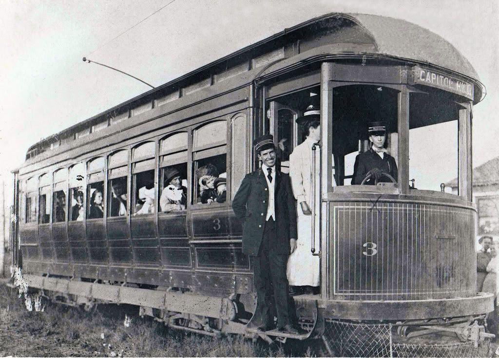
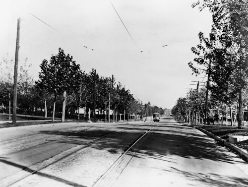
TROLLEYS & NORTH CANADIAN FLOODS. As will be described in the beginning text once I'm through uploading photos, the Oklahoma Railway Company added Capitol Hill to its city trolley routes in 1906 and, from Capitol Hill, the company's Interurban line to Norman also passed through Capitol Hill as well. The following photos are courtesy of Vintage Rail Photos/Whistle Stop Trains at 1313 West Britton Road, and are from their great CD, "Oklahoma Railway Vintage Rail Photos," disk number VRP-32.
A Trolley On South Walker
Courtesy Vintage Rail Photos/Whistle Stop Trains
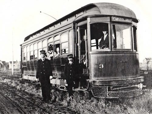
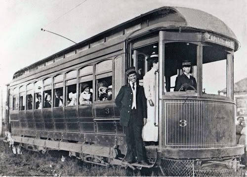
Posing For Photos On The Capitol Hill Line
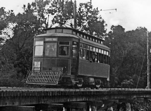
Crossing The North Canadian At Walker
In Capitol Hill On Walker Looking North
(Notice the Harbour Longmire Building in the far background)

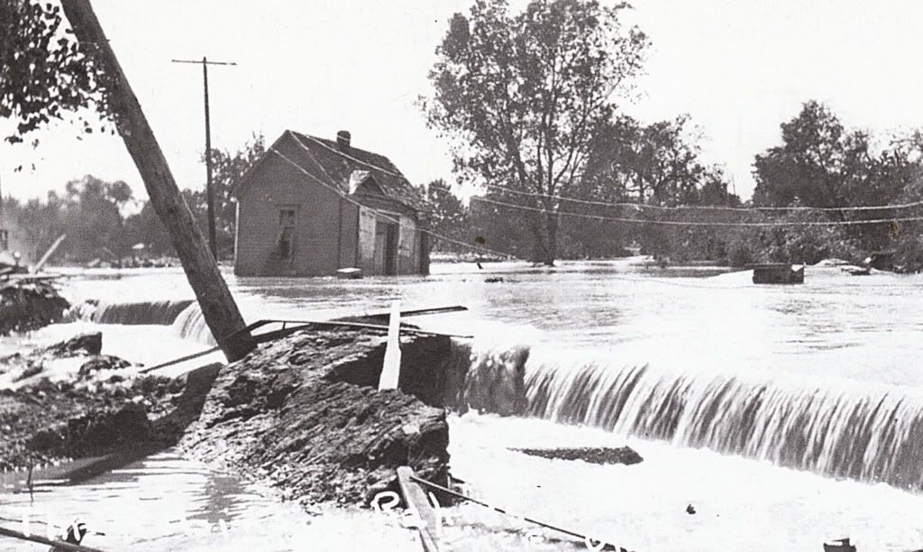
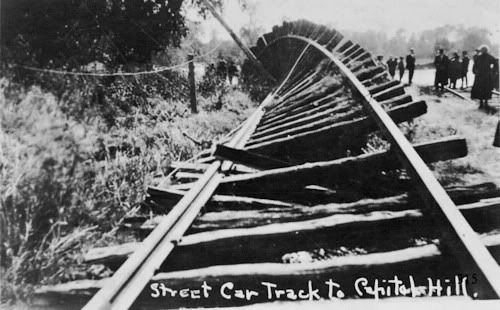
Although the North Canadian River didn't actually pass through Capitol Hill, it came very close at two points — at the Walker trolley bridge and closer still at Robinson and the Capitol Hill area was certainly impacted by the river's flooding.
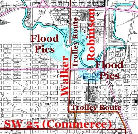
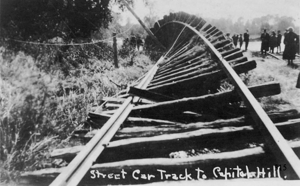
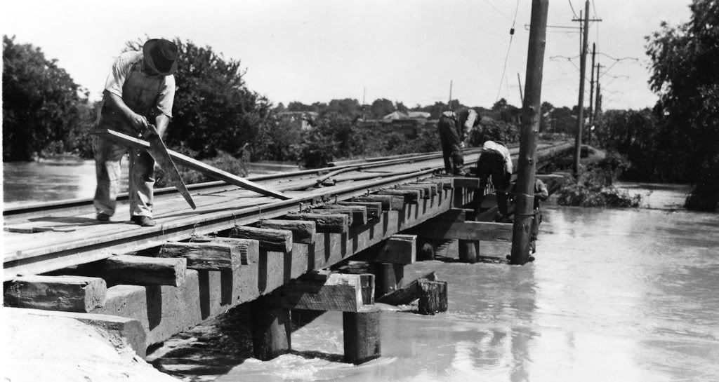
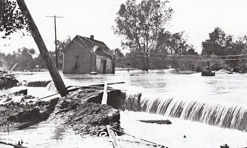
Doubtless the most severe flooding occurred in 1923 — twice. On May 29 and October 16, torrential rains caused the North Canadian to rise yards beyond its banks and result in flooding to many areas of Oklahoma City, certainly including Capitol Hill. I've written about that more extensively in the Trains Part 2 article to which you are referred for further detail. Here, I'll show photos of these floods in the Capitol Hill area. The images which follow are not dated so I'm not able to say whether they were taken during the spring or fall floods.
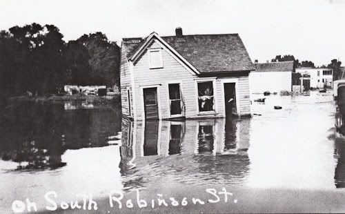
The Next 3 photographs are credited to Terry L. Griffith,
Oklahoma City, Statehood To 1930 (Arcadia Publishing 2000)
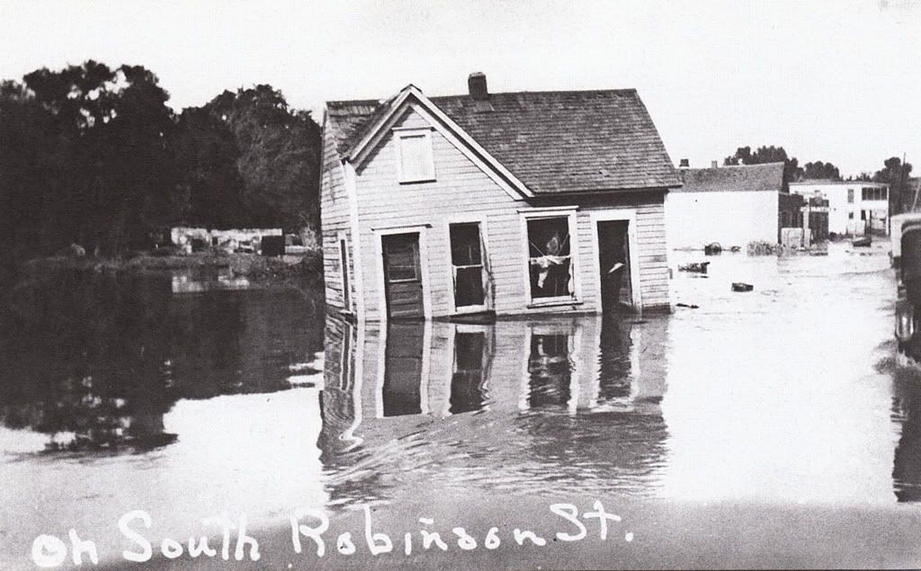
Houses Sitting In The Street On South Robinson
As shown in the above 1922 Sanborn map, the trolley line crossed the river just north of Capitol Hill. Again, I cannot say whether the photographs which follow are from the spring or fall 1923 flood.
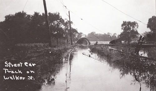
From My Postcard Collection

Credit Jim Edwards & Hal Ottaway, Vanished Spendor II
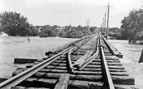
The next series of photographs are courtesy of Vintage Rail Photos/Whistle Stop Trains at 1313 West Britton Road, and are from their great CD, "Oklahoma Railway Vintage Rail Photos," disk number VRP-32.
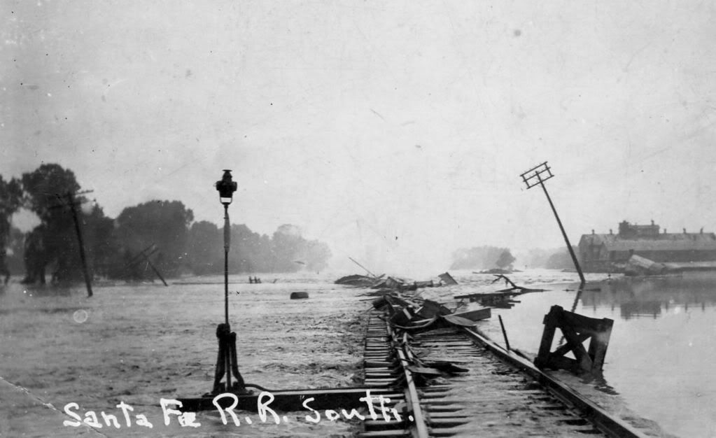
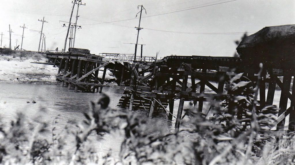
In 1923 Before The Bridge Was Impassable
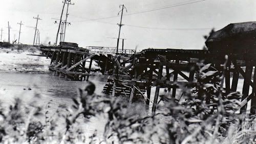
I can't be certain that the next two photographs are of the Walker trolley bridge or some other, but from them you'll get a good idea of the damage, even if at a different trolley river crossing.
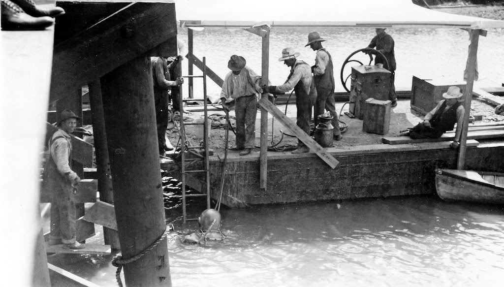
ORC Trolley Crane Not Doing So Well
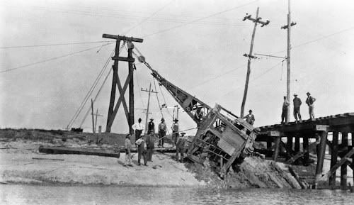
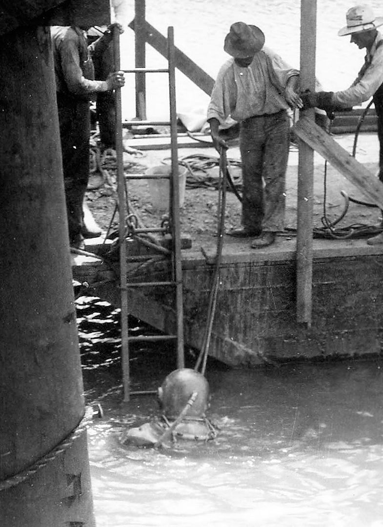
Check This One Out — Notice They Guy In The Diving Suit

Looking South At The Walker Bridge Into Capitol Hill

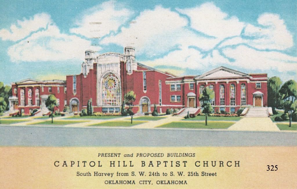
CAPITOL HILL FROM 1923 INTO THE 1940s. The next group of photos and postcards shows parts of Capitol Hill after the destruction caused by the 1923 floods, perhaps appropriately beginning with a church.
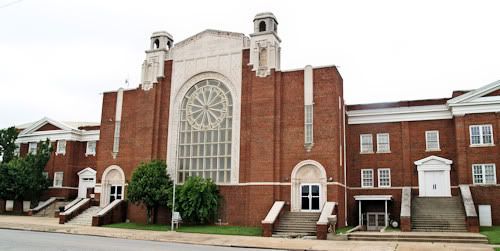
Capitol Hill Baptist Church Built In 1923
Credit Jim Edwards & Hal Ottaway, Vanished Spendor II
(Abalache Book Shop Publishing 1983)
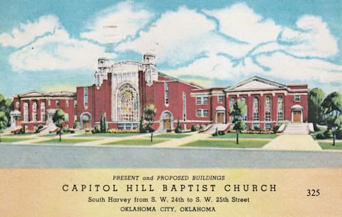
Photos of the same building in 2009 are in the "Current Day" images at the end.
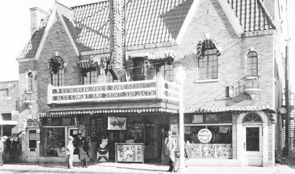
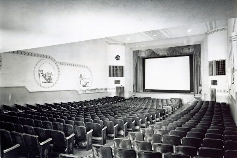
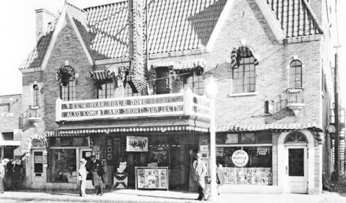
A December 18, 1928, ad in the Daily Oklahoman Announced
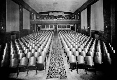
The Opening Of The Circle Theatre At 2510 S. Robinson
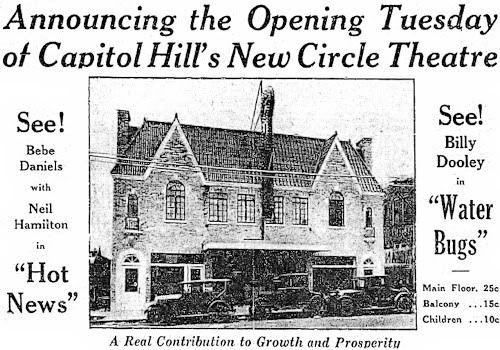
Credit William D. Welge, Oklahoma City Rediscovered
(Arcadia Publishing 2007)
Inside The Circle Theatre
Credit Oklahoma Historical Society
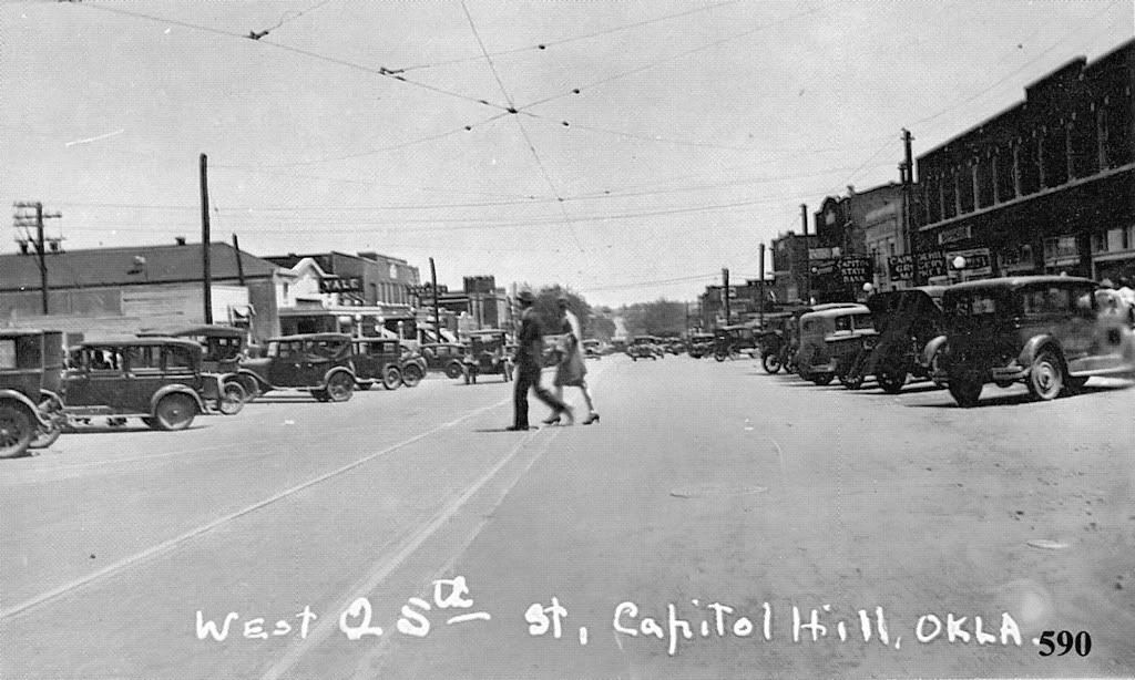
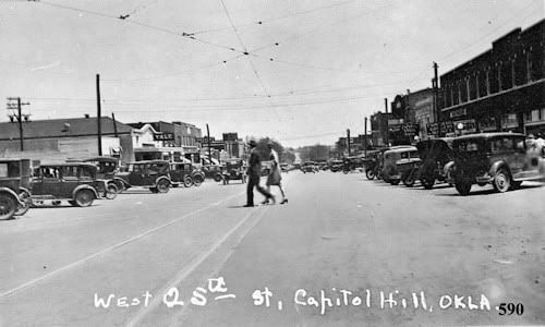
Downtown In The Early 1930s
Credit Jim Edwards, Hal Ottaway & Mitchell Oliphant
Vanished Splendor III (Ablalache Book Shop Publishing 1985)
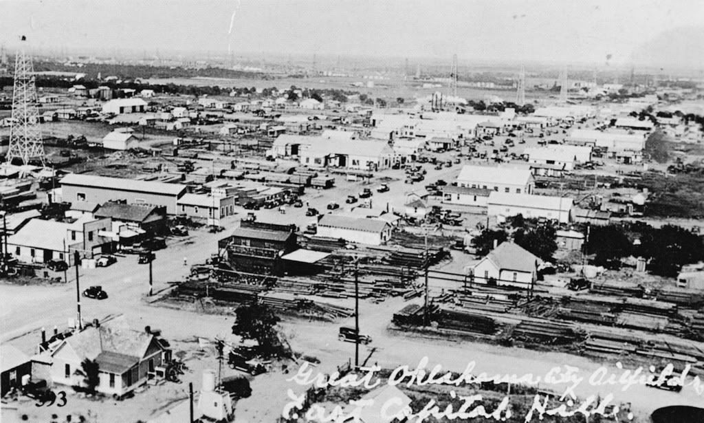
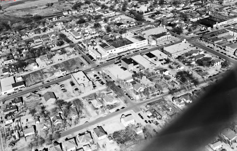
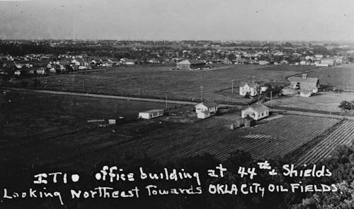
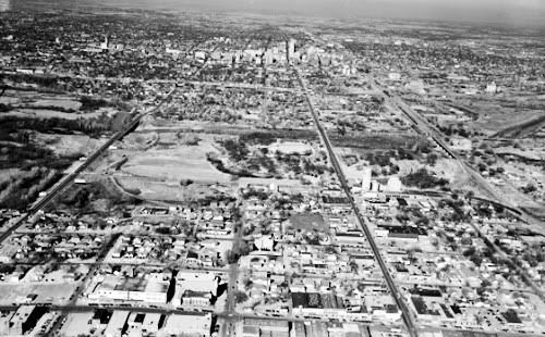
The following photos are also from Vanished Splendor III and, while Capitol Hill is not, strictly speaking, in the images, the general vantage point is from Capitol Hill and they show the area immediately east of Capitol Hill following the "Discovery Well" hitting black gold in December 1928.
Aerials of the Capitol Hill Environment Circa 1930
Looking East On 29th Street Into East Capitol Hill
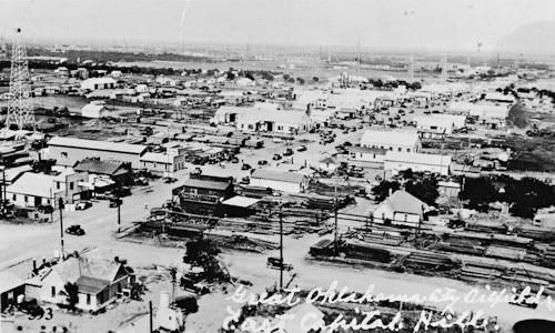
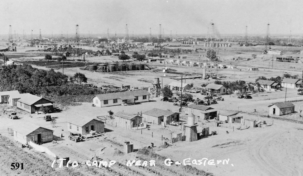
Looking Northeast To The ITIO
(Indian Territory Illuminating Oil Company)
Facilities & Camp at Avenue G (Southwest 29th) & Eastern
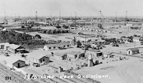
ITIO Office Building (2 story building at the right)
at SW 44th & Shields In Foreground
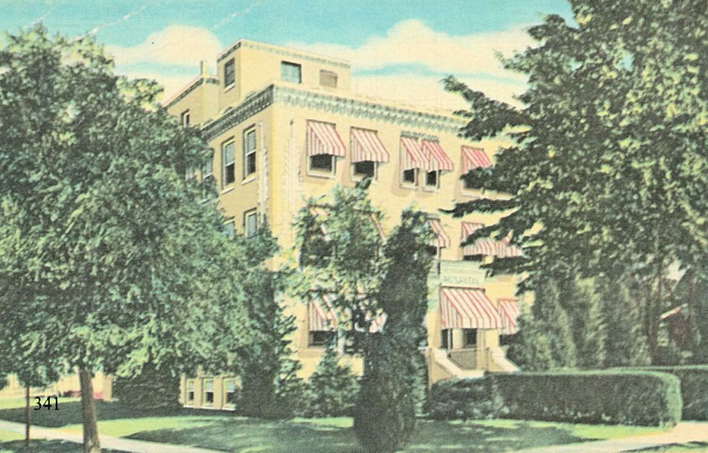
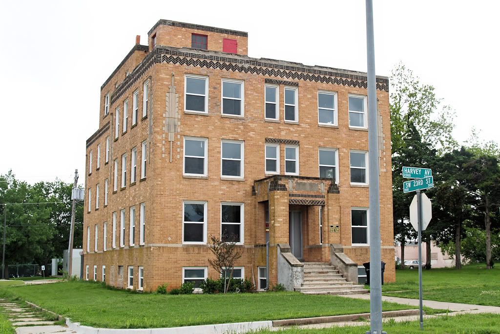
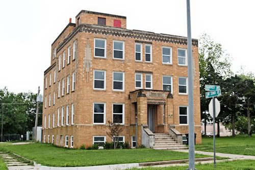
Capitol Hill Hospital (1930), 2400 South Harvey
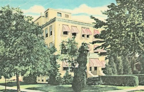
Credit Oklahoma Historical Society
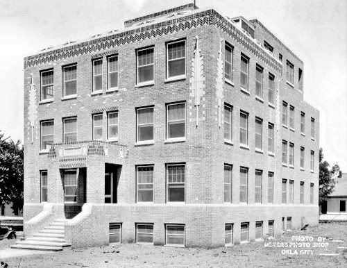
The Building In 2009 (Credit Me)
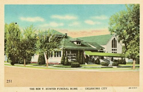
Hunter Funeral Home at 2427 S. Harvey in 1938
Credit Jim Edwards & Hal Ottaway, Vanished Spendor II
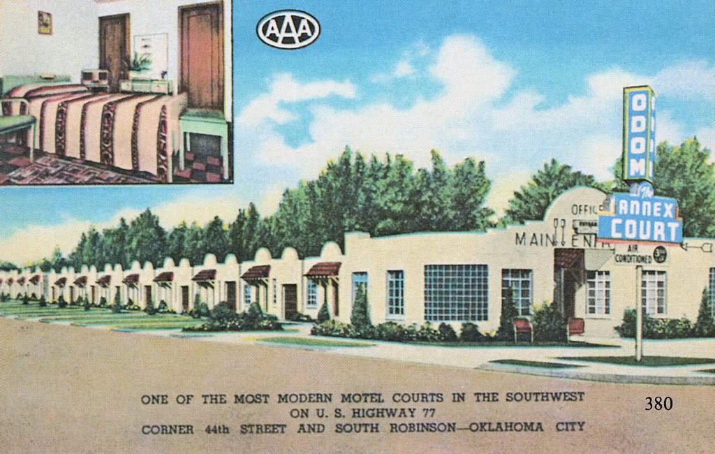
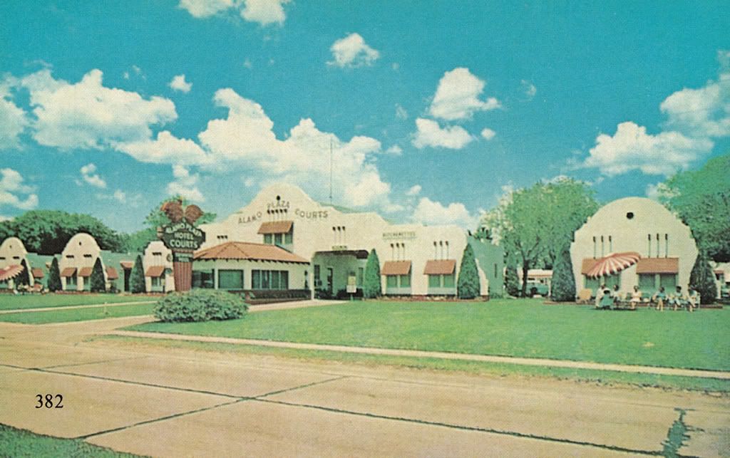
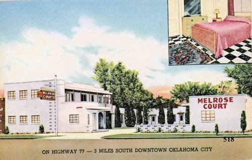
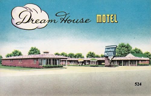
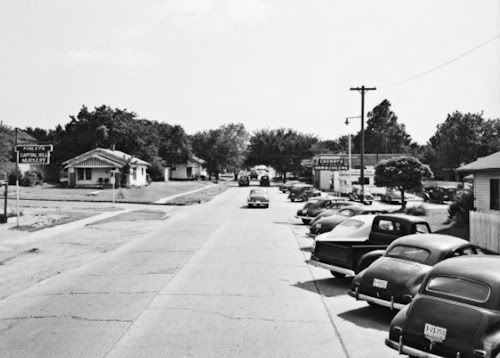
PLACES TO SLEEP & EAT. U.S. Highway 77 passed through Capitol Hill on its eastside in the early days, and several motels found their way into Oklahoma City history books on that account. Some are shown below. All postcard images below are credited to Vanished Splendor II or III by Jim Edwards & Hal Ottaway.
The 1st three are at the then busy intersection of SW 44th & South Robinson, on opposing corners of that location.
Odom Annex Court (date unknown but probably 1930s), SW 44th & Robinson

Melrose Court (by 1939), SW 44th & Robinson
Alamo Plaza (1936), SW 44th & Robinson

Dream House Motel (1953), Southwest 45h & Shields
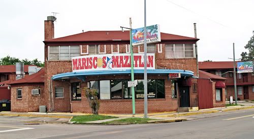
Cafe Palacio (1949), 3325 S. Robinson
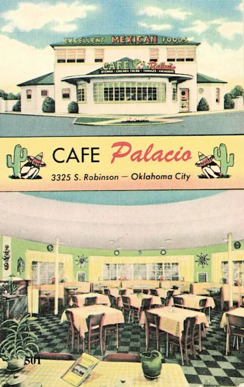
Same Building In 2009
THE 1940s-1960s. Understanding that overlap exists between the last section and this one, I felt the need to have a break point somewhere, so this is it. More text will shortly follow.
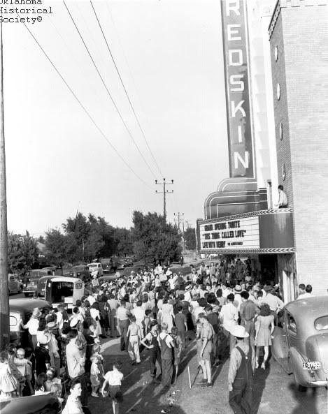
Redskin Theater, 822 Southwest 29th (1941) (credit OHS)
It was destroyed in 2004
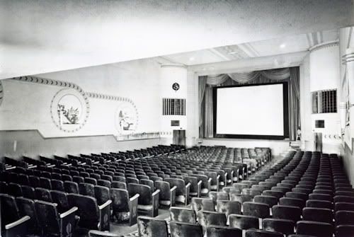
Inside View of the Redskin (credit OHS)
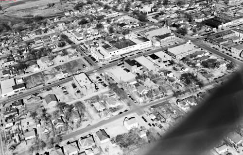
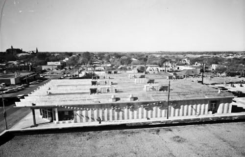
1951 Aerials (credit OHS)
Looking South on Walker (credit OHS)
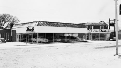
Need A Nash? 2423 S. Walker (credit OHS)
Proceeding East From Walker on Commerce Street
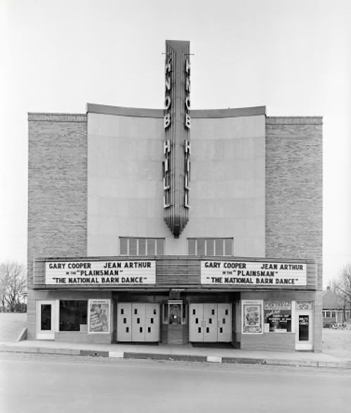
Knob Hill Theater, 404 W. Commerce (credit OHS)
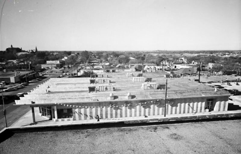
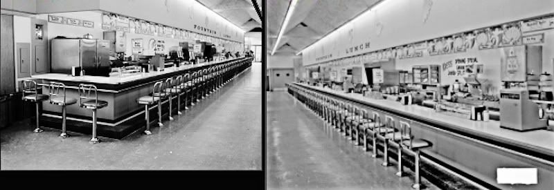
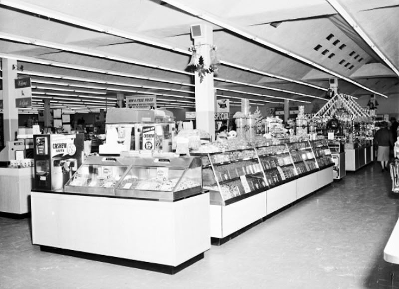
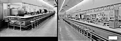
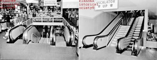
S.H. Kress at 405 Commerce
All Kress Photos below are credited to OHS
The store was built in 1960 at a cost of $550,000

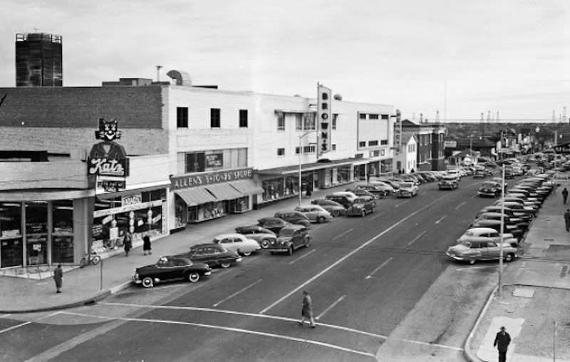
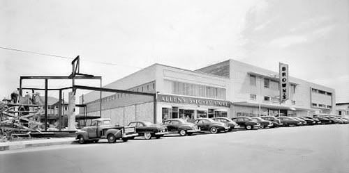
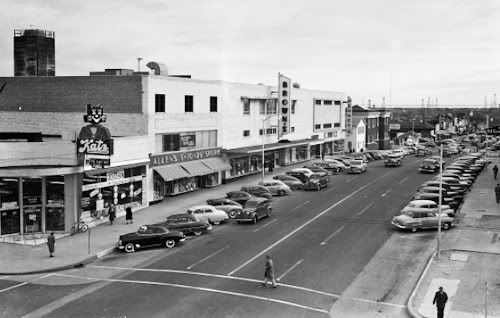
North Side of Commerce & Hudson (credit OHS)
Notice the Allens 5¢ and 10¢ store
In 1951 (credit OHS)
In 1956 (credit OHS)
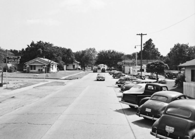
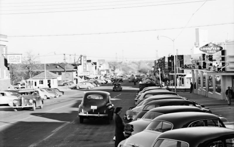
1949 Street View (credit OHS)
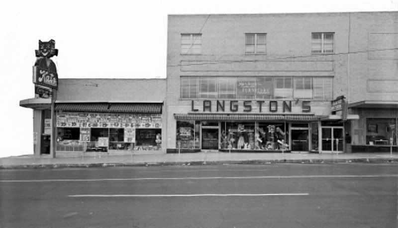
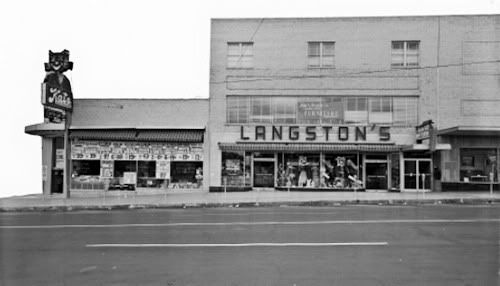
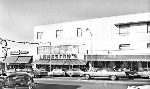
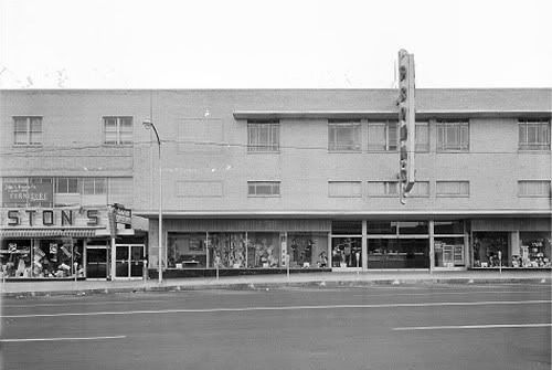
Langstons (credit OHS)
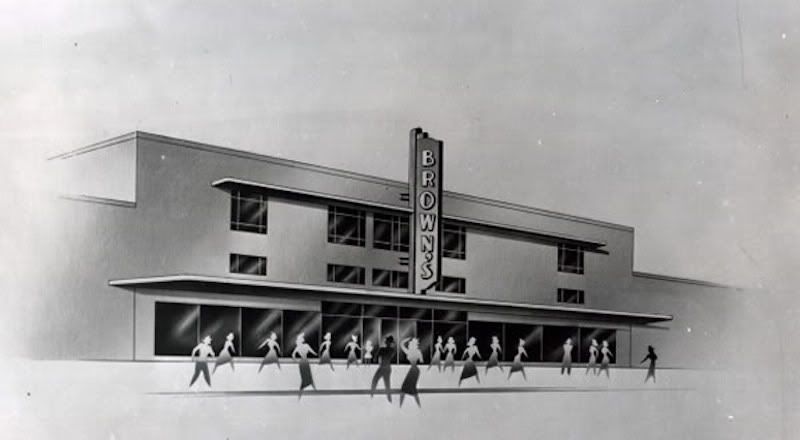
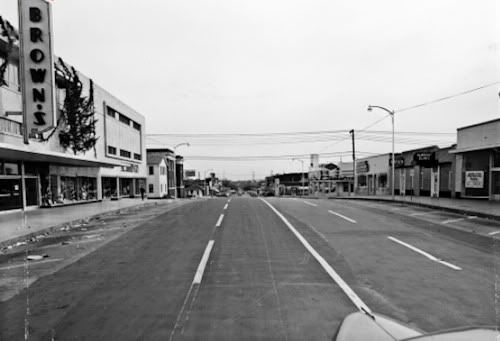
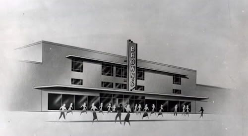
Browns Concept Drawing (1948) (Credit OHS)
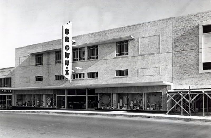
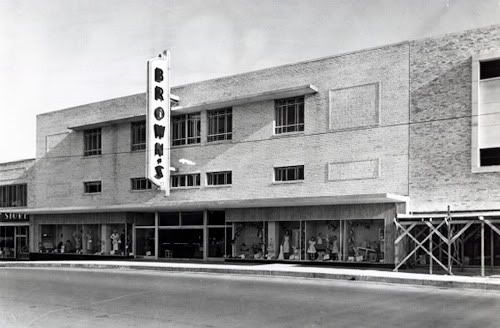
Browns In 1956 (Credit OHS)
And Another Browns
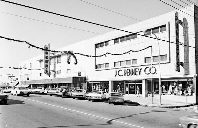
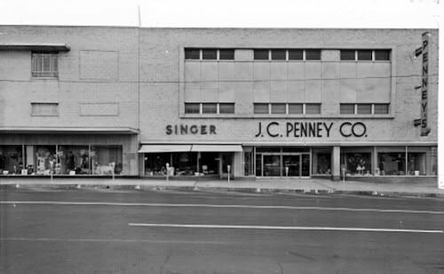
JC Pennys (credit OHS)
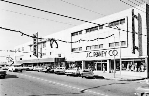
In 1956 (credit OHS)
From Harvey Toward Robinson In 1951 (credit OHS)

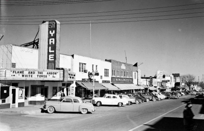
Yale Theater (credit OHS)

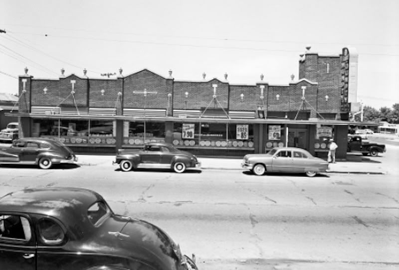
Humpty Dumpty at SW 25th and Walker (credit OHS)

CAPITOL HILL TODAY. Capitol Hill may well have been an indirect victim of downtown Oklahoma City's urban renewal in the 1960s-1970s. At the least, the ownership of John A. Brown's may have had something to do with the area's downturn. See the John A. Brown's article for the full history of Brown's, but suffice it here to say that, in the midst of downtown Oklahoma City's urban renewal, (1) following the 1967 death of Della Dunkin Brown, she apparently being committed to keeping Brown's in downtown Oklahoma City, the Brown's ventures were acquired by Dayton-Hudson in January 21, 1971 — local owners are almost unvaryingly more concerned about their communities than are corporate organizes from outside the state; (2) Dayton Hudson decided to pull Brown's out of downtown and, at the same time, it closed the Capitol Hill store in 1974. Whether these speculations as to cause have validity or not, Capitol Hill surely suffered a downturn beginning at some point in the 1970s, and the loss of Browns must have been huge upon the community.
My drive-through a few days ago showed the signs of deterioration but showed signs of reemergence, as well, and the general thrust appears to be positive, even if there is a long way to go.
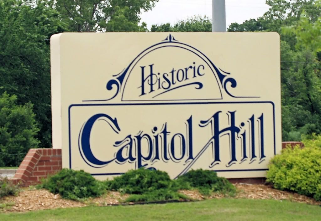
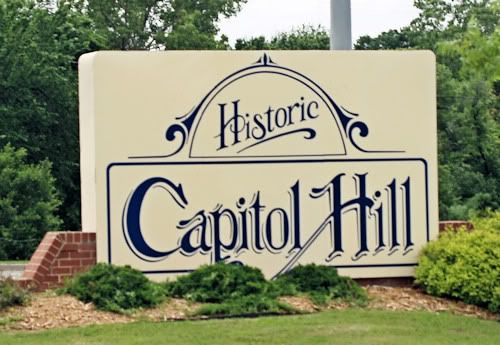
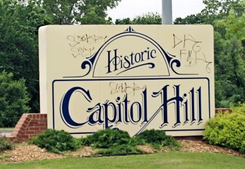
Both the community's pride, as well as its downside, is evident from the "Historic Capitol Hill" marker at Shields and Commerce, shown below.
This is how the marker is supposed to look ...
... but this is how it DID look before I cleaned up the photo ...
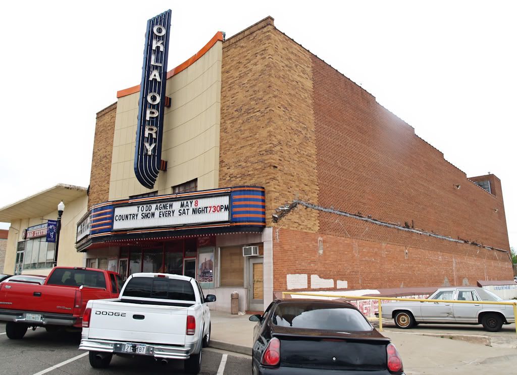
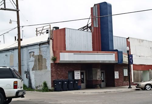
Concerned citizens and interests are clearly attempting to get this historic area back in good shape, but there is clearly a long way to go before that can become true. The old Knob Hill Theater is now home to the Oklahoma Opry and that building looks good ...

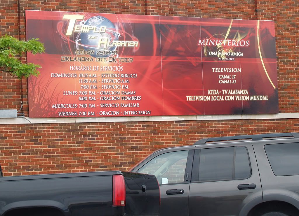
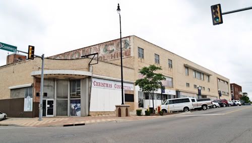
... and the area formerly occupied by Katz Drug, Langstons, Browns & Pennys could be a lot worse ...
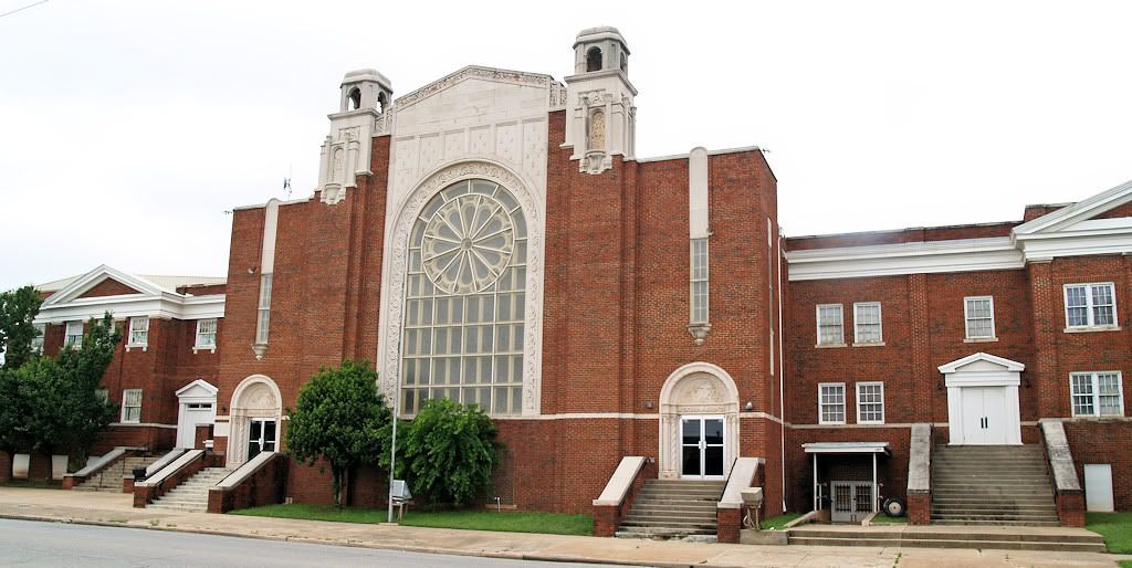
... and the group which now owns the former Capitol Hill Baptist Church is doing a reasonably good job, boarded windows treatment notwithstanding ...

But many areas, such as the old Yale Theater and its surrounding structures cannot be said to be anything but embarrassing to a proud Capitol Hillian ...
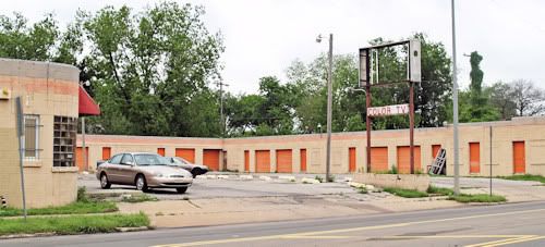
... some of which are frankly so bad that I chose not to show them at all. The remnants of the former motel area are either gone or are in total disrepair, as is this one at Southwest 29th and Robinson ...
The once proud Capitol Hill is struggling as this is written in 2009, but trying, they are. My sense is that progress has been made during the last decade and that more progress is yet to come.
Go To Top
... Click here to read the full article and any comments ...
|