
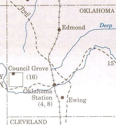
Although Council Grove in western Oklahoma County has a venerable history and tradition much older than Oklahoma City, it's not often mentioned as part of our early-day legacy. The above image from Charles Robert Goins and Danney Gobles' Historical Atlas of Oklahoma, 4th Ed (University of Oklahoma Press 2006) shows the region at page 125.
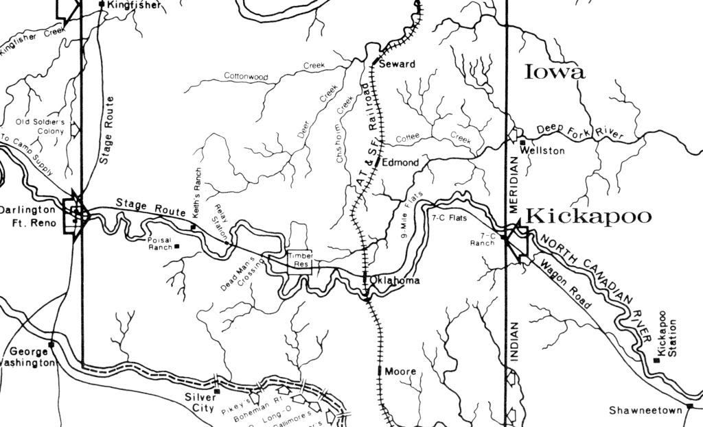
The map below is a crop from a map contained in The Oklahoma Land Rush of 1889 by Stan Hoag (Oklahoma Historical Society 1984). The map shows the complete area embraced in the April 22, 1889, Land Run, but this crop focuses on the area discussed in this article. Notice the area identified as "Timber Res" -- that is Council Grove. The map shows that a stage route ran through it from El Reno. If you'd like to see a 2827 x 3444 pixel version of the entire map, click here.
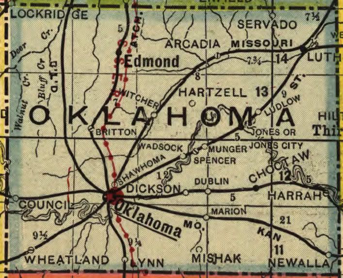
A pair of post-land run maps show the Council Grove area:
(see this article here for much more about that map)
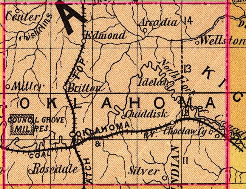
1905 Geographical Publishing Company Map
(see this article here for much more about that map)
(The gazetter with this map shows a population of 18)
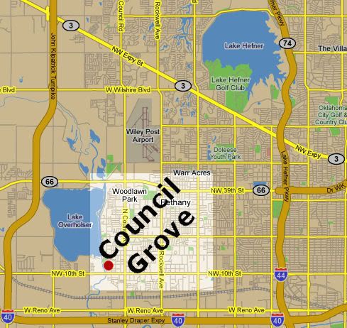
Those living in Oklahoma City are familiar with "Council Road" which runs north-south along the east side of Lake Overholser one mile east of the western Oklahoma County boundary. The road gets its name from the historic "Council Grove" area which no longer exists as such even though schools and street names bear all or some parts of the name. But, what was "Council Grove?"
The Bethany, Oklahoma, website contains the most information and says this:
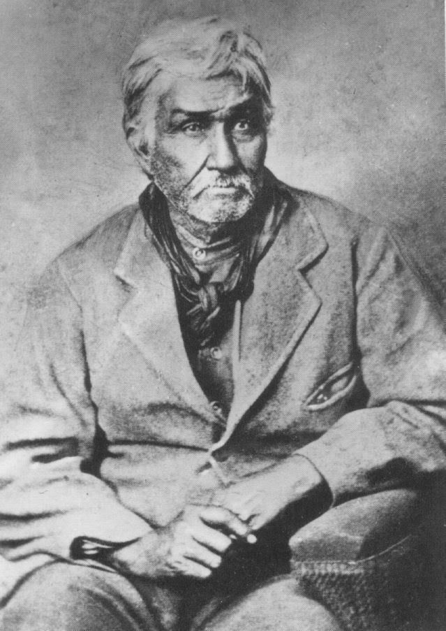
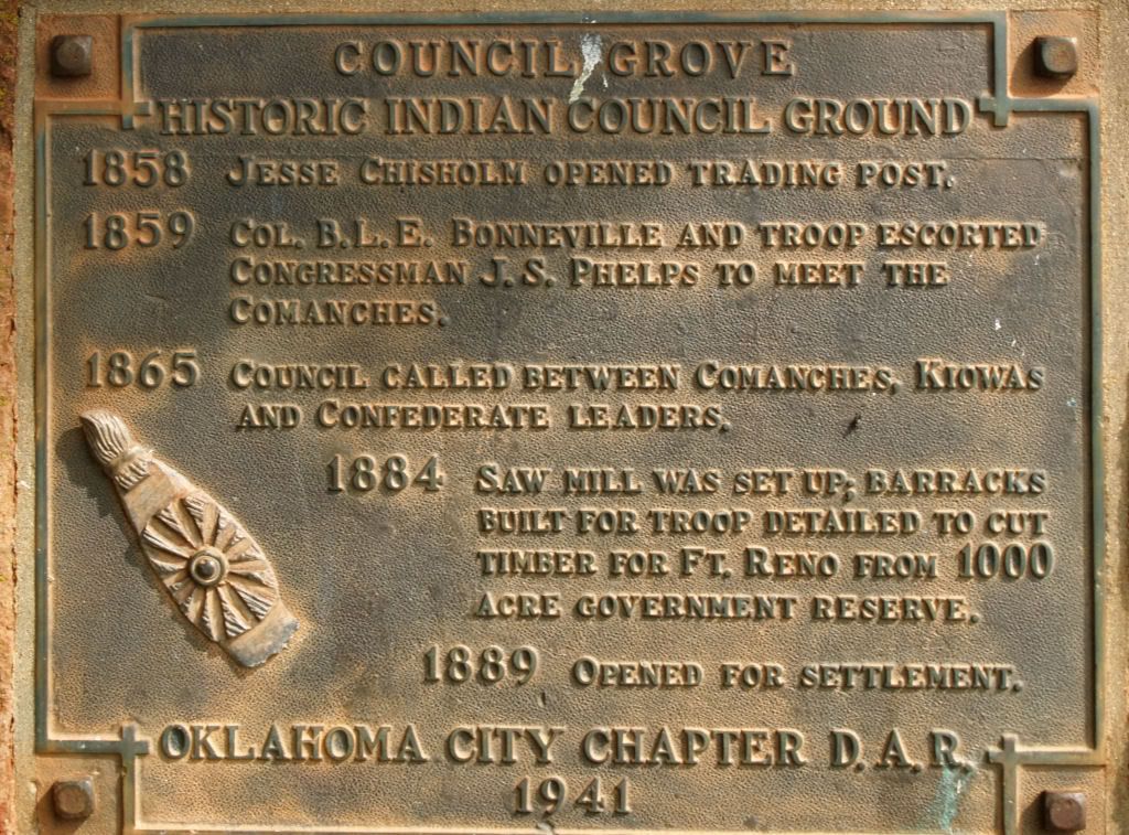
Council Grove was an important part of the “Unassigned Lands.” Although it was in the Creek Nation, it was a gathering place for many of the Plains Indians. Its good spring water and its large grove of cottonwood, elm and oak trees made it an attractive spot for Indian Councils. It was here that the Confederate Indians decided to hold a council with the Plains Indians when it became obvious that the tide had turned against them in the Civil War. Because Union armies were too near this area, they moved to Camp Napoleon in what is now Verden, Oklahoma.From this Oklahoma Historical Society Chronicles of Oklahoma article, we read:Just before the Civil War (1858), Jesse Chisholm opened a trading post at Council Grove. This great trader is remembered for the famous cattle trail named for him although he was never a part of the cattle business. He was also a nephew of Tiana Rogers, the Cherokee wife of Sam Houston. (One writer says: “Chisholm’s part in the history of Oklahoma . . . is fully as important and no less romantically picturesque than that of Daniel Boone in Kentucky.”) Council Grove had famous visitors in 1859. One of these, Colonel B.L.E. Bonneville who as a youth had been a close friend of LaFayette, but had been exiled to America because he found himself on the losing side when Napoleon came into power. He graduated from West Point in the same year that Napoleon started his sojourn at St. Helena. With Bonneville were Congressman J.S. Phelps of Missouri, and Superintendent of Indian Affairs Collins. These leaders came with 180 troops to have a conference with the Comanches in which they hoped to establish more friendly relations between these Plains Indians and nearby white settlers. But the expedition contained just 180 too many soldiers; so the Comanches, mindful of the attack upon their camp while on a peaceful mission in 1858, broke their camp at Council Grove and fled northward in great confusion.
The first attempt at a permanent settlement was a result of ignorance of the geography of the region. Thinking that he was in Chickasaw country, Montford Johnson started ranching operations that included “ground covered with acorns, a paradise for hogs in the fall of the year.” His discovery of error seems to have coincided with a proclamation by President Hayes that warned homesteaders to keep out of the “Unassigned Lands.” He, therefore, had to abandon his Council Grove Ranch. Johnson continued his ranching activities south of the Canadian River that was safely in Chickasaw territory and is credited with starting the first bank in Minco.
In 1889, the United States Government set aside the equivalent of nine sections as a source of timber needed for Fort Reno. The area included all of Bethany south of N.W. 42nd Street and extended southward to a half mile south of N.W. 10th Street and from Council Road eastward for about three miles. It was soon deemed practical to move a sawmill from Darlington (near Fort Reno) to near the present N.W. 10th Street Bridge.
When the “Unassigned Lands” were opened in 1889, this part of Council Grove was exempted from settlement. People in the surrounding area were permitted to take fallen timber for fuel. Those who knew how to avoid the spirit, but live up to the letter of the law quickly abused this permission. One day they would cut down timber and the next day they returned to take this as “fallen timber.”
The coming of what is now the Rock Island Railroad relieved the government’s need for the timber reserve so this area was opened for settlement. Homesteaders who were a part of the “run” of 1889 purchased much of the land. The first sale was on December 1, 1896. Among the purchasers was I.F. Melrose, who obtained forty acres at $2.00 per acre. This title had the signature of President Grover Cleveland. The next sale occurred in 1901, but this time, the price was $17.50 per acre. Mr. Melrose purchased another forty acres but he decided to stop with this amount because that was too much to pay for land even if it did have the signature of President William McKinley on the papers.
William Darlington who was a cousin of Edwin F. Williams, and who was an experienced engineer and mechanic, was placed in charge of the removal and reinstallation of the engine, boiler and saw-mill and he directed its operation thereafter. The plant was set up just north of "Dead Man's Crossing," now better known as the West Tenth Street Bridge, about half a mile below the Oklahoma City Water-works dam, in Council Grove Township, west of Oklahoma City. There, most of the best post-oak and whiteoak timber in the Council Grove area was sawed up into the heavier grades of lumber to be hauled to Fort Reno. Council Grove was later set aside as a wood reserve to supply Fort Reno with fuel and fence posts and, as such, it was reserved from settlement when Oklahoma was opened to homesteaders, in 1889. Its lands were not thrown open for sale until in December, 1899.Judging by the other references already identified in this article, the OHS's "December 1899" date for the property becoming available "for sale" appears to be inaccurate. Also, see Jesse Chisholm: Ambassador Of The Plains by Stan Hoig (University of Oklahoma Press 2005) at Amazon. Chisholm died of food poisoning in March 1868 at Geary and he is buried near Left Hand Spring, northeast of Geary.
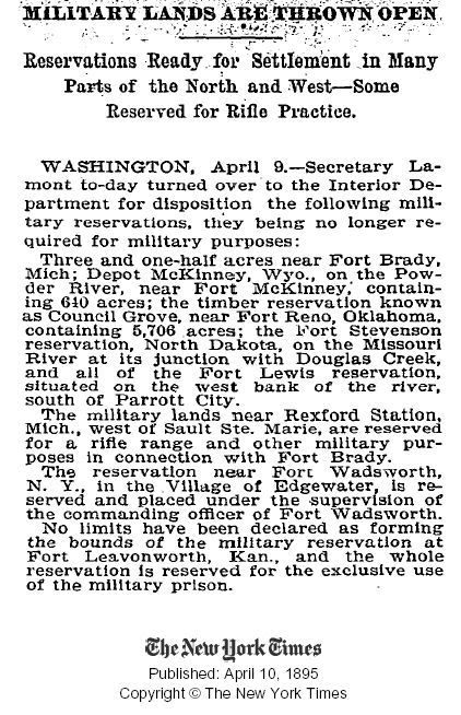
As noted above, the area became open to settlement in 1889. This authorization apparently occurred in 1885, as evidenced by this brief article in the New York Times ...
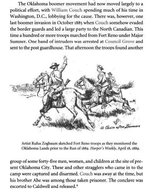
 Before the April 22, 1889, Land Run and before he became Oklahoma City's first mayor (provisionally), William L. Couch led a group of "Boomers" into Oklahoma County, establishing a presence at Council Grove before being escorted back to Kansas, probably by Ft. Reno's black cavalry group known as the Buffalo Soldiers, as said by Larry Johnson in this article at the Oklahoma City Metropolitan Library website (you may have to press your refresh key - F5 - for the link to load). There, he said,
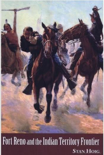
In 1880 settlers from Kansas, known as Boomers because they loudly pushed for opening, attempted to settle in Oklahoma land. Led by David L. Payne and William Couch, the Boomers arrived at land near what is now west of Trosper Park and tried to begin farming, but they were arrested by soldiers from Fort Reno and sent back to Kansas. They made many more attempts to settle: once near what is now Stiles Park; once they laid out a townsite called Ewing (Ewing Cemetery is still on Northeast 63rd Street); and they even tried to settle near Council Grove in 1885 and killed some of Montford Johnson´s hogs and cows! Each time they were run out of "Oklahoma City" by the 9th and 10th Cavalry (Buffalo Soldiers) from Fort Reno.Another illustration is given in Fort Reno And the Indian Territory Frontier by Stan Hoig (University of Arkansas Press 2005), available at Amazon. The book cover and an excerpt are shown below.
See my Cops & Robbers Boomers/Sooners article for a little more on the topic.
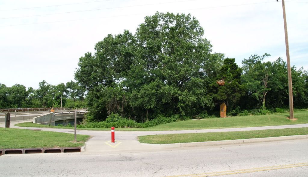
In this Chronicles of Oklahoma article, I learned that the Council Road Chapter of the Daughters of the American Revolution established a historical marker for Council Grove in 1941, near Northwest 10th at the North Canadian River. Not being aware of that until yesterday, Sunday morning, June 29, 2008, I decided to see if it was still there. It was.
The red spot by NW 10th is the marker location
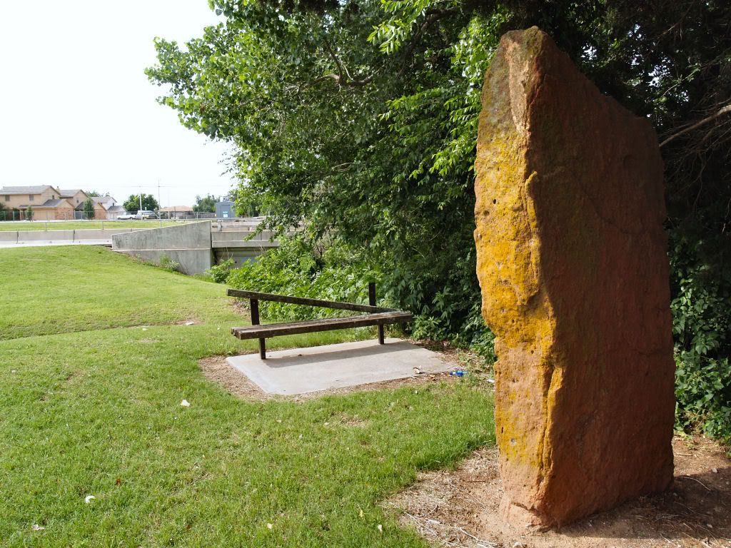
Here are a few photos taken that morning.
Looking West at NW 10th From East of Council Road
A closer look at the marker
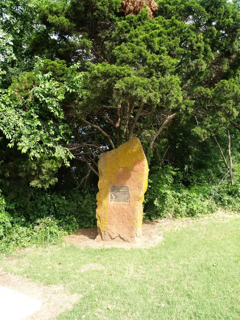
The Commemorative Plaque
The Site Needs Maintenance
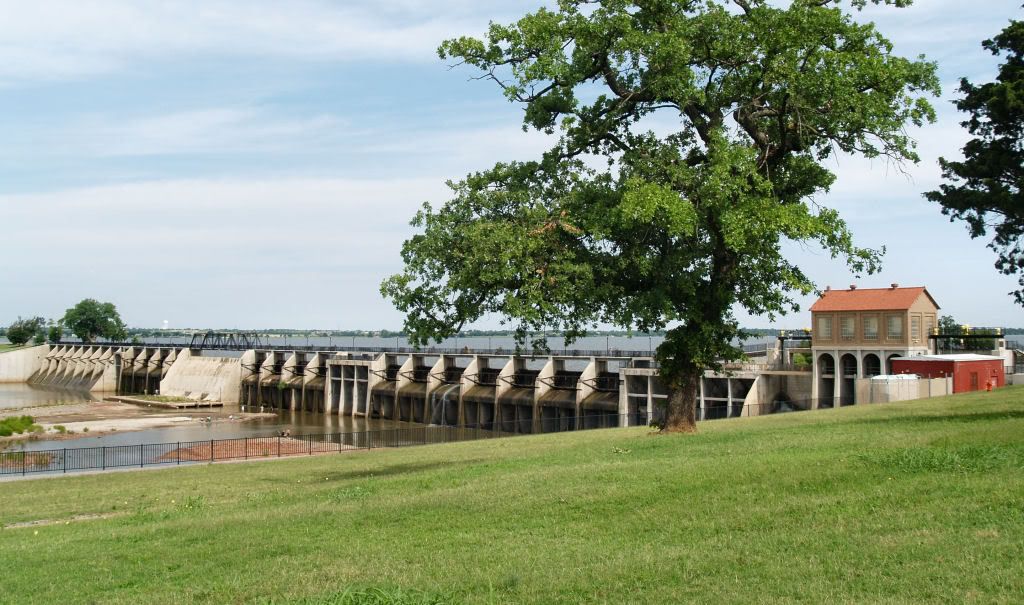
Council Grove Included Lake Overholser's Dam Area at NW 16th
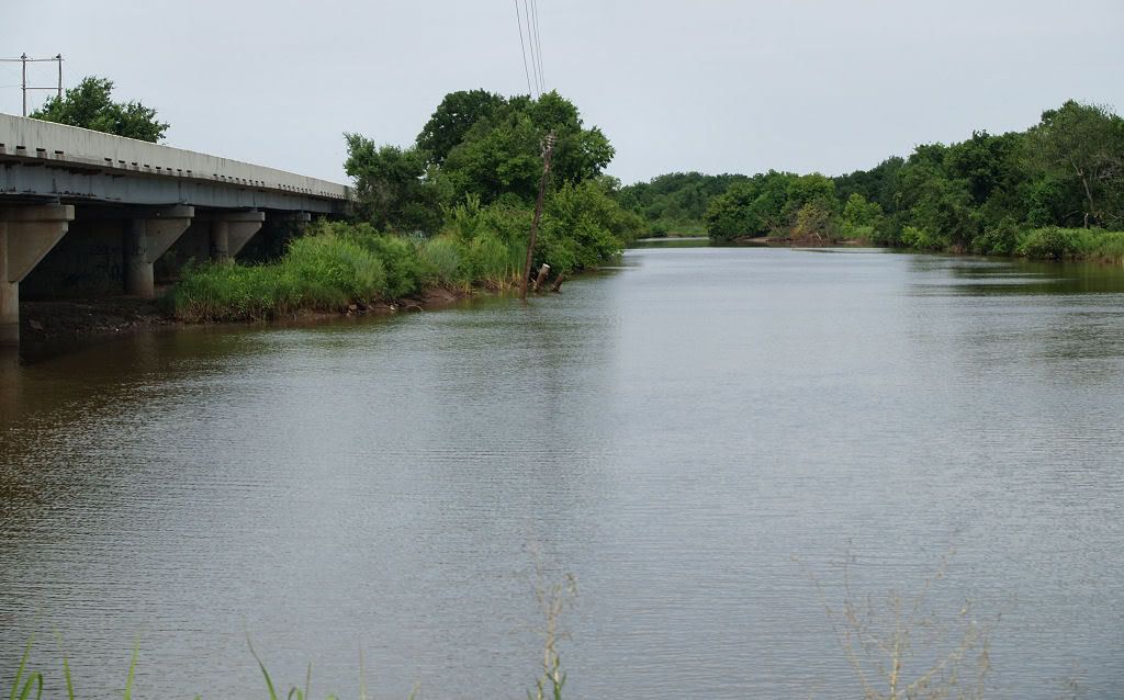
The area extended north to about this location,
looking west at the North Canadian, just north of the westbound bridge
For further reading, see Ray Asplin's "A History of Council Grove," Chronicles of Oklahoma, XLV (Winter 1968), 433-450, apparently not available on-line.


13 comments:
Great History, Doug! Thanks for this post.
Thanks, solitude!
While poking around for some other material, I happened upon this: while Council (Grove) no longer had its own post office after 1906, the Rock Island maintained a stop there until 1934.
Thanks, Chaz. I'm going to get a copy of that Chronicles article tomorrow ... maybe it will add some more good stuff!
I am a member of Council Grove DAR Chapter. The historical marker was provided by the Oklahoma City DAR Chapter April 22, 1941, as the marker states. The property is maintained by the Oklahoma City Parks Department. Our chapter was organized Nov 9, 1947 by members living in the vicinity and selected for its name historic Council Grove. Maybe this slight correction in the narrative could be made to keep it accurate.
Freda C.
Thanks for the comment and correction, Freda. I'll modify the article this afternoon.
My friend Mike Distler lived at 3rd (?) and council. He always said it was an old train depot. It was torn down about 15 years ago. I'm reading Chickasaw Rancher and came across Council Grove and got to wondering if it was the same place. Great blog.
Hi, whoever. This is great history and from the history I have obtained is accurate with that. We have lived in this Council Grove area for nearly 40 years. Thank you for the interest in this beautiful wooded area of OKC. Jan
Thanks, Jan. I guess that I'm "whoever." If you have some stories to add about the Council Grove area, that would be great and please feel free.
Dear Doug Dawg,
You've done a really outstanding job building and maintaining a truly unique blog and valuable historical reference. Thank you so much for your time, talent and tenacity in articulating a passion that so many of us share.
JG
Thanks, JG.
Great article Doug!
Were is/was the spring located at council grove ? I have never heard of it before. It should be marked for historical reasons.
Post a Comment