
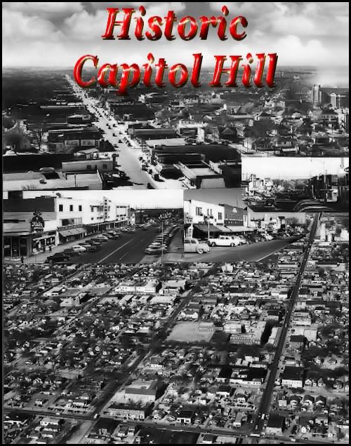
INTRODUCTION. The origins of Capitol Hill will be discussed shortly. Here, I want to talk about the general character and personality of the residents of the area known as Capitol Hill, however that area might be defined (see below). They were and are a proud and feisty group of folk who care greatly for their identity as Capitol Hillians (my term but I couldn't think of a better) quite separate and apart from merely being Oklahoma Citians — not that they don't seem themselves as members of the larger community as well, which they do. But, of all the former towns that Oklahoma City has incorporated into its city limits, such as Britton, the strong and proud identity as being "from Capitol Hill" is probably more strongly felt than it is by any other town which Oklahoma City has absorbed — and, for that matter, incorporated municipalities which are surrounded by Oklahoma City on all sides such as Warr Acres and perhaps even the posh municipality of Nichols Hills.
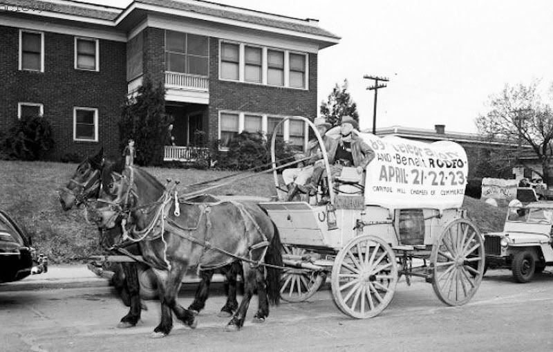
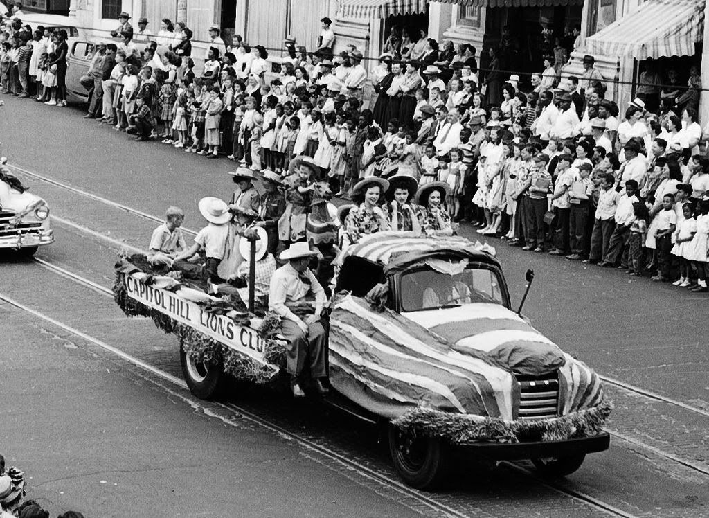
Below are photos from 1948 and 1949 showing the participation of Capitol Hill in 89er parades in downtown Oklahoma City — those people clearly wanted everyone else to know who they were and where they came from — Capitol Hill! I don't know but seriously doubt that a Nichols Hills float was in either of these parades.
Early Buildings Trolleys & Floods 1923-1940s
Places to Sleep & Eat 1940s-1960s Today

 I don't get no respect. For some, many, or most, from Capitol Hill, it is also true that a pervasive undercurrent is that Capitol Hill hasn't received the credit that it is due, and/or has been ignored or thought of as being less important than Oklahoma Citians who reside north of the North Canadian River, particularly in the north central and northwest parts of the city. Such a sentiment is shared by many other "south siders" who reside in other southwest and southeast parts of my town.
Doug Dawg gives respect right here in what is hoped is a reasonably thorough and fair treatment and tribute to that special race of white folk (I'll explain why I use that term in the next section) who are now, and always will be, indelibly imbeded with the Capitol Hill gene.
WHAT IS CAPITOL HILL? This one's something of a toughie, particularly concerning the area included.
AREA. In an article by Jana C. Hausburg entitled, "South of the River - The Community of Capitol Hill at the Oklahoma City Metropolitan Area website (you may need to press F5 after clicking on the link to load the article), she reports that:
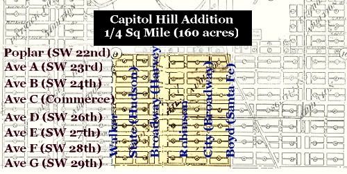
It should have been the home of the state capitol. At least, that was the plan. Home to a promising hill overlooking much of Oklahoma City, the area was named accordingly by B.R. Harrington, a newspaper correspondent for the Wichita Beacon. In 1900, he purchased the land from Miss Tryphosa Boyd, who had been among the early settlers attracted to the area after the Land Run of 1889, when Oklahoma lands were opened by the Federal Government. Her deed bore the signature of President Grover Cleveland.The area just described is shown in a 1909 city map cropped and annotated below to show that original Capitol Hill Addition — an addition to Oklahoma City.
Harrington platted the 160-acre tract near the old Santa Fe Trail and staked out individual lots for sale. His purpose, said Harrington, was to give "sober and industrious mechanics an opportunity to secure homes."
The site originally extended from Walker to Santa Fe, and from what is now called SW 22nd to SW 29th, the north boundary being the North Canadian River. Later, it grew to incorporate Penn Ave. on the west, SW 44th on the southern edge, stretching all the way to I-35 on the east.
Well, sort of. Even though a consensus might not be formed as to what Capitol Hill IS, a consensus is possible by what it IS NOT. When reading William D. Welge's Oklahoma City Rediscovered (Arcadia Publishing 2007), a generally fine book which includes a very nice section on Capitol Hill, some of his comments and photographs included Packingtown and even Oklahoma City Community College way far away from what any others (that I know, at least) would include as part of the Capitol Hill definition. But, I am not from Capitol Hill (even though my 1st wife taught school at Capitol Hill Junior High while I was in law school, my closest familial tie to the area). I decided to ask the view of the Capitol Hill folk who are regulars at OkcTalk.com in this thread which received many replies but quite naturally produced nothing absolutely definitive.
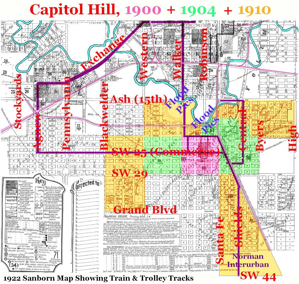
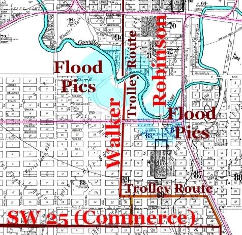
A fair consensus, though, may be that most Capitol Hill people consider Capitol Hill to be a composite of parts 1, 2, and 3, in the second map below (but note that Ms. Hausburg would extend it a mile further west, to Pennsylvania). First, the map is shown without color-coded Capitol Hill areas:
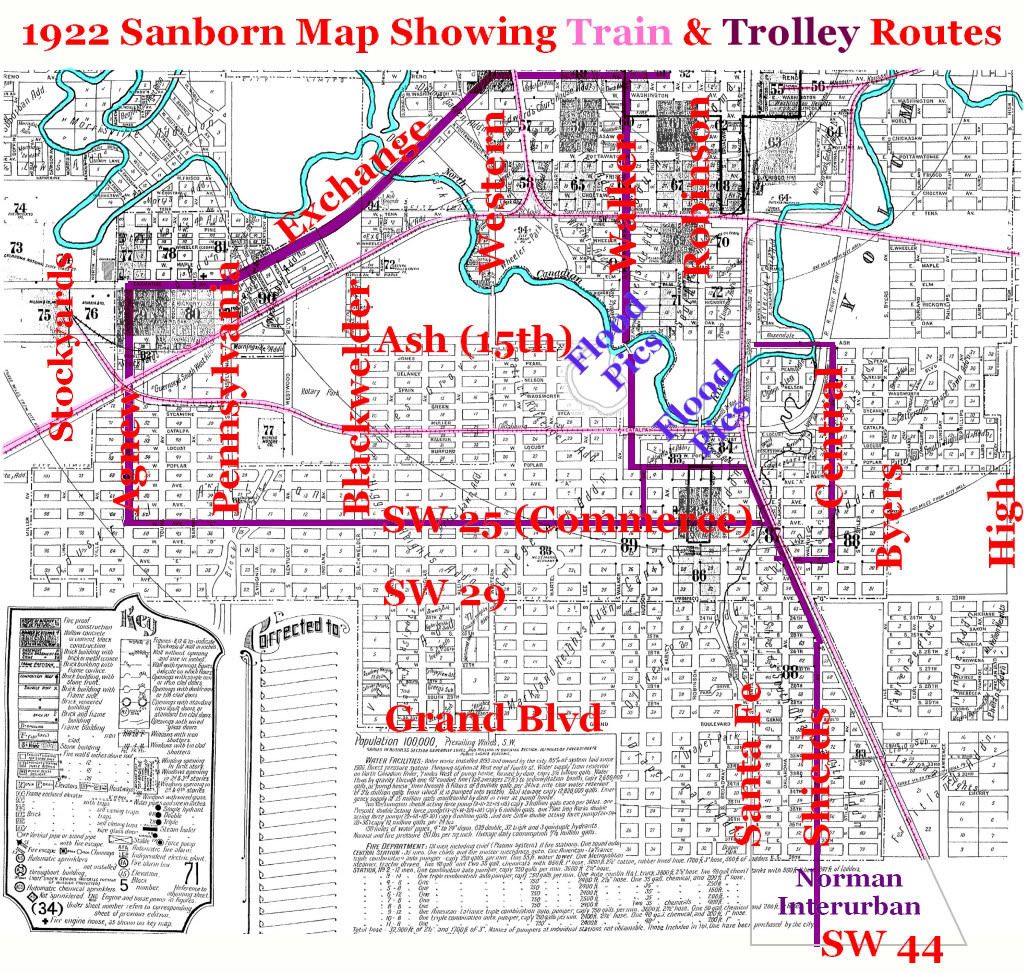
The dark red line shows the ORC trolley routes
Same Map Showing Capitol Hill Growth, 1900-1904-1910
Frankly, I think it likely that the above is as good as it's gonna get by way of consensus but I reserve the right to modify this perception after obtaining something definitive about Oklahoma City's absorption of Capitol Hill in 1909 or perhaps something else objective about which I am not presently aware.
RACE. Above, I mentioned that Capitol Hill was composed of "white folk." Here, I'll be more precise. During the days of the Oklahoma Constitutional Convention and the constitution which was subsequently adopted by vote of the people, Oklahoma's constitution embraced the notion that two, and only two, races, for constitutional purposes, existed: white and colored. If a person had any degree of African blood, they were "colored." Everyone else was "white." This March 29, 1916, Daily Oklahoman article, upon the adoption of Oklahoma City's first set of Jim Crow residential ordinances, reported that:
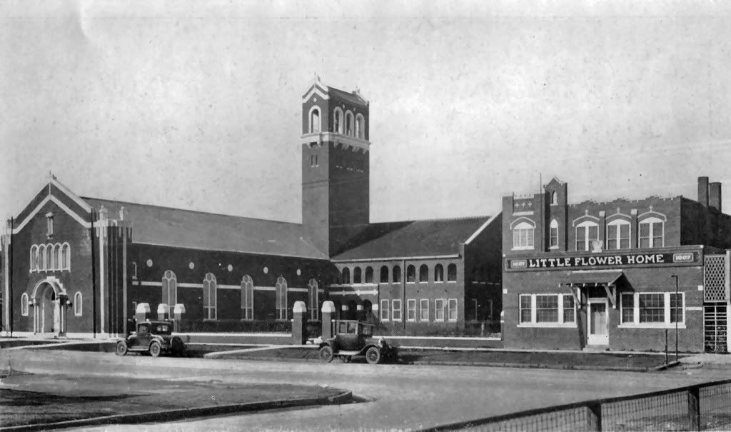
In Capitol Hill, with its 5,060 inhabitants there is not a negro resident. The new law means that this section of the city will be free of colored people for all time.Most probably, the Capitol Hill "white" residents included at least some Mexican Americans, or whatever the politically correct term is today. Today, the area may contain more Mexican Americans than "anglos." Immediately north of Capitol Hill on Walker is the incredibly beautiful (from the inside) Little Flower Catholic Church which is not generally regarded as part of Capitol Hill. That said, when the church (and, at the time, school) was formed in 1927, at least a part of its stated mission was to serve those in Oklahoma City whose origins were from Mexico, and they doubtless lived in areas around the church. So, if Mexican Americans weren't initially in Capitol Hill, they were certainly nearby and would come to be within.
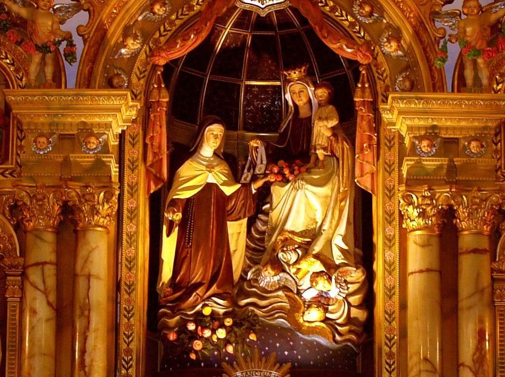
Little Flower From The Inside In 2007
THE CAPITOL HILL STORY. Text to follow shortly.
OLD PICS. Text to follow shortly.
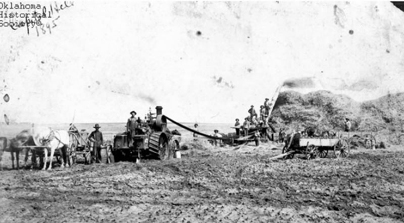
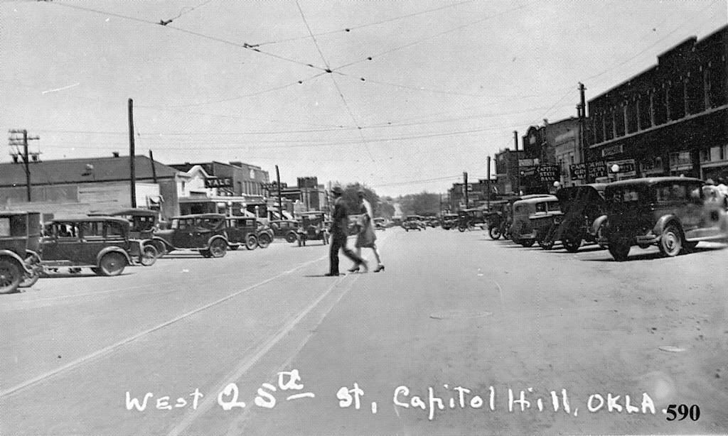
South Robinson In 1911
Credit Oklahoma Historical Society
SCHOOLS. Text to follow shortly.
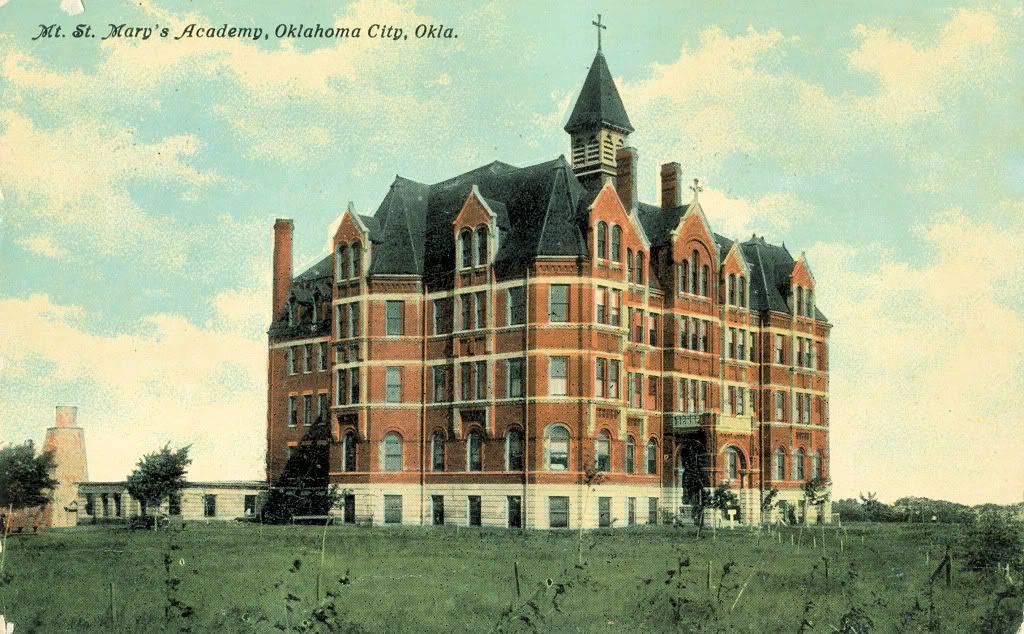
Lourdes Grotto At Mt. St. Mary's

The 1st Public School — Lee School (1910)
Hudson & SW 29th

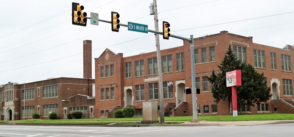
Lee School Today
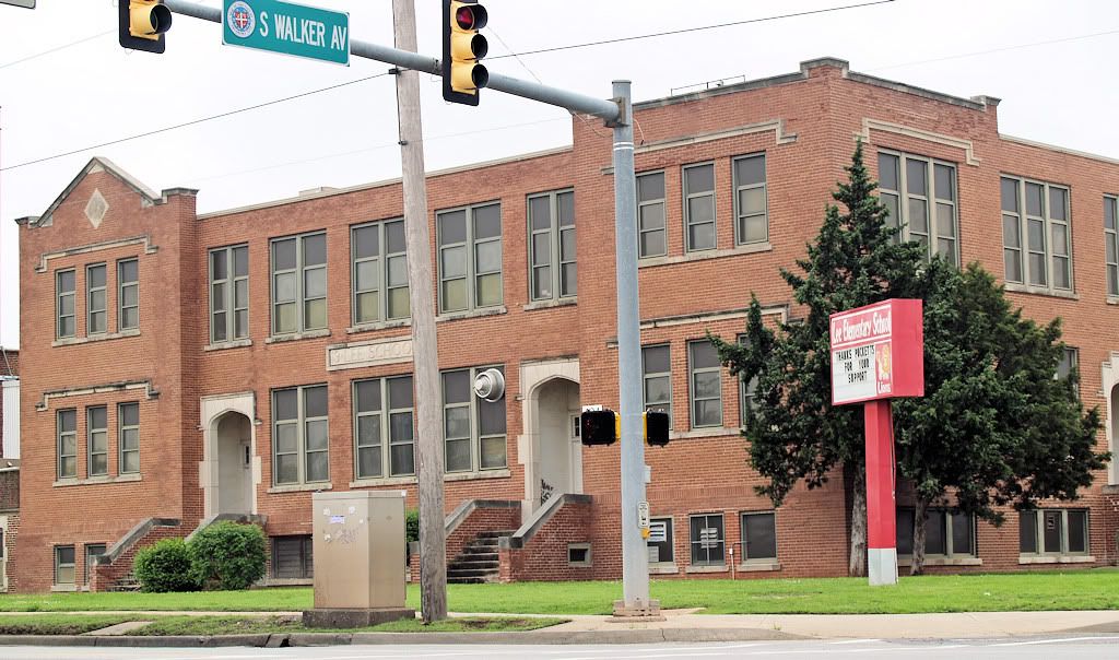
2nd School — Capitol Hill Junior High (1921)
2717 S. Robinson, Now Capitol Hill Elementary School
(Vintage Pic Not Available — 2009 Photos Shown Below)
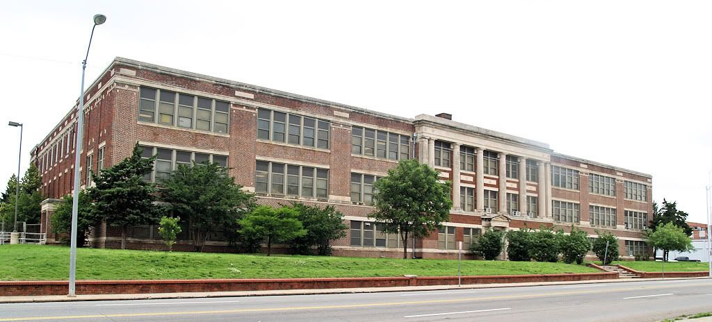
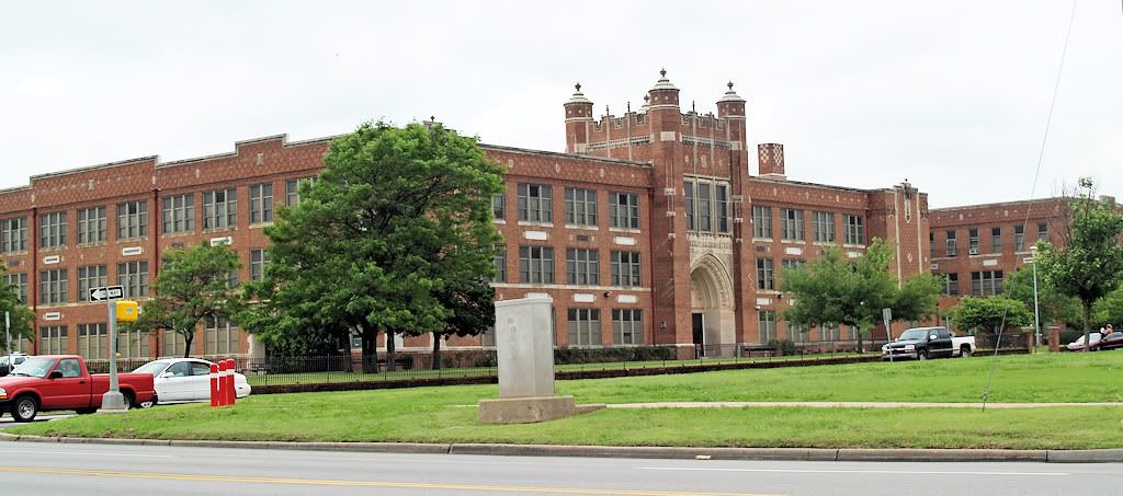
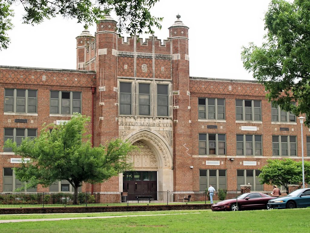
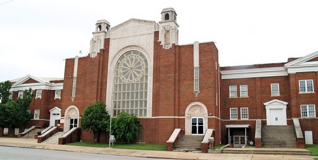
Capitol Hill High School (1928-29)
500 Southwest 36th Street
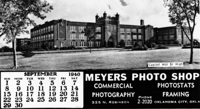
A 1940 Calendar Photo
(Next 2 Pics Credit Oklahoma Historical Society)
1956 Gymnasium Photo
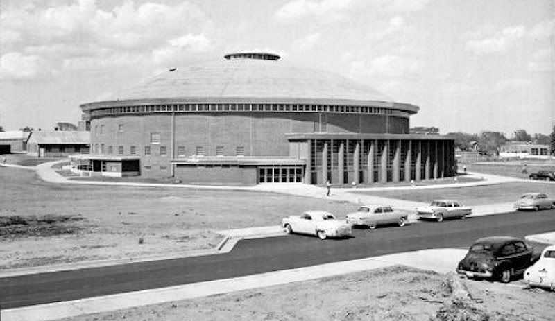
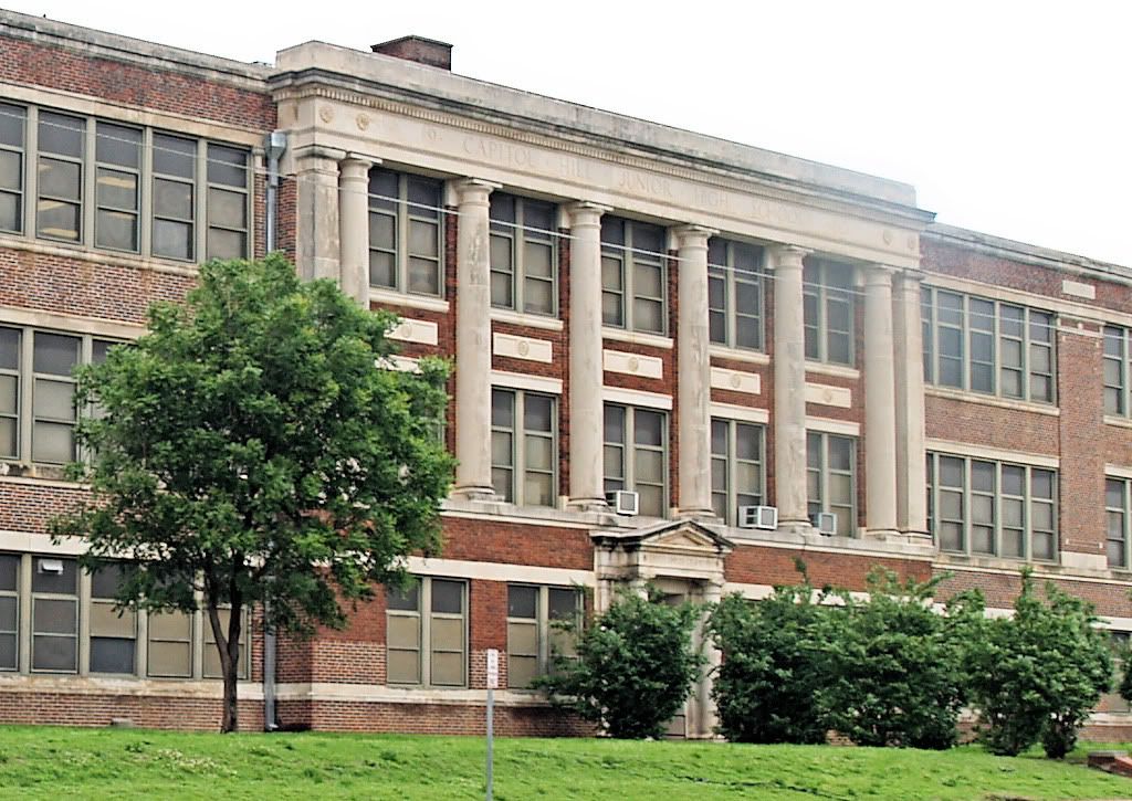
2009 Photos
EARLY DAY BUSINESSES & BUILDINGS. Text to follow.
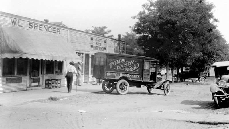
Delivering to Spencer Grocery At 2523 S. Central In 1922
Kimbrough-Jones Drug Co. in 1922, 2543 S. Robinson
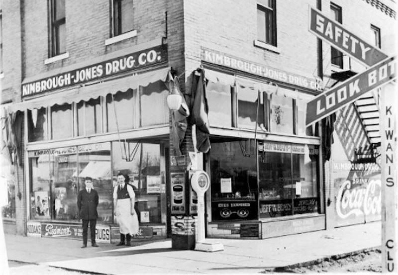
September 24, 1939 Article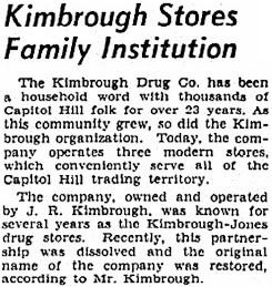 | Its Competition — March 2, 1906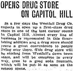 |
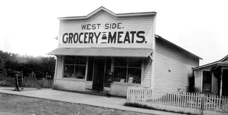
A Grocery At 547 Southwest 28th Street
Credit Oklahoma Historical Society
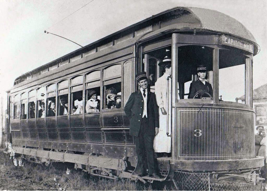
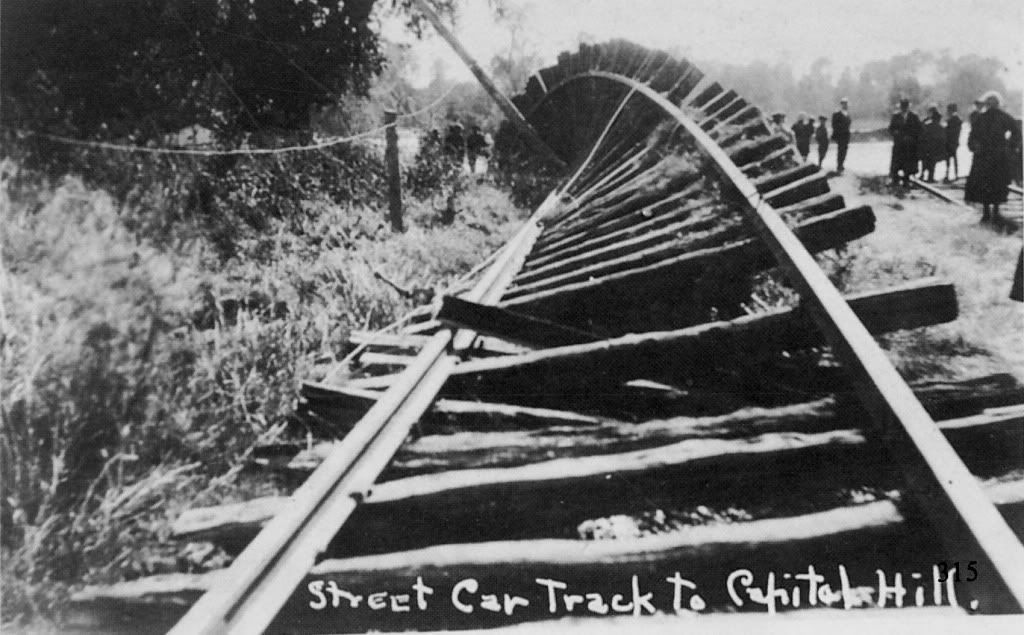
TROLLEYS & NORTH CANADIAN FLOODS. As will be described in the beginning text once I'm through uploading photos, the Oklahoma Railway Company added Capitol Hill to its city trolley routes in 1906 and, from Capitol Hill, the company's Interurban line to Norman also passed through Capitol Hill as well. The following photos are courtesy of Vintage Rail Photos/Whistle Stop Trains at 1313 West Britton Road, and are from their great CD, "Oklahoma Railway Vintage Rail Photos," disk number VRP-32.
Courtesy Vintage Rail Photos/Whistle Stop Trains

Posing For Photos On The Capitol Hill Line

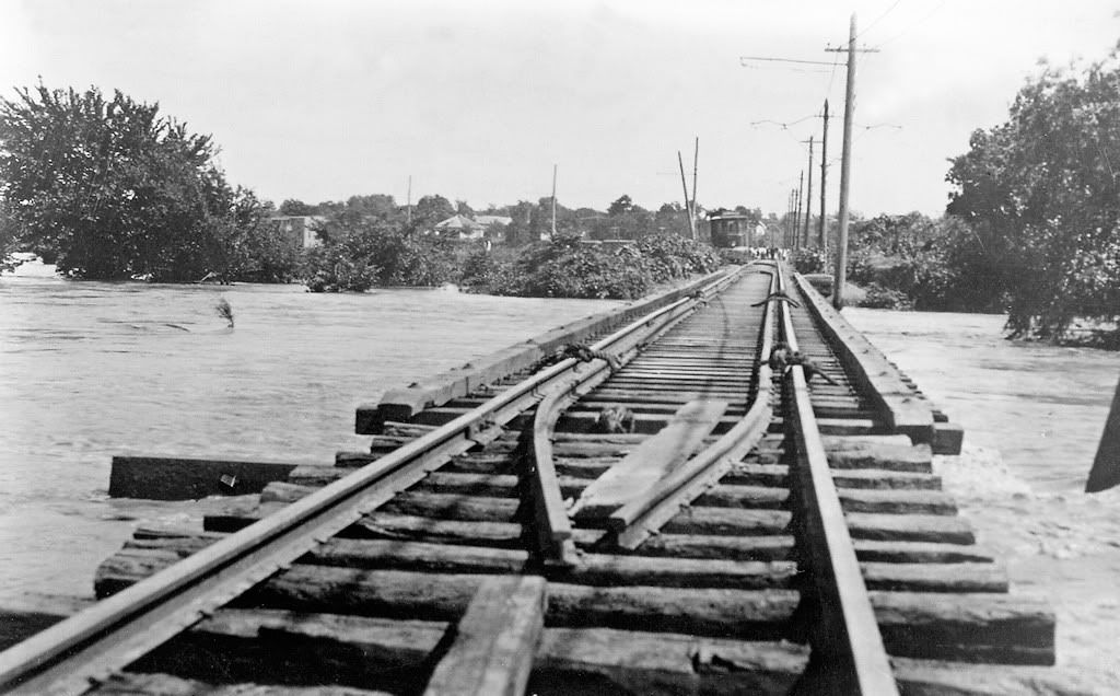
Crossing The North Canadian At Walker
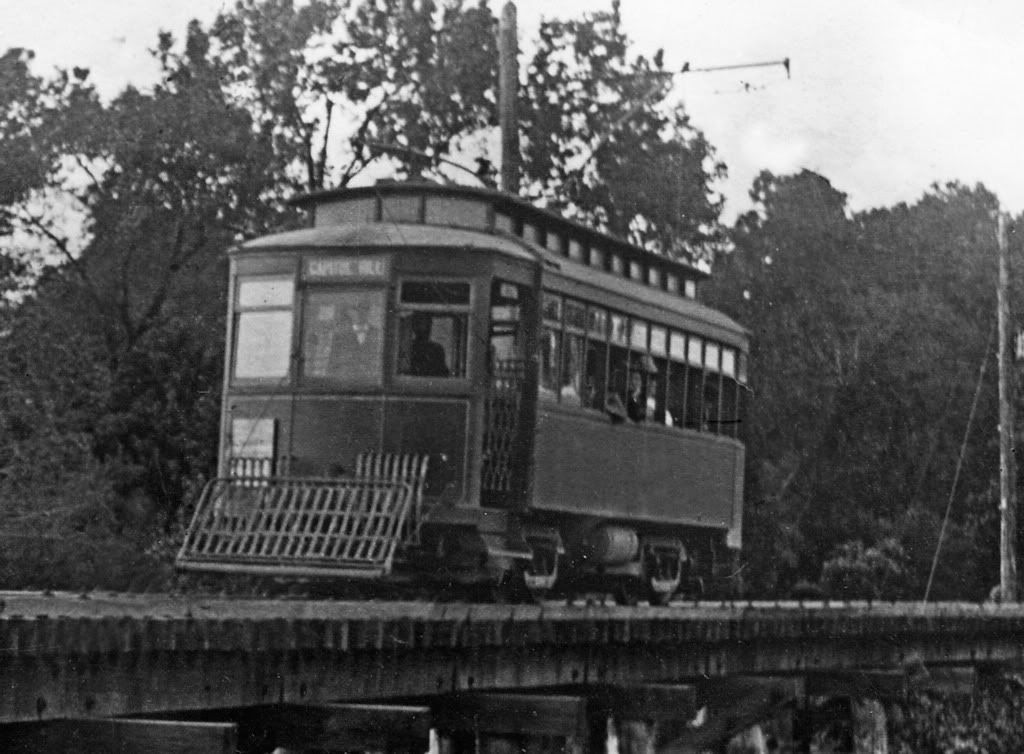
In Capitol Hill On Walker Looking North
(Notice the Harbour Longmire Building in the far background)

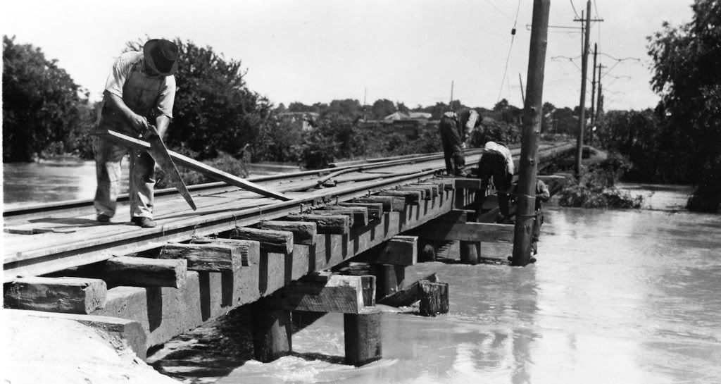
Although the North Canadian River didn't actually pass through Capitol Hill, it came very close at two points — at the Walker trolley bridge and closer still at Robinson and the Capitol Hill area was certainly impacted by the river's flooding.
Doubtless the most severe flooding occurred in 1923 — twice. On May 29 and October 16, torrential rains caused the North Canadian to rise yards beyond its banks and result in flooding to many areas of Oklahoma City, certainly including Capitol Hill. I've written about that more extensively in the Trains Part 2 article to which you are referred for further detail. Here, I'll show photos of these floods in the Capitol Hill area. The images which follow are not dated so I'm not able to say whether they were taken during the spring or fall floods.
Oklahoma City, Statehood To 1930 (Arcadia Publishing 2000)
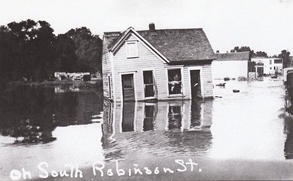
Houses Sitting In The Street On South Robinson
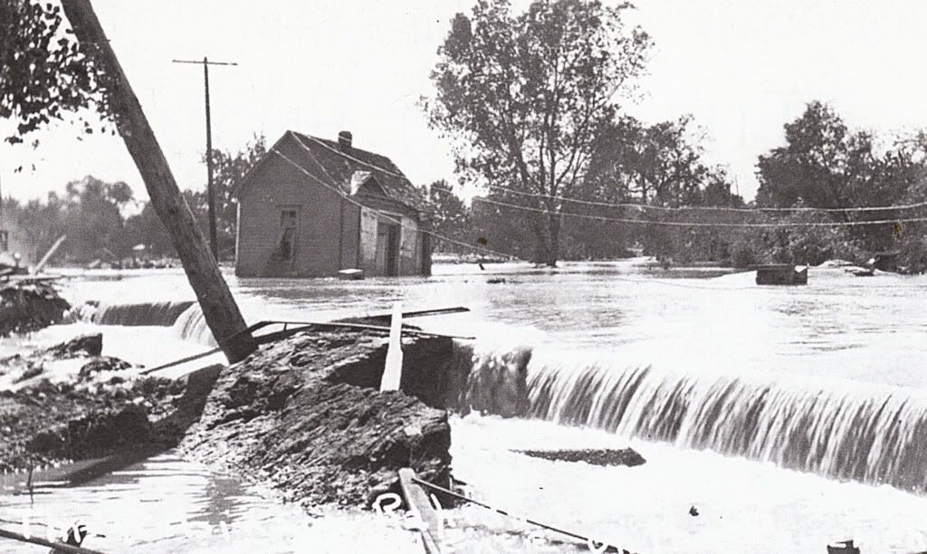
As shown in the above 1922 Sanborn map, the trolley line crossed the river just north of Capitol Hill. Again, I cannot say whether the photographs which follow are from the spring or fall 1923 flood.

From My Postcard Collection
Credit Jim Edwards & Hal Ottaway, Vanished Spendor II
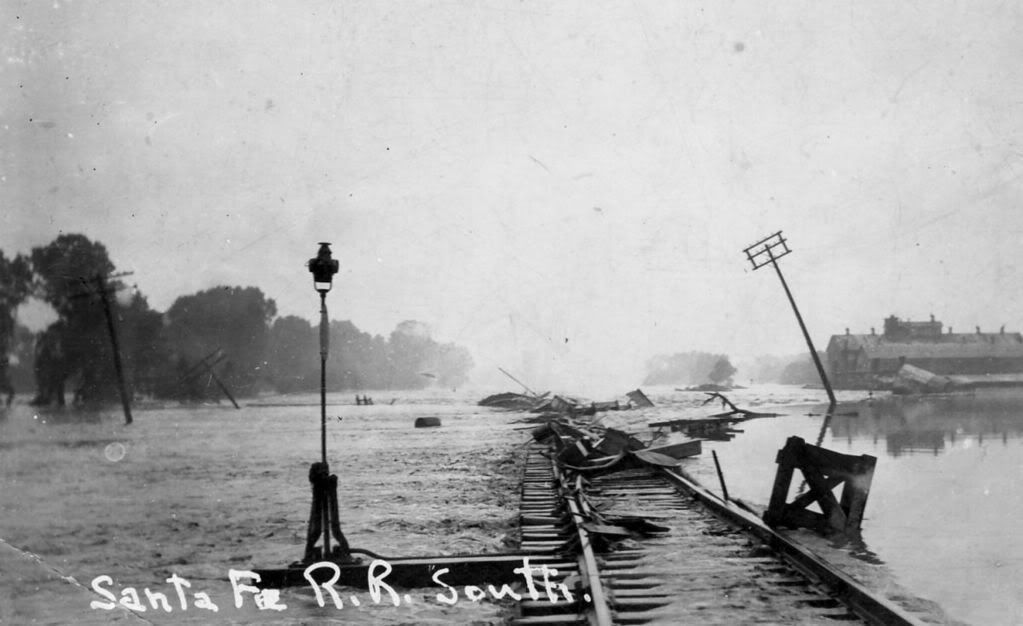
The next series of photographs are courtesy of Vintage Rail Photos/Whistle Stop Trains at 1313 West Britton Road, and are from their great CD, "Oklahoma Railway Vintage Rail Photos," disk number VRP-32.
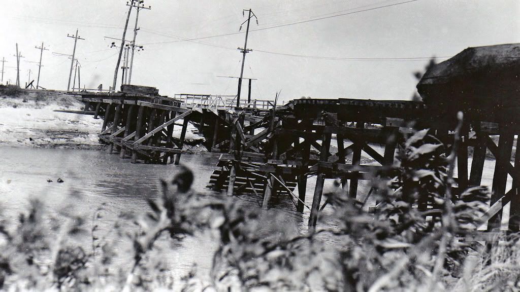
I can't be certain that the next two photographs are of the Walker trolley bridge or some other, but from them you'll get a good idea of the damage, even if at a different trolley river crossing.
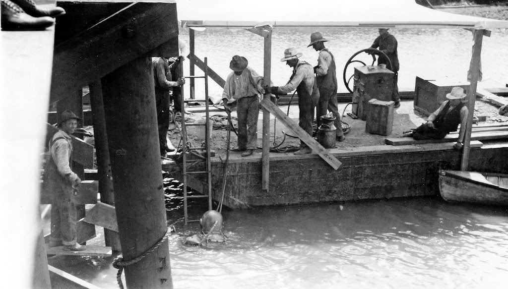
ORC Trolley Crane Not Doing So Well

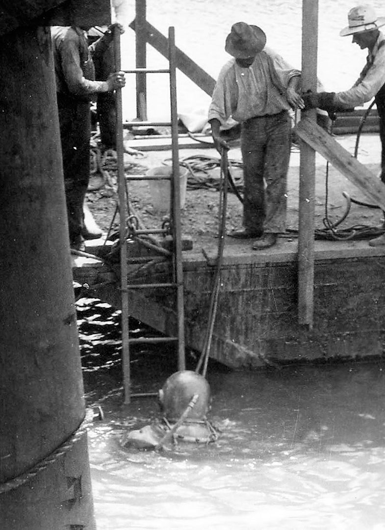
Check This One Out — Notice They Guy In The Diving Suit
Looking South At The Walker Bridge Into Capitol Hill
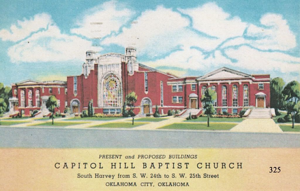
CAPITOL HILL FROM 1923 INTO THE 1940s. The next group of photos and postcards shows parts of Capitol Hill after the destruction caused by the 1923 floods, perhaps appropriately beginning with a church.
Credit Jim Edwards & Hal Ottaway, Vanished Spendor II
(Abalache Book Shop Publishing 1983)
Photos of the same building in 2009 are in the "Current Day" images at the end.
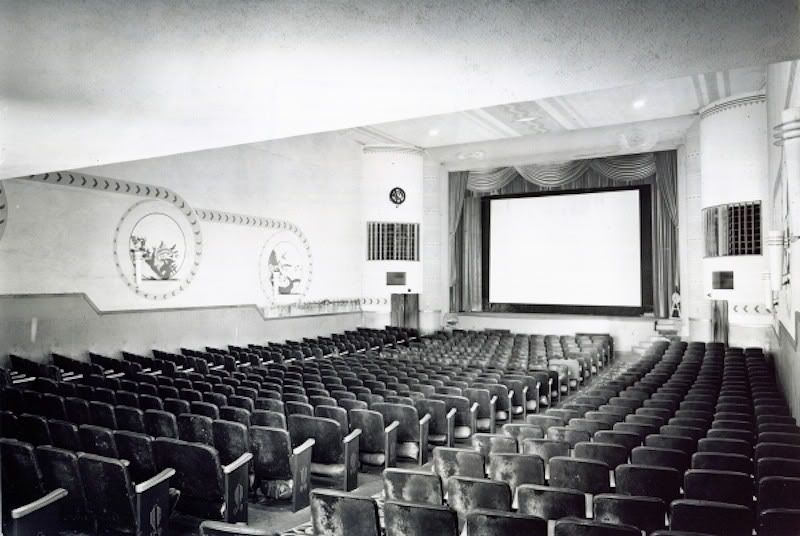
A December 18, 1928, ad in the Daily Oklahoman Announced
The Opening Of The Circle Theatre At 2510 S. Robinson
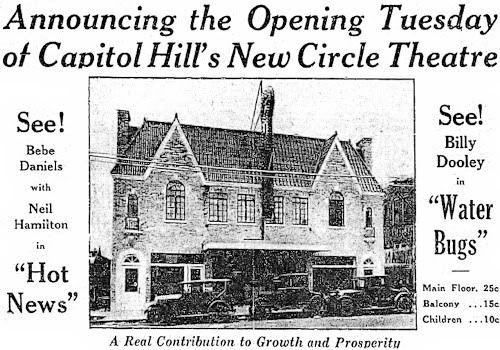
Credit William D. Welge, Oklahoma City Rediscovered
(Arcadia Publishing 2007)
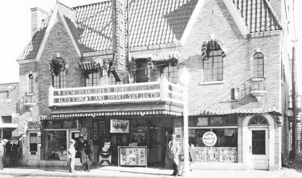
Inside The Circle Theatre
Credit Oklahoma Historical Society

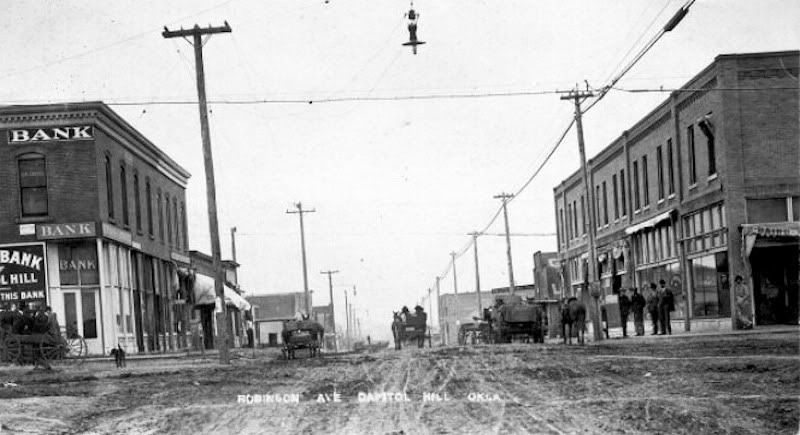
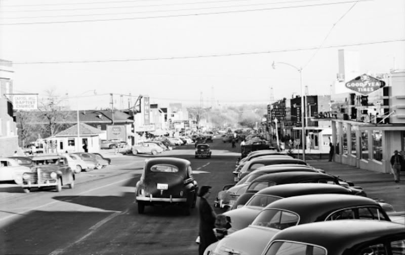
Downtown In The Early 1930s
Credit Jim Edwards, Hal Ottaway & Mitchell Oliphant
Vanished Splendor III (Ablalache Book Shop Publishing 1985)
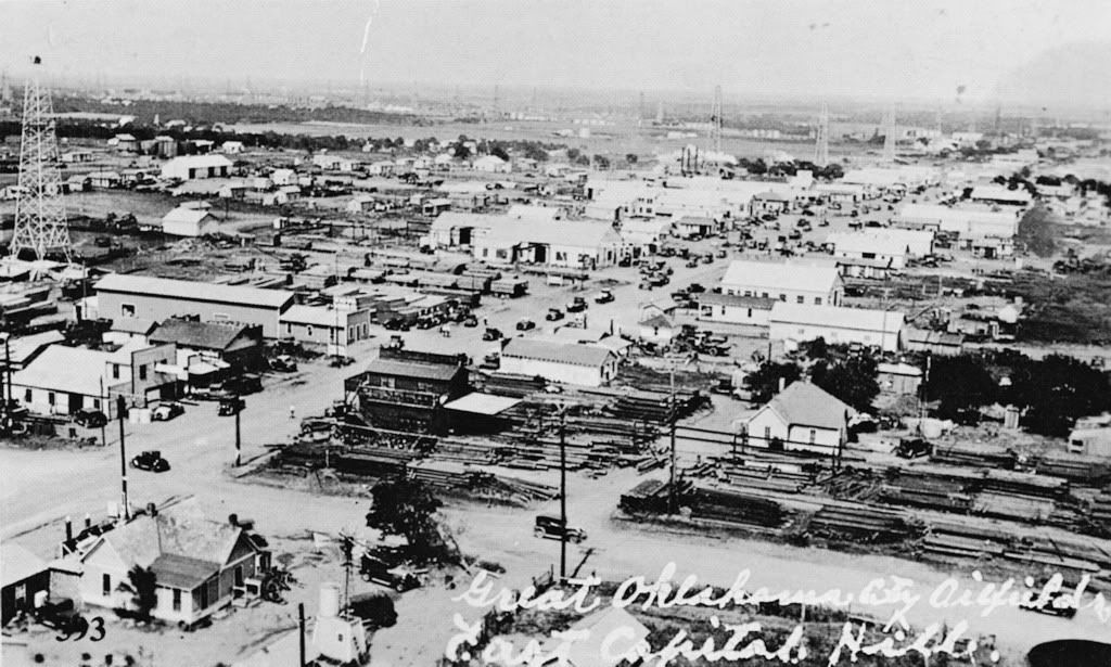
The following photos are also from Vanished Splendor III and, while Capitol Hill is not, strictly speaking, in the images, the general vantage point is from Capitol Hill and they show the area immediately east of Capitol Hill following the "Discovery Well" hitting black gold in December 1928.
Looking East On 29th Street Into East Capitol Hill
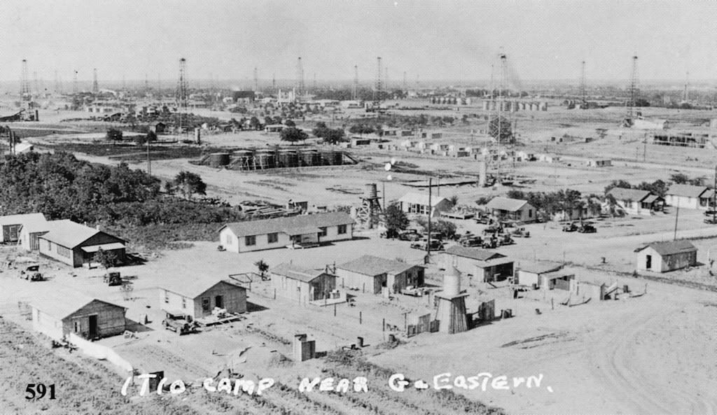
Looking Northeast To The ITIO
(Indian Territory Illuminating Oil Company)
Facilities & Camp at Avenue G (Southwest 29th) & Eastern
ITIO Office Building (2 story building at the right)
at SW 44th & Shields In Foreground

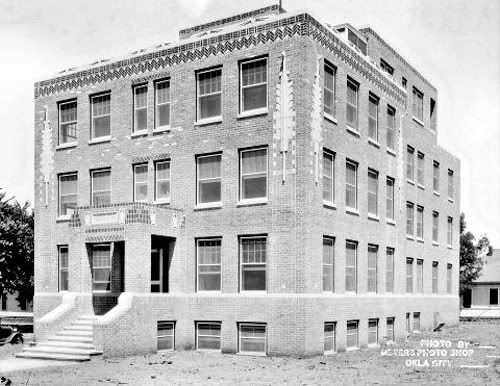
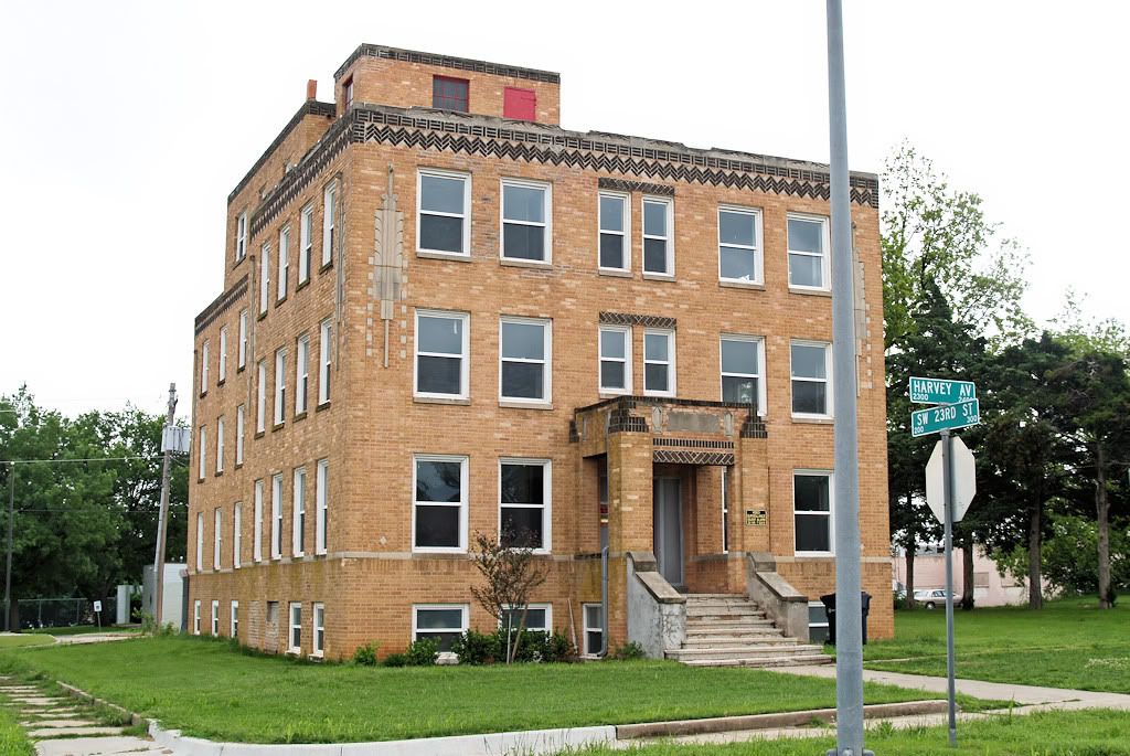
Capitol Hill Hospital (1930), 2400 South Harvey
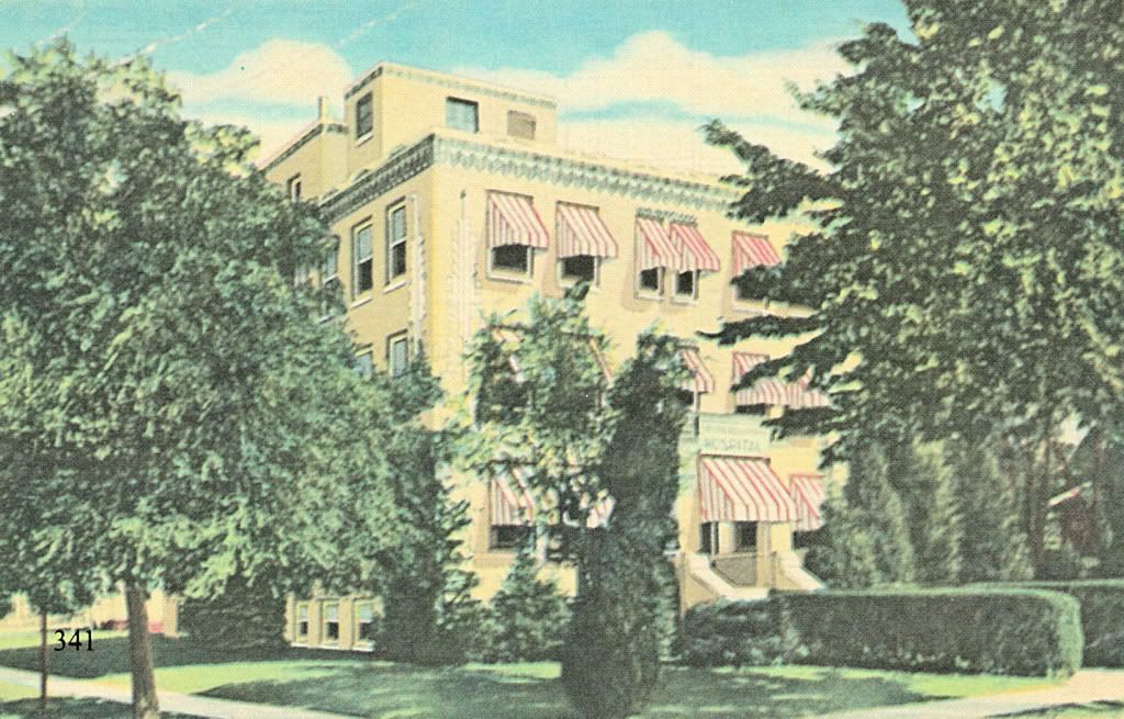
Credit Oklahoma Historical Society
The Building In 2009 (Credit Me)
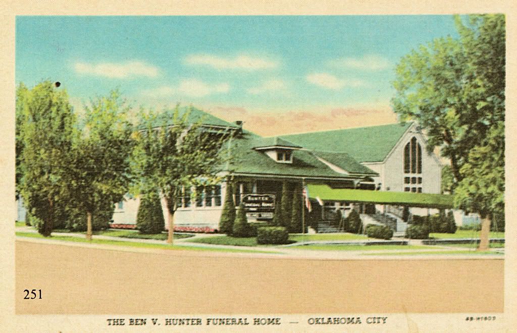
Hunter Funeral Home at 2427 S. Harvey in 1938
Credit Jim Edwards & Hal Ottaway, Vanished Spendor II
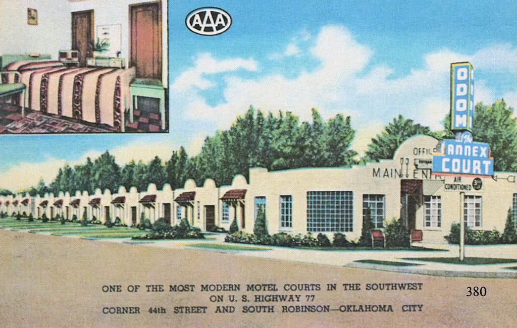
PLACES TO SLEEP & EAT. U.S. Highway 77 passed through Capitol Hill on its eastside in the early days, and several motels found their way into Oklahoma City history books on that account. Some are shown below. All postcard images below are credited to Vanished Splendor II or III by Jim Edwards & Hal Ottaway.
The 1st three are at the then busy intersection of SW 44th & South Robinson, on opposing corners of that location.
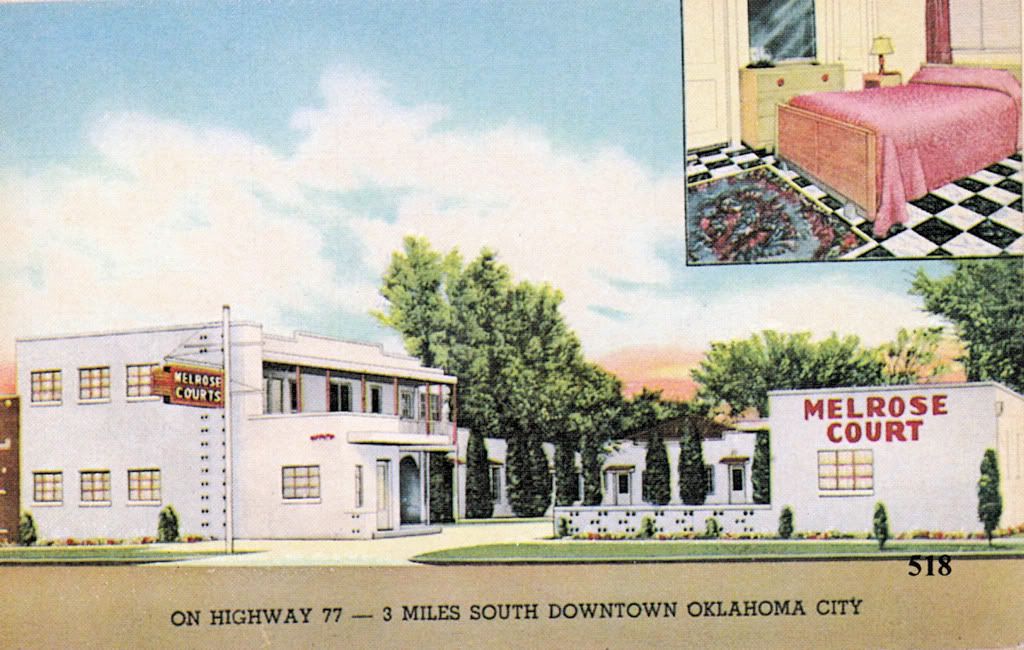
Melrose Court (by 1939), SW 44th & Robinson
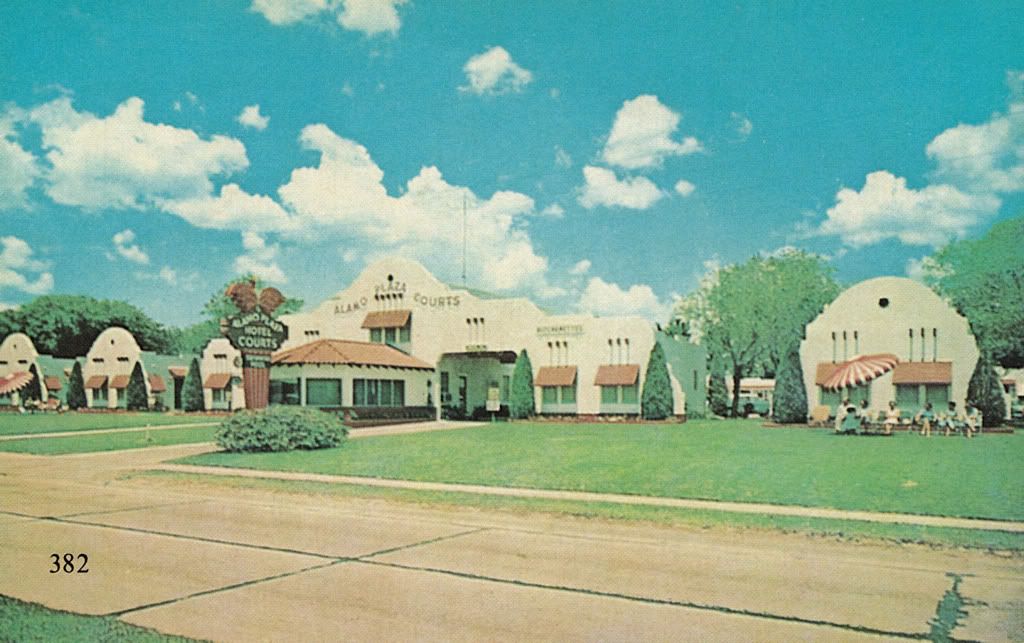
Alamo Plaza (1936), SW 44th & Robinson
Dream House Motel (1953), Southwest 45h & Shields

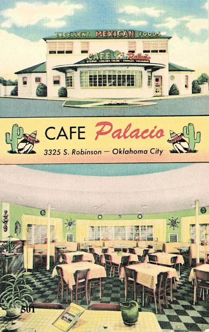
Cafe Palacio (1949), 3325 S. Robinson
Same Building In 2009

THE 1940s-1960s. Understanding that overlap exists between the last section and this one, I felt the need to have a break point somewhere, so this is it. More text will shortly follow.
It was destroyed in 2004
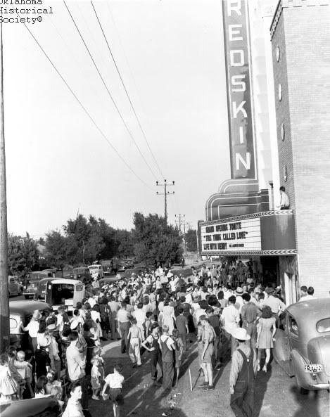
Inside View of the Redskin (credit OHS)
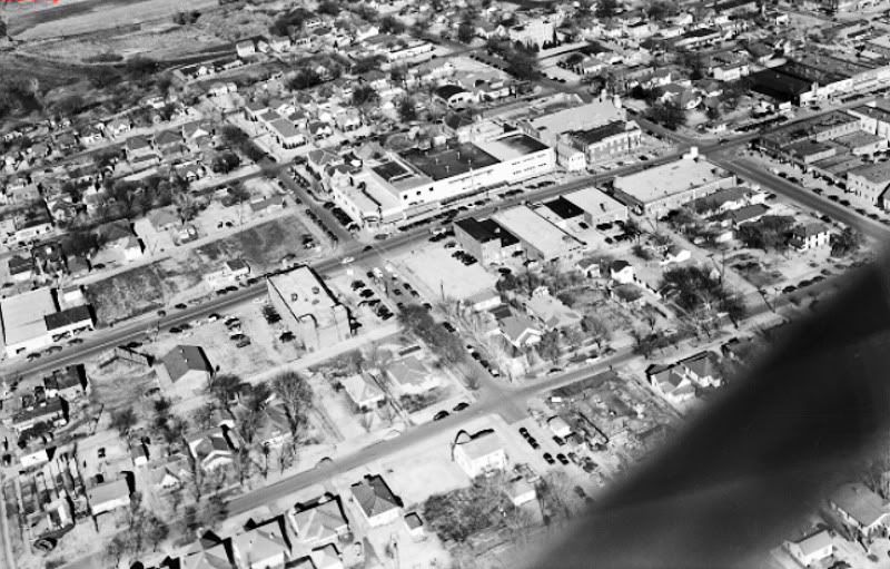
1951 Aerials (credit OHS)

Looking South on Walker (credit OHS)
Need A Nash? 2423 S. Walker (credit OHS)

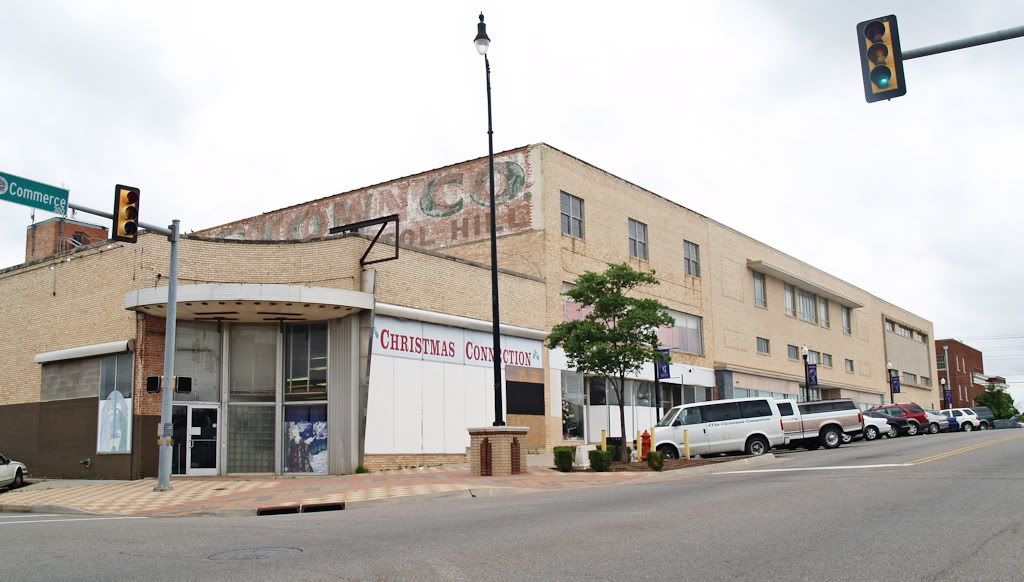
Proceeding East From Walker on Commerce Street
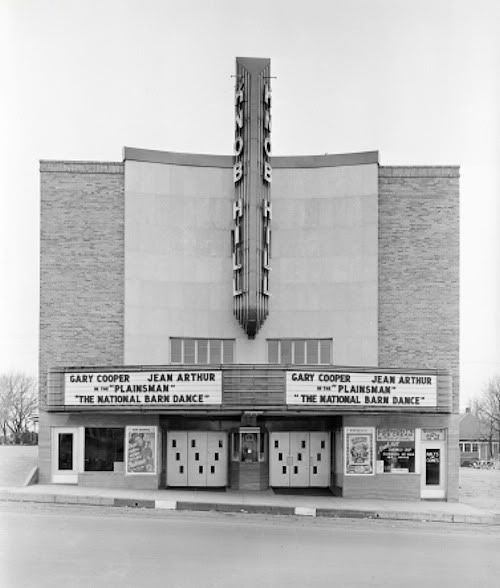
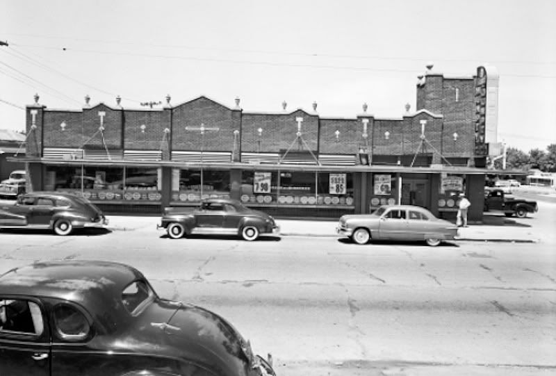
Knob Hill Theater, 404 W. Commerce (credit OHS)
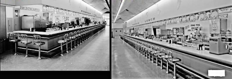
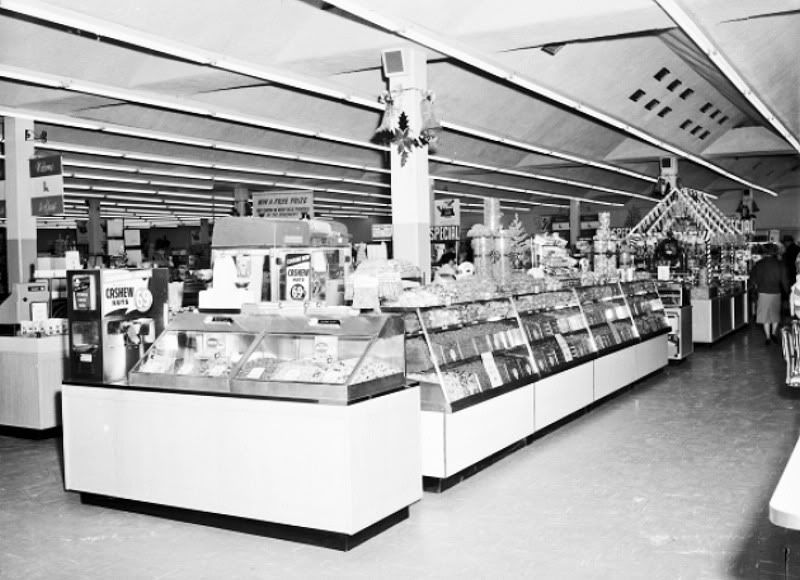
S.H. Kress at 405 Commerce
All Kress Photos below are credited to OHS
The store was built in 1960 at a cost of $550,000
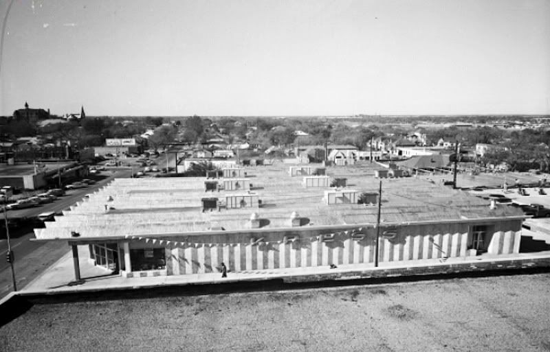

North Side of Commerce & Hudson (credit OHS)
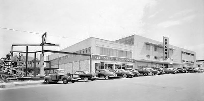
Notice the Allens 5¢ and 10¢ store
In 1951 (credit OHS)
In 1956 (credit OHS)
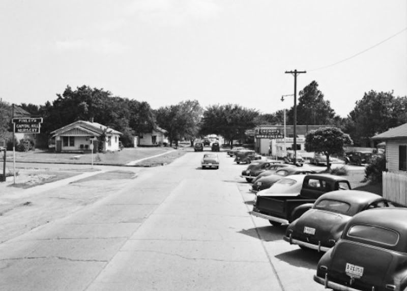
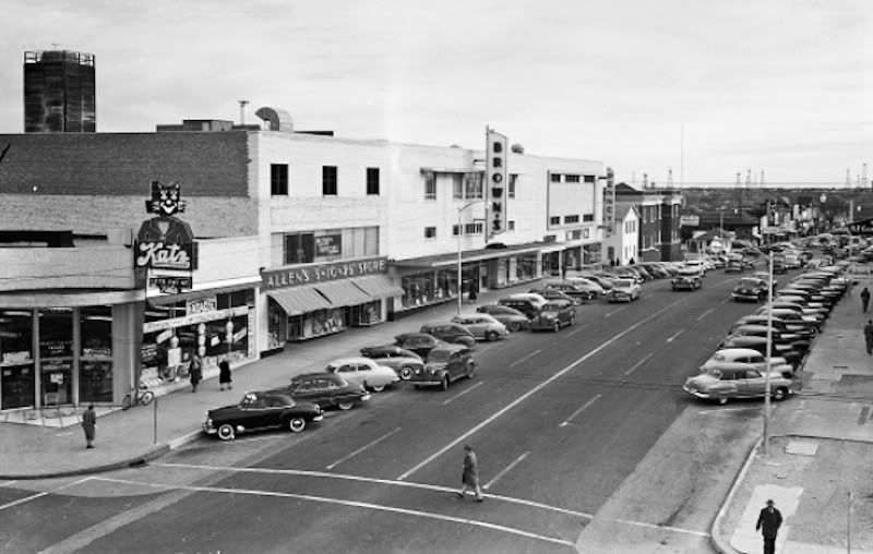
1949 Street View (credit OHS)

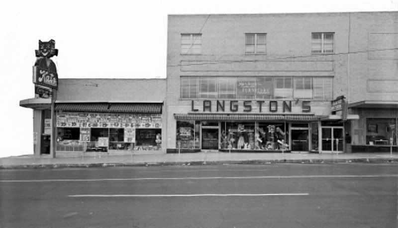
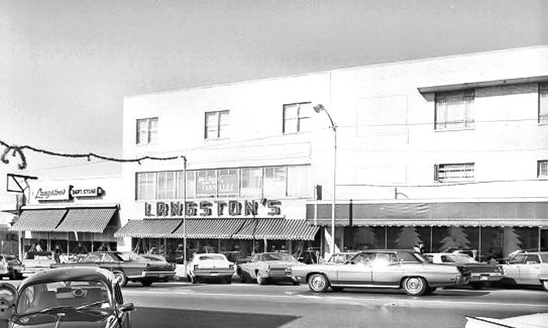
Langstons (credit OHS)
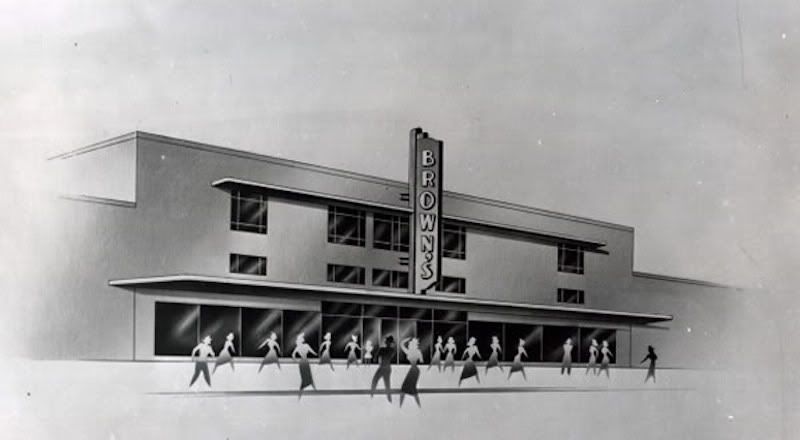
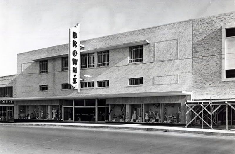
Browns Concept Drawing (1948) (Credit OHS)
Browns In 1956 (Credit OHS)
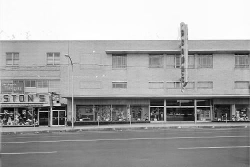
And Another Browns
JC Pennys (credit OHS)
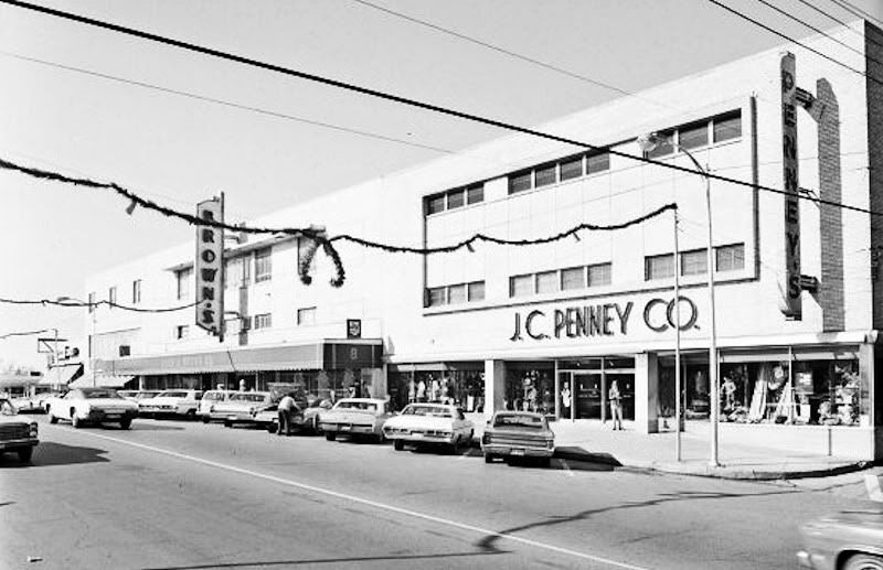
In 1956 (credit OHS)

From Harvey Toward Robinson In 1951 (credit OHS)
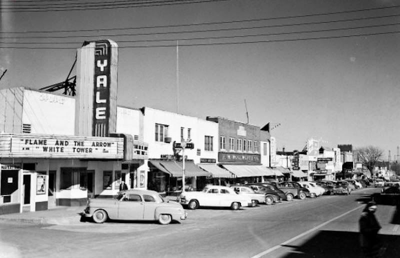
Yale Theater (credit OHS)
Humpty Dumpty at SW 25th and Walker (credit OHS)
CAPITOL HILL TODAY. Capitol Hill may well have been an indirect victim of downtown Oklahoma City's urban renewal in the 1960s-1970s. At the least, the ownership of John A. Brown's may have had something to do with the area's downturn. See the John A. Brown's article for the full history of Brown's, but suffice it here to say that, in the midst of downtown Oklahoma City's urban renewal, (1) following the 1967 death of Della Dunkin Brown, she apparently being committed to keeping Brown's in downtown Oklahoma City, the Brown's ventures were acquired by Dayton-Hudson in January 21, 1971 — local owners are almost unvaryingly more concerned about their communities than are corporate organizes from outside the state; (2) Dayton Hudson decided to pull Brown's out of downtown and, at the same time, it closed the Capitol Hill store in 1974. Whether these speculations as to cause have validity or not, Capitol Hill surely suffered a downturn beginning at some point in the 1970s, and the loss of Browns must have been huge upon the community.
My drive-through a few days ago showed the signs of deterioration but showed signs of reemergence, as well, and the general thrust appears to be positive, even if there is a long way to go.
Both the community's pride, as well as its downside, is evident from the "Historic Capitol Hill" marker at Shields and Commerce, shown below.
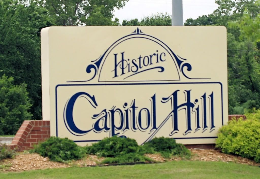
... but this is how it DID look before I cleaned up the photo ...

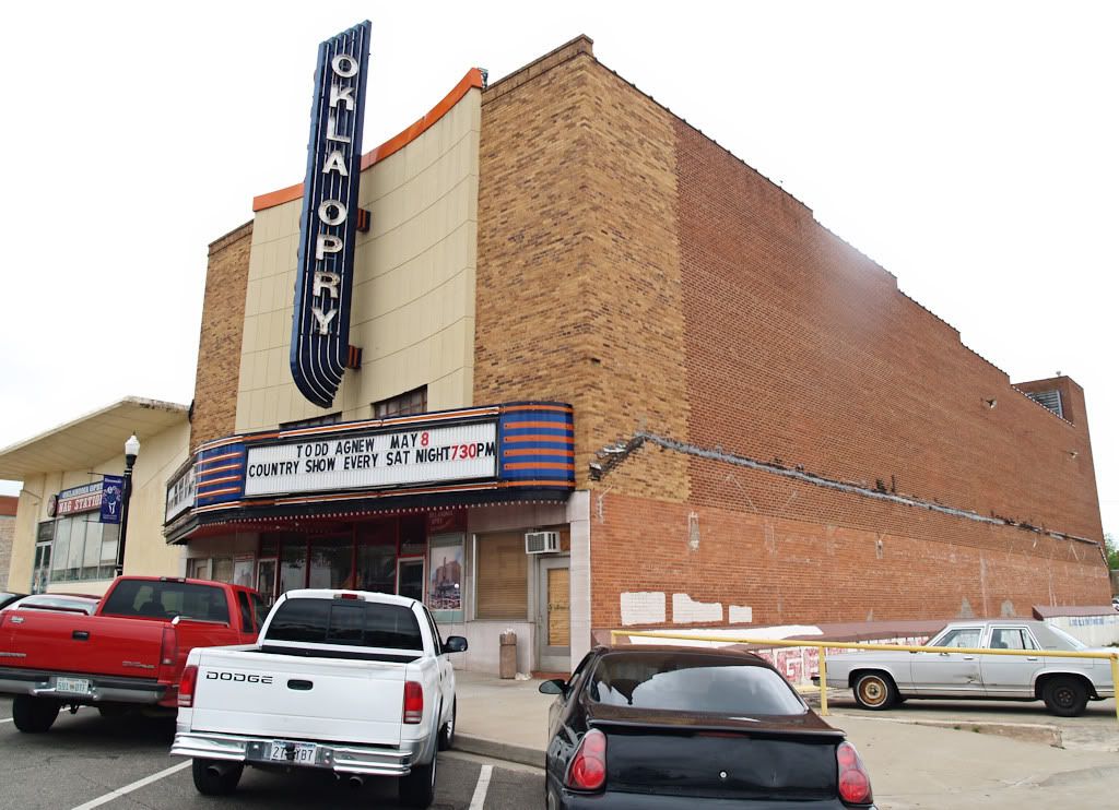
Concerned citizens and interests are clearly attempting to get this historic area back in good shape, but there is clearly a long way to go before that can become true. The old Knob Hill Theater is now home to the Oklahoma Opry and that building looks good ...
... and the area formerly occupied by Katz Drug, Langstons, Browns & Pennys could be a lot worse ...
... and the group which now owns the former Capitol Hill Baptist Church is doing a reasonably good job, boarded windows treatment notwithstanding ...
But many areas, such as the old Yale Theater and its surrounding structures cannot be said to be anything but embarrassing to a proud Capitol Hillian ...

... some of which are frankly so bad that I chose not to show them at all. The remnants of the former motel area are either gone or are in total disrepair, as is this one at Southwest 29th and Robinson ...

The once proud Capitol Hill is struggling as this is written in 2009, but trying, they are. My sense is that progress has been made during the last decade and that more progress is yet to come.


38 comments:
While I was growing up the "Palacio" was an El Charrito.
Currenty the Yale is a "dance" club on friday and saturday nights. I am not sure what age group but they pack the place and require additional security.
Kress has been redone and is a DHS office.
Brown's has also been refirbished and is used as Goverment offices. Don't know if state, city, county.......
One thing that has not changed. Friday, Saturday, and Sunday it's hard to find a parking place!!
Thanks for the good and encouraging report, John.
Amazing stuff. Thanks so much for writing all this and posting the pics.
Believe it or not Doug, this area is drastically cleaned up over the last ten years. I've heard rumors of bringing back Penny's. That old building is owned by the Capitol Hill Neighborhood Association who is attempting to turn into a community center. Right now it has a lot of Latino-oriented programs inside of it. They recently added a rooftop garden with a $100,000 gift..but if you ask me they should have started from the street level LOL. They're looking for a big retail tenant which they may or may not get, but they'll have much better luck now that the river is becoming a big deal and Crossroads Mall is dying. I've always liked Capitol Hill, which is why I always hated Crossroads Mall with a passion. Crossroads is what killed the inner south side, which as you chronicled..was once a really cool area of the city.
Thanks, Nick. I agree that there are good signs of a comeback and that the area has improved over the last 10 years. When I'm done with the complete Capitol Hill article, many more things will be covered. I've pretty much finished the research but have yet to do the re-write but will probably get to that next week.
Hi Doug:
I'm so thrilled I found your blog! My great-grandparents bought property in Capitol Hill back in the 30's or early 40's. While my GGF worked during the week in the china dept. of John A. Brown's (downtown) my GGM ran the corner grocery that was attached to their home. They loved where they lived but my mother had always told me the south side was *low class*. What a bunch of bunk! Granted, there were many poor people, but they were mostly good people.
I loved spending Christmas with them because they would always deliver fabulous gift boxes to the poorer neighbors in their neighborhood. The boxes were always full of toys and food and lots of love.
Even though I now live in Texas, it is a tradition I have carried on.
One time during the 1950's my GGM was robbed at gunpoint. She looked the young man in the eye and said, "Honey, you don't really want to do this do you? How can I help you?"
He then began to cry and told her of his financial problems & that his wife was in the hospital & he couldn't pay for it.
My GGM went over to the cash register, pulled out all the money she had, and gave it to him. However, she demanded he give her the gun for the cash. It's just the kind of people they were.
They have both been gone for many years now but, I have very fond memories of the Capitol Hill area...
So glad I found this site. Love the pictures and comments. My dad was assistant manager of the Humpty Dumpty store on 25th and Walker in the early to mid 50s. We attended Capitol Hill Baptist, and I went to 3 of your schools pictured -- Lee CHJH and CHHS...a true Capitol Hillian.
Why don't you do a book on Capitol Hill!!!
Thanks, Okiejan, the article is still not finished ... hope to get back to it fairly soon. About the book, I'm just a novice on Capitol Hill, learning as I go. I think I'd embarrass myself if it took it beyond blog articles, but thanks.
Thank you so much for this very nice piece of work. I have so many memories of Capitol Hill. I delivered the Capitol Hill Beacon. I Worked at the Yale as an usher. I also worked at Schiffs Shoe Store. I married my highschool sweetheart ( she still is) at Capitol Hill Baptist. etc. etc. etc.
Thanks so much. I was in the Jackson JHS band and marched on those streets. What a memory. Living Florida but enjoyed my picture visit so much. Chuck C Retired USN
Thanks, Chuck.
I moved to OKC in 1956 from Broken Bow and graduated from Capitol Hill HS in 1960. It was a magnificent area during that time. We loved shopping, eating, and going to movies on SW 25th (Commerce) Street. I worked at the TG&Y while in high school and worked at OG&E on S Harvey and a dentist and optometrist. I always hated to see it go down. John A. Brown's was the BEST! I used to go there and eat US Sentate bean soup and corn pone for my lunch break and shop there and Penneys. Also, Streets was across the street catey-cornered from Browns. They had the cutest clothes.
No one has said anything about Bob's Hot Dogs across the alley from Capitol Hill/Oklahoma State Bank and next to the music store. You could get two dogs all the way and a Grapette. What a lunch! Bob's was just one block north of CHJH down the alley. Across 25th street was Cherry's Diner. Across the alley east of Cherry's was the Yale and a beer joint next to the theater. Emmer Brothers was next. I almost left out Levian's and Lerner's clothing stores. Around the corner on Robinson to the north was Merle Norman cosmetics on the west side of the street and just across the street from the Capitol Theater.
Veasey's Drugs was on the NE corner of Commerce and Robinson. Next to the drug store was an army surplus and down a couple doors was a record store which was across from KLPR and the Beacon. Veasey's may have been on the southwest corner of that intersection later on. Anthony's was first on the south side of
25th street and maybe another shop and then the bank again.
Up the hill, you could get your shoes shined at the Commerce Shoe Shop. A tire store was next and Capitol Hill Savings and Loan was west of the tire store, across the alley. Pettie's (sic) hardware was next and across Commerce was Brown's and Penny's. Capitol Hill Baptist was across the alley east of Penny's. Pastor Bumpus was there for many years. Langston's, up the hill, came later and was between Brown's and Katz's Drugs. I think most of this is correct. Please correct it if you have a better understanding than I. This piece was spur of the moment and not well thought out. T
Hi. I've been living here for many years and am seeing and experiencing so many strange things and beings, I've been researching like mad.
I heard about Puckett's ghost caught on video and forgot about it long time, but went back last night to watch it again and realized that parking lot is less than half a block away from me.
I've been thinking these folks I've been catching with photos were not ghosts but ETs or UFO folks as they morph into beings and folks like Jesus and some of the demi-gods that people hear about in mythology.
But to find out if these are ghostly beings, I thought I better research some of the history of Capitol Hill.
Have any ideas where I can find some history about this place goes further than the city they built?
I'm wondering if this could have been a graveyard for Indians perhaps.
Have any thoughts on that? I would greatly appreciate that.
If you want to see what I've been catching on photos, I have a page on WebShots.com/Democratbrat
and here is my link/http://community.webshots.com/user/Democratbrat
I'm gonna add u to my 'follow' button if u don't mind.
Have a great day!
Hi, Zena,
I wish I could help but I have no knowledge about the things you're asking about nor do I know anyone who does.
At 3501 S. robinson in the late fiftys and early sixties was a cafe and drive in called brenda burger, across the street from the el palacio, i also remember the restuarant as the el charrito, from living on that corner as a young boy. My grandparents owned brenda burger which was named for my mom. Directly to the south of us was Deans car lot, my sister and i would help him lock the cars up at night. The cafe building still stands to day but was turned into a bar many years ago, which has had several names. Right behind the building on the vacant lot sat two mobile homes, ours and my grandmothers. a t-shirt print shop sat behiind our lot to the west, my sister and i used to bring home t-shirts with mistakes printed on them that they threw away. right down the street was capitol hill monument company. A park was directly across Robinson from us. My sister and i attended Lee elementary while living there.
I agree that a book needs to be done on capitol hill as well.
I, too, spent much of my early years living and schooling in Capitol Hill (jr. high, sr. high and Lee School where we recently celebrated the 100th anniversary).
However, before my stepfather passed away in 2008 he showed me his birth certificate and the house where he was born. It was just off south Walker on 28th, just behind Jude and Jody's Furniture. In 1919, 28th street was called "F" street which we presumed alphbetical names, beginning with "A" street just as you crossed the river and continuing. He lived in that house for several years before his family became share croppers up and down the trail from Capitol Hill to North Texas. Any info on these original street names might be interesting.
My dad managed the Western Auto at 2730 S. Robinson for a couple years. I was in 3rd grade at the time and helped out on Saturdays with assembling bikes, trikes, mowers, etc. He paid me 5 cents per unit I assembled plus extra for sweeping, cleaning, and light stocking. I would try to get at least 50 cents so I could get Necco wafers and an icee at the local convenience store. I was also intrigued by the memory dialer the phone system had even though it was in the early 70's. It was a plastic card system with holes punched out for the digit. So a card had at least 7 lines of holes punched out. It was mainly for calling in credit cards and such but dad had made up cards for the family members. Those days down in Capitol Hill were great.
My grandfather, Harlow Gers, deceased, was city councelman for 30 years in Capitol Hill. He also owned a grocery store. I am trying to gather info about that area. He and my grandmother owned a huge home in this area as well. Do you have any information that would be helpful to me??
Stephanie Melton
Weddinglady@pldi.net
Stephanie, I'm researching the Oklahoman's archives for a reply. It might be a day or 2 before I'm done. I can easily say at this point that some good info is forthcoming.
Stephanie, this is what I've come up with about your grandfather and grandmother:
About Harlow Gers, Sr.
Researching the Oklahoman archives reflects the following:
Harlow owned and operated West Side Grocery at 547 SW 27th from at least May 1931 through at least February 1956. During this time, he was married to Nevada, but they apparently divorced before their respective deaths. Harlow died May 5, 1983, and his surviving spouse's name was shown as Lola in the Oklahoman obituary. Nevada died June 20, 1986, but her obit is not shown with a surviving spouse. Nevada and Harlow were the parents of 5 children, a daughter, Jeaneen, and 4 sons, Chris, Aldy, Harlow, Jr., and Jack. A 5/10/1938 article located their home at 529 SW 30th Street.
Most of the Oklahoman articles focus on Harlow during his 20-year tenure as one of the ward 4 Oklahoma City Council members. Several others identify "Mrs. Harlow Gers" as being involved with numerous social and philanthropic activities centered in the Capitol Hill area, but nothing more is said about her.
Personally, Harlow was very much involved in baseball and golf. As to Capitol Hill, he was involved with Capitol Hill's chamber of commerce (or by other names) beginning at least by 1932, and was president of the Capitol Hill chamber in 1942.
As for Harlow, Oklahoman articles reflect that, beyond his ownership in the West Side Grocery, he was a 5-term Oklahoma City Council member from ward 4 — spanning 20 years (1935-1955).
Sad to say, but by 1956, Gers fell on hard times, and he and his wife filed separate bankruptcy petitions in that year. Oklahoman reports aren't thorough, but one report states Harlow's principal assets as Gers Barbeque Cafeteria, 4506 S. Shields; West Side Grocery, 547 SW 27th.
A July 14, 1963, Oklahoman obituary about Harlow's father, John, said that Harlow's address was then shown as 6739 NW 8th Street.
I'll have a graphic image for you shortly, showing a few images of your grandfather and some of his kids, as shown in the Oklahoman.
Here is a collage of Oklahoman images relating to Harlow Gers: Oklahoman images.
Doug: I lived in south OKC from 1941 til now & believe Capitol Hill is a community as opposed to a street or neighborhood. Southsiders did not identify with a particular real estate subdivision, like Mesta Park, Crown Heights, Linwood, Gatewood, etc. If you lived south of the river you lived in Capitol Hill. Good example is when CH Baptist church moved from Commerce & Harvey to sw 134 & Western they kept the same name. Great source of historical material on CH is the CH Beacon. David Sellers the owner is generous with his knowledge & printed materials. I think the pic you identified as CH Jr. High, now CH Elementary was originally CH High School. The old Brown's building is owned by the Community Action Agency - they also own the old Penney's building. The old Langston's & Katz drug buildings are owned by OCCC & they are developing a satellite operation there. I could go on forever but need to stop here. Call me one of these days - I host a lunch almost every Friday in the back room @ the Grill on the Hill across the street from the old Brown's store. Place is full of old CH memorabilia.
Thanks, Pete. Hope to see you again soon.
I notice you have no pictures of Capitol Hill Methodist Church.
Sorry that the church was not included. It was not intentional.
Doug, I know it wasn't not intentional. I was just surfing and noticed the only pics on line of Capitol Hill Methodist were after 1974. The church was one of the first in CH and I think began as a wooden building. I know there was a brick building to the west of the now standing sanctuary that as maybe built around 1907. I don't have any pictures of the church besides my plates I own. But it was definitely a big part of the Capitol Hill district.
Thanks, Scravens. If you'd care to take a picture of the plates and email it to me, I'll be glad to post it in the article, with credit to you. loudenbk@swbell.net
The three photos you have titled Hunter Funeral home have me curious. My grandma said that the multi story building was Doctors General Hospital where she delivered 5 of her 6 children. Can you confirm?
Lisa Windle-Westbrook
2inoklahoma@cox.net
Joe Spence said...
I moved to Capitol Hill in 1951 at the age of 13, and began singing on country music radio station KLPR at SW 25 and Robinson above the Capital Hill Beacon owned by Jack Beasley. Wanda Jackson, Norma Jean Beasler , myself and others would
sing live for 15 minutes about every other week.
Cousin Jay Davis would spend the records for 45 minutes and young girls would write in requesting songs and asking for photos. I remember country star Hank Thompson would
come to the studio and sing for us.
I can't believe how the years and time change things.I was born at the old capitol hill hospital Aug 12th 1945.then surrounded by beautiful trees and grass.sure brings back lots of childhood memories of the capital hill area.Roy L. Parkerson Oklahoma city OK.
I was raised in an area called the Gander Flats, some call the Shidler School area. It is never mentioned much in the Oklahoma City history. It borders SE 15th South, Byers West, High East. The train tracks north. I remember when I was a kid in the 40's the whole neighborhood was flooded. I don't know if we were part of Capitol Hill, but I went to Jr High and Sr High at Capitol Hill.
I worked for TP machine and too, and used to eat lunch at EL Charitos on robinson every friady for years! I loved that food!
Earlyier in my life i had worked for the DR.Pepper bottling co,on walker ,south of i -40 . There was a mexican resturant down the street to the east,we ate supper there alot ! It was about two blocks east of walker !
James did you know any of the Smith's that lived in Gander Flats...Oley, Opal, Lucille, Bertha, Joyce or Arley? There were others but these were my immediate family. I understand that Gander Flats was very poor area and a rough area. A lot of little dirt floor shacks.
Thanks for your comments
Dot
Did any early pictures of Capitol Hill Methodist Church come? I see a blogger by name of Scravens was asking, and you said you'd post. I am writing a book that includes one of its early pastors, and I would love to see what the church looked like in say, 1940.
Thank you!
Vicki
2 Jun 2017
Does anyone recall a record store (possibly the one referenced in "T said. . " comments:
"easey's Drugs was on the NE corner of Commerce and Robinson. Next to the drug store was an army surplus and down a couple doors was a record store which was across from KLPR and the Beacon."
The store was near the Beacon building but it seems like it was a street south perhaps. It seems like it was off of an alleyway or you had to go through and enclosed walkway to get there. It would have been open from the mid 50's to around 69 or 70 and may have been called "Philllips record store" or something simular?
My mother had introduced me to the place about 1970, and I recall buying my first record album there. . .
Anyone?
Thanks, Lou. Sorry that I can't help with your question.
Post a Comment