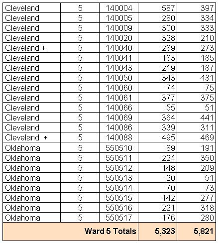
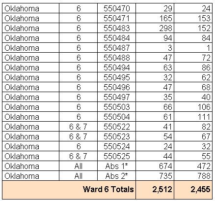
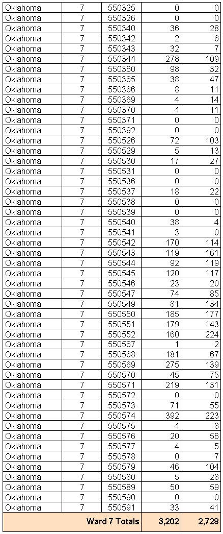
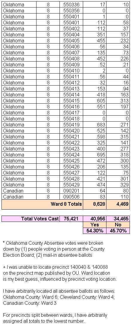
For some reason, press reporting of the MAPS 3 vote detail has been slow in coming. So I went to the County Election Board yesterday and was kindly supplied a printout of the vote, precinct by precinct. Unfortunately, a vote tally by wards was not available, however they were able to furnish a list of precincts in each Oklahoma County ward — for precincts located in Cleveland, Canadian, and Pottawatomie Counties, most of that information was available via the Center for Spatial Analysis at the University of Oklahoma.
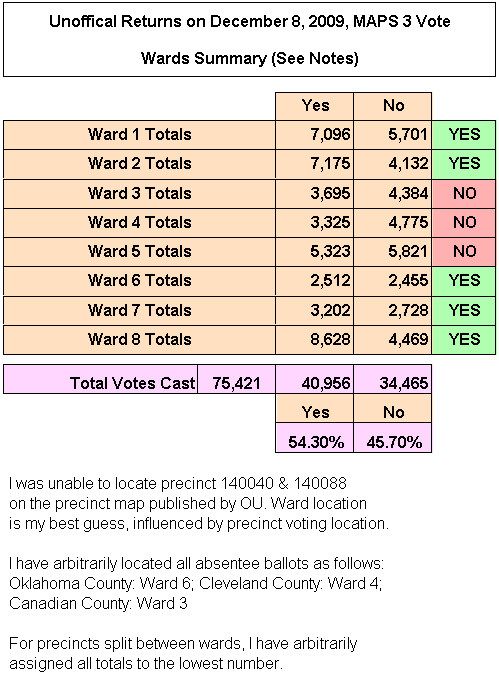
Technically, the information was assembled as follows: The printout from the County Election Board was scanned and then OCR'ed in spreadsheet format. That document was then checked for errors and it was then reorganized (sorted) into wards instead of the numerically arranged precinct-by-county list that the original report used.
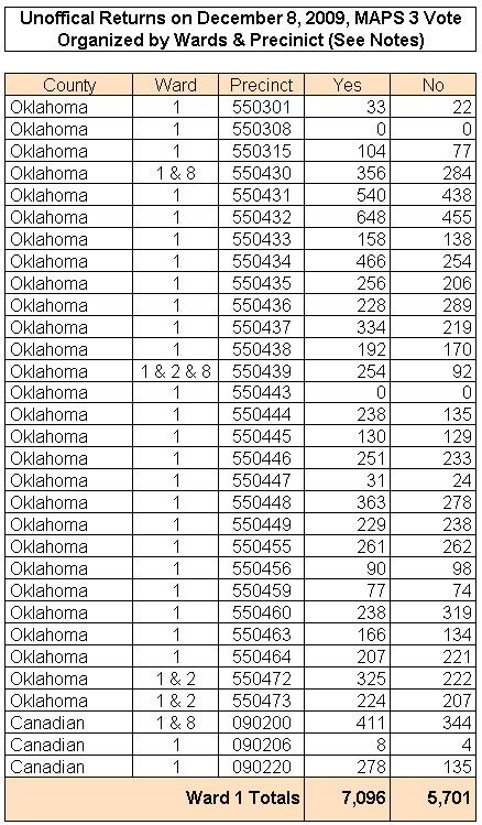
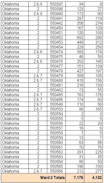
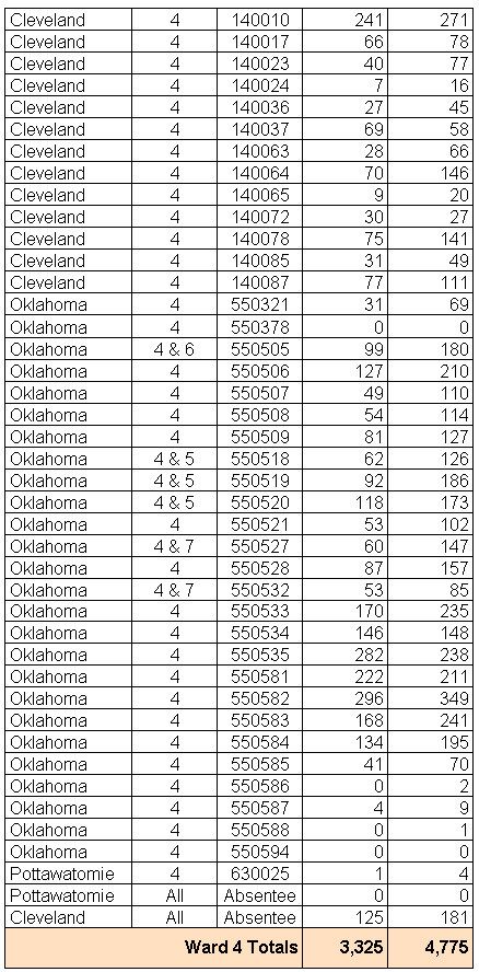
The detail of precinct and ward votes appears below.
Ward 5 Ward 6 Ward 7 Ward 8
WARD 1
WARD 2
WARD 3

WARD 4
WARD 5
WARD 6
WARD 7
WARD 8
Go To Top


3 comments:
Thanks for doing the database work Doug, Paul Monies should be putting together a good maps by precinct soon, like he has done in the past for the votes.
040 and 088 do go in ward 5
I'm surprised how close Ward 6 was. What's your hypothesis for that?
Post a Comment