
Click here to go to Part 1 - Introduction
Click here to go to Part 3 - MAPS & Change
Click here to go to Part 4A - Facilities & Activities
Click here to go to Part 4B - Oklahoma River Trails Tour
THE FLOODS & THE CURE
As said by Larry Johnson in the Delmar Gardens and Wheeler Park post,
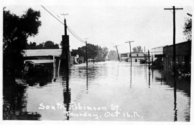
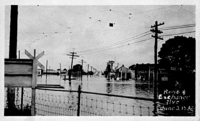
Delmar Garden eventually fell victim to prohibition after statehood in 1907 and the capricious North Canadian River, which flooded the area regularly, and closed in 1910.Chances are that those "regular" floods weren't in the "major" category, but I don't know. I've not located a whole lot of information about the North Canadian's flooding history downtown. The only pictures of major downtown flooding I've found so far had to do with floods on 10/16/1923 and 6/3/1932, but I'd be surprised if there weren't others.
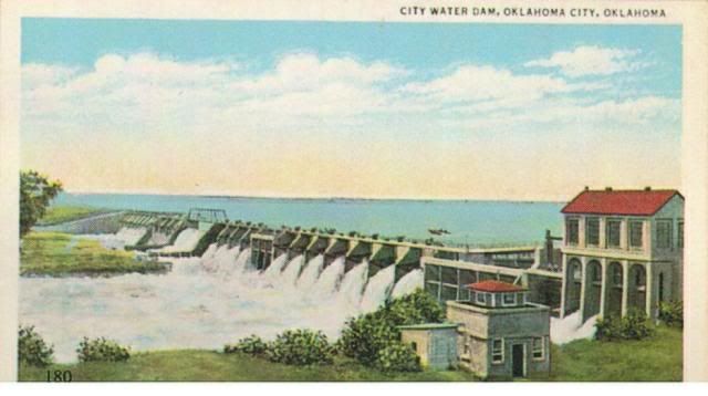
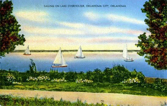
The North Canadian fed (and feeds) Lake Overholser (and by a canal also feeds the larger 1947 Lake Hefner). The Lake Overholser dam was completed in 1918 and the lake appears to have had some day sailer traffic.
October 16, 1923, was not a good day to sail or be downtown!
Edwards and Ottaway, Vanished Spendor II
(Ablache Book Shop Publishing Co 1983)
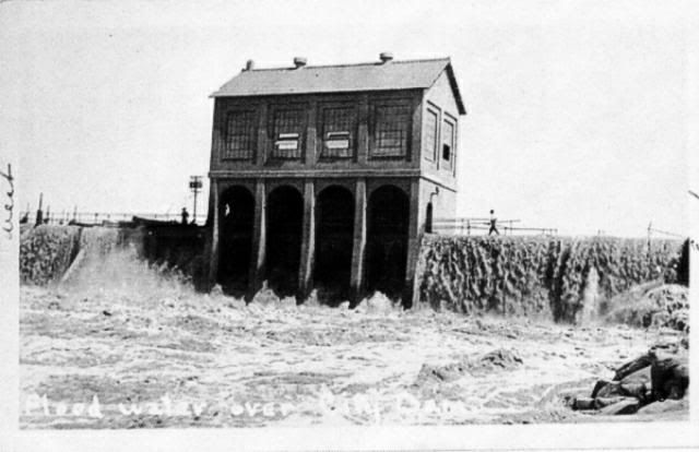


Neither was June 3, 1932.
Edwards, Oliphant and Ottaway, Vanished Spendor III
(Ablache Book Shop Publishing Co 1985)
According to Jim Edwards and Hal Ottaway as to the 1923 flood,
Later that same morning Mayor O.A. Cargill issued a special proclamation to the Citizens of Oklahoma City stating that "for the protection of property within the flood district, police and soldiers on duty have been ordered to shoot to kill any person found looting and breaking into any abandoned house or store building."Wow! Pretty strong stuff! The authors do not say whether the order was ever executed.
THE CURE
A 2000 report (a large PDF file) by the Corps of Engineers gives some history:
January 2000So, no more floods, but the report also said this:
DRAFT
ECOSYSTEM RESTORATION REPORT
AND INTEGRATED ENVIRONMENTAL ASSESSESSMENT
SECTION 1135 RIVERINE RESTORATION PROJECT
NORTH CANADIAN RIVER
OKLAHOMA CITY, OKLAHOMA
1.3 Project History. The North Canadian River Floodway was authorized by the Flood Control Act approved on July 24, 1946 as amended by Section 204 of the Flood Control Act of May 17, 1950. It carries flood flows from several tributary streams within Oklahoma City. The floodway serves a drainage area of about 13,222 square miles and has a maximum water surface area of 10,346 acres.
The United States Army Corps of Engineers constructed the North Canadian River floodway to contain the 100-year flood flows. Construction began in January 1953 and was completed in March 1958. Construction principally consisted of straightening, widening, and realigning the North Canadian River.
The degraded and fragmented condition of the existing riverine, bottomland hardwood and wetland riparian habitat along the North Canadian River has reduced the habitat value for common wildlife species found in riverine, wetland, and bottomland hardwood forest habitats to unacceptable levels. Representative photographs of the project area are given in Appendix A.The 2 photographs contained in Exhibit A are the following, with the captions included in the report:
Photo 2. Basin 3 – exposed pipes
They didn't include this cool photo in the report, though!
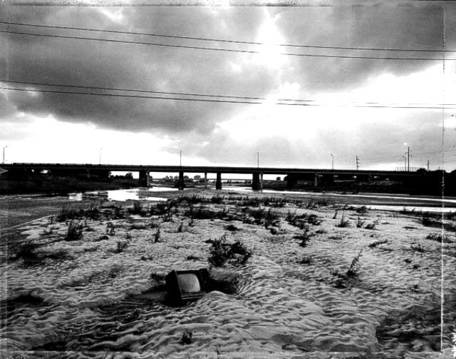
Mark Klett, Photographing Oklahoma 1889-1991 (Oklahoma City Art Museum 1991)
Next ... along comes M.A.P.S.


2 comments:
do you have some informations or maps of oklahoma river flooarea, as maps of 100 yr, 50 yr 10yr flood plain and what is thw flooding situation now. or do you know resources from where they can be found.
Sorry, I don't. I did a quick look at a few of the National Weather Service pages but didn't see what you're looking for. If you've not already done so, you might try this as a "starter" page there:Noaa History Pages.
Post a Comment