
Click here to go to Part 1 - Introduction
Click here to go to Part 2 - Floods & Change
Click here to go to Part 4A - Facilities & Activities
Click here to go to Part 4B - Oklahoma River Trails Tour
CONTEMPORARY NON-M.A.P.S. PARTS OF THE NORTH CANADIAN RIVER
Without repeating (very much) of what's already been said in Parts 1 and 2, the downtown Oklahoma City portion of the North Canadian River looked pretty much like those parts of the river upstream from Oklahoma City except (1) those parts seem to have had more running water, (2) they still meander with less or no control, (3) they don't have the flood control infrastructure that the downtown Oklahoma City portion came to have in 1958.
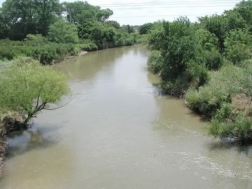
Here are a couple contemporary upstream pics taken by the National Weather Service, but the images would probably not be much different in pre-M.A.P.S. days. On the left, around Woodward, on the right, near Watonga:

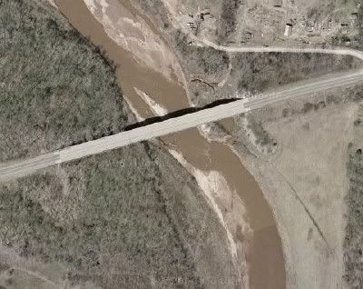
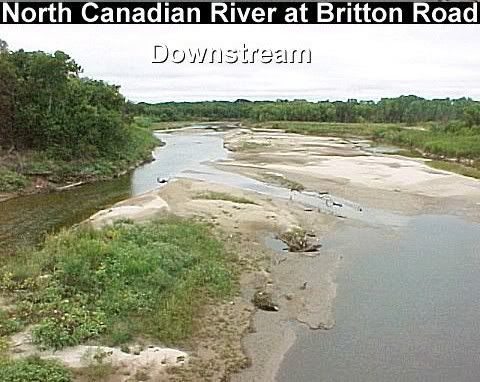
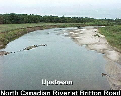
Another perspective is to look at contemporary National Weather Service Images for the river in Oklahoma County but well past its rendevoux with downtown Oklahoma City - on East Britton Road between Midwest Boulevard and N. Post Road.
First, here's a Google satellite image of the area, but possibly a few years old:
Probably more contemporary are National Weather Service photos which, while they show the river has changed from the Google image, present the river in a way probably not too unlike pre-M.A.P.S. by way of analogy - but without as much security and with a bit more water than would have been in the downtown area:
M.A.P.S. AND RIVER CONSTRUCTION
From the same Corps of Engineers 2000 report quoted from in Part 2, paragraph 1.3 (Project History) of the report continues:
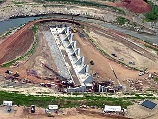
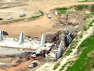
The flood control channel has provided Oklahoma City residents with significant reductions in flood damages; however, in an attempt to restore habitat and enhance aesthetic resources along the channel, Oklahoma City approved Ordinance No. 20,045 in December 1993. This ordinance provided funding for nine Metropolitan Area Projects (M.A.P.S.) plan venues which includes the development of the North Canadian River Riverfront. The riverfront development plans include the construction of three low water dams and river-lake environments. Construction began on the first low water dam at Eastern Avenue in June 1999.The following images are from Oklahoma City's Oklahoma River website and, taken during construction of what would become The Oklahoma River, they pretty much speak for themselves - quoted text is from the City's website:
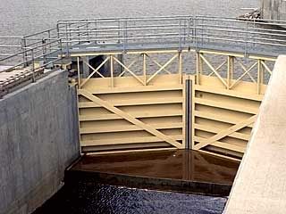
"Locks allow boat passage
Locks were built on two of the dams to allow boaters access to the entire length of the river below downtown and west to May Avenue."
"A completed lock
Just like the Panama Canal, only smaller."
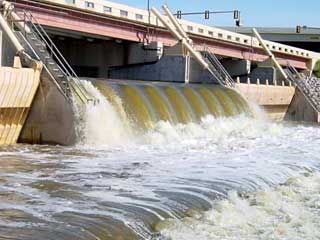
"It works!
A May, 2002 test of the spillway at Eastern Avenue. Hydraulic pistons raise and lower the dam gates."
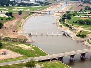
"Filling the river
Water rises in the North Canadian south of downtown. The Downtown Airpark is at upper left."
OPENING THE OKLAHOMA RIVER
As reported at http://www.rivernetwork.org/estream/estream_aug05.htm, this August 2005 article reads,
Will the River Run Through It?Obviously, the 2005 article's expectation that water taxis would begin in 2006 was wrong. But, we're coming right along and that'll come.
SOURCE: OK Business.com
Don’t call it the North Canadian River if you’re in Oklahoma City. And, certainly don’t call it a “lazy river.” While development goals for the stretch of the North Canadian River in Oklahoma City have been in the works for more than 25 years beginning with the “String of Pearls Plan” in 1980, the vision of a city is finally coming together. The newly transformed and renamed Oklahoma River – a seven-mile stretch of the North Canadian River that flows through Oklahoma City – is generating a lot of energy and excitement these days.
“In an awful lot of ways, the biggest accomplishment to date is probably the excitement this development is generating about the possibilities over what the river can do for the city,” said Assistant City Manager Jim Thompson, who was director of the Metropolitan Area Project Funding during the first four years of the river project.
According to the strategic action and development plan, Oklahoma City has invested $54 million in improvements to the North Canadian River Corridor and created more than 16 miles of waterfront property in the heart of the city. Getting to that point hasn’t been easy. Despite the 1980 plan, there were two critical ingredients missing: water and money.
“It took vision to see beyond what was nothing more than a drainage ditch that we mowed three times a year,” said Pat Downes, director of development for the Oklahoma City Riverfront Redevelopment Authority.
The once-dry river that Downes said was once an embarrassment to the city has been transformed into a series of river lakes bordered by landscaped trails. After several environmental studies, engineers began to build dams at Eastern, Western and May avenues to raise the level of the river, which is fed during the dry season from water at the Canton Reservoir. Locks at Western and May avenues will allow boats to navigate the seven-mile length of the river project. A much anticipated water taxi terminal near Meridian Avenue will shuttle visitors from their hotels or the airport to downtown Oklahoma City and beyond beginning in 2006.
“Water was always in the river,” Thompson said, allowing that the city did have to mow the riverbed several times a year. “We needed to make some changes to create the lake areas that now have a function on the river. And we had to do so in a manner that didn’t create an adverse environmental condition and was still conducive to development.”
The second ingredient that put the riverfront development project into motion was the passage of a $350 million MAPS package in 1993. Recognizing the need to revitalize the city’s center, voters overwhelmingly passed a temporary 1-cent sales tax. The MAPS program provided the money for investment into the riverfront transformation, Downes said. Oklahoma City officials looked at river corridor development projects in cities of similar size around the nation. They found that public investment often spurred private investment — a benefit of the redevelopment that Oklahoma City has begun to experience.
Texas-based computer manufacturer Dell Inc. has started construction of a business services campus on 62 acres of land along the Oklahoma River near S.W. 15th Street and Portland Avenue. Oklahoma City provided $5.5 million in job-creation incentives which will be funded by a forgivable section 108 loan. The city also is providing $11.7 million in infrastructure improvements, such as water, sewer and street upgrades. According to the city’s finance department, the cumulative overall economic impact of the Dell project is estimated at $764.7 million. The direct real estate tax impact is expected to be around $664,807 during the initial three-year period and have an indirect property tax impact of $5,544,246, according to city estimates.
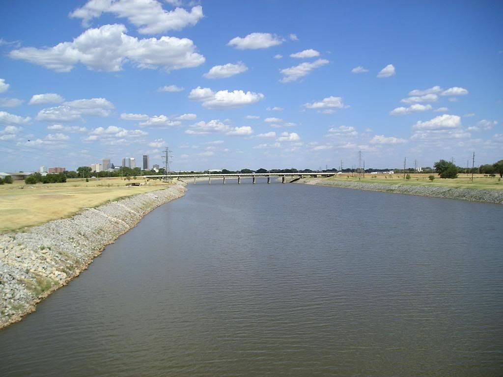
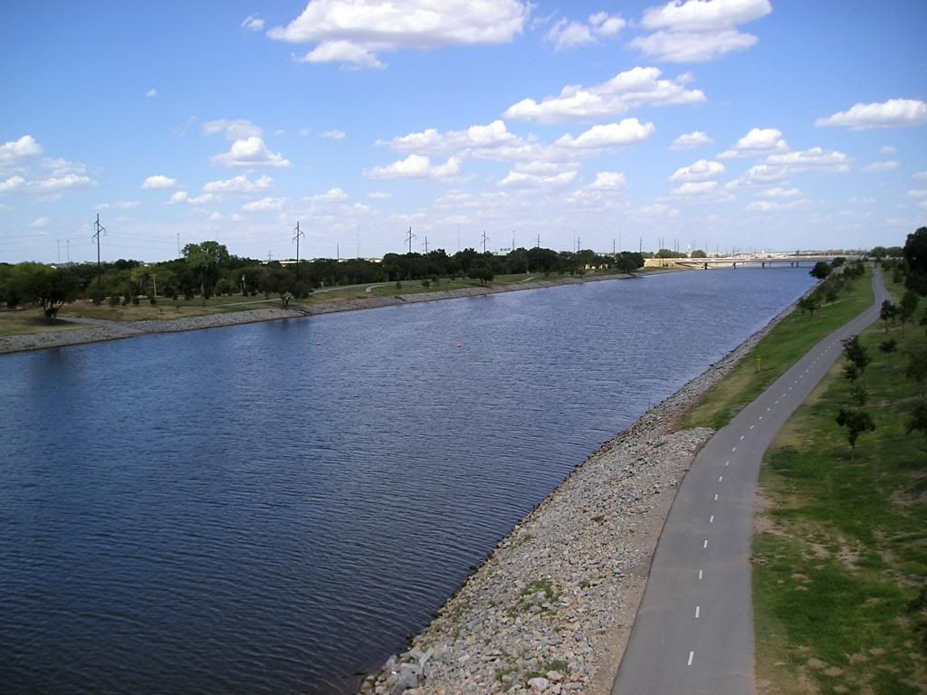
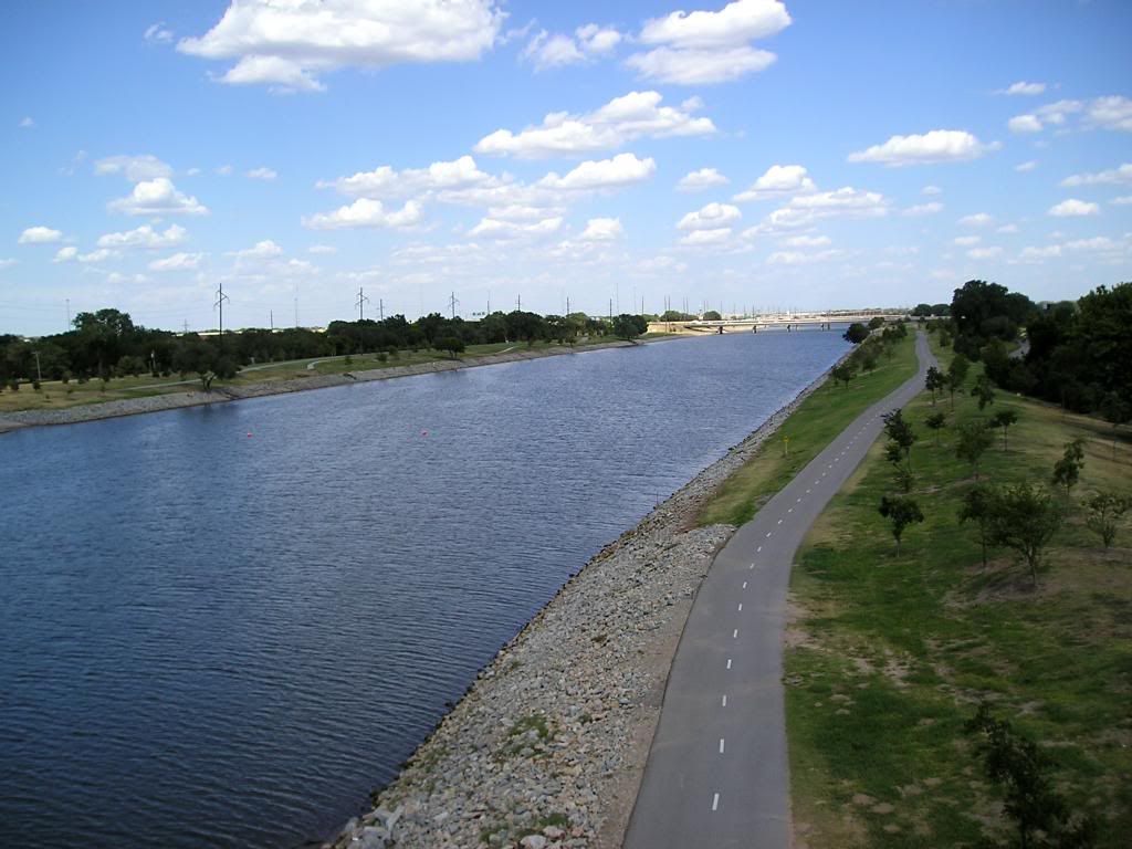
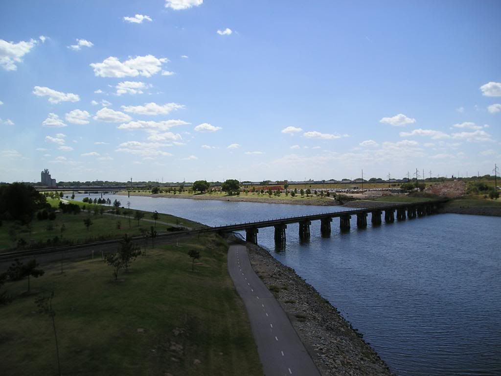
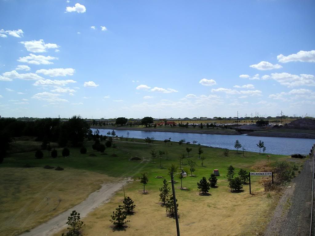
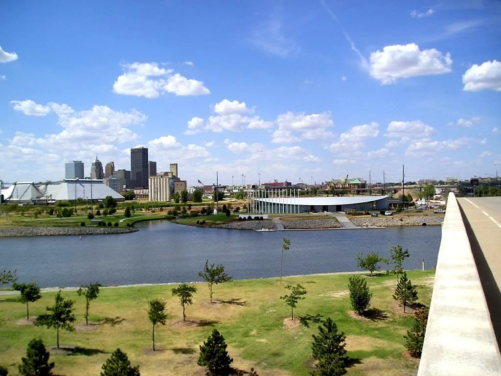
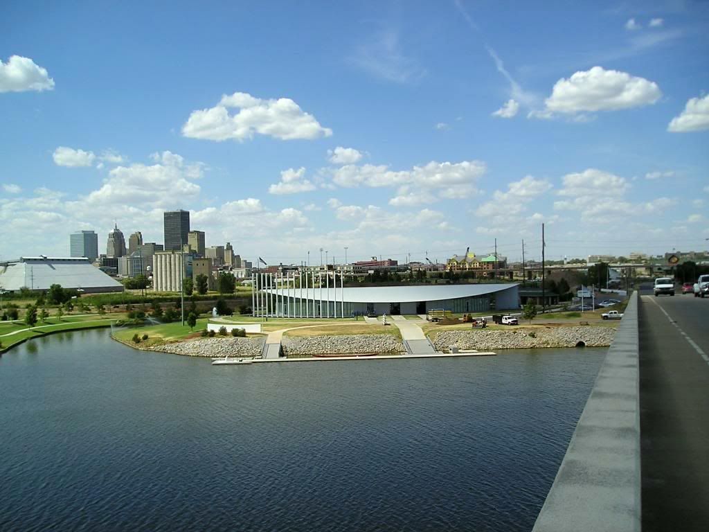
But, for now, here are some pics that I took on August 8, 2006 ... sure, need more landscaping ... sure, need more projects ... sure, they will come! Click on a pic for a 1024 x 768 view with much more detail.

Next ... WHAT'S HAPPENING NOW?


No comments:
Post a Comment